


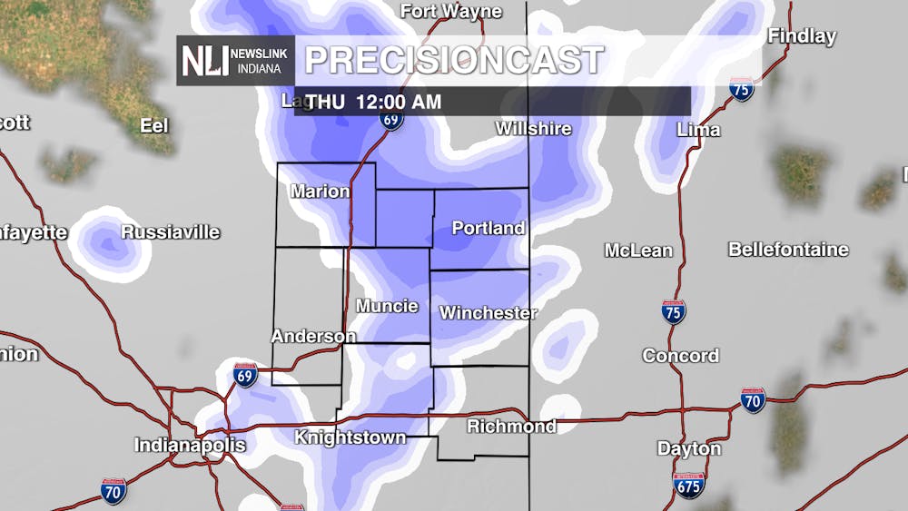
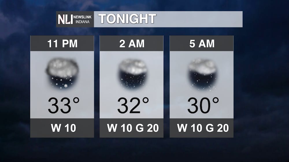
Tonight: Snow showers continue which look to taper to some leftover flurries with temperatures steadily cooling into the lower 30s. Winds will start a slow increase which will be one of our main headlines besides the cooler temperatures we have on their way.
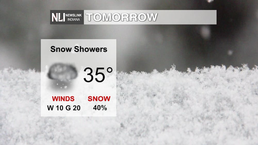
Tomorrow: Snow showers re-enter the weather picture as a new impulse of upper-level energy kicks through. As the winds shift and continue to increase, we will have to keep an eye on the possibility of some lake-effect snow streaming in from the NW out of Lake Michigan tomorrow night (with the possibility of some light accumulations) with us still hanging on to some decent moisture.
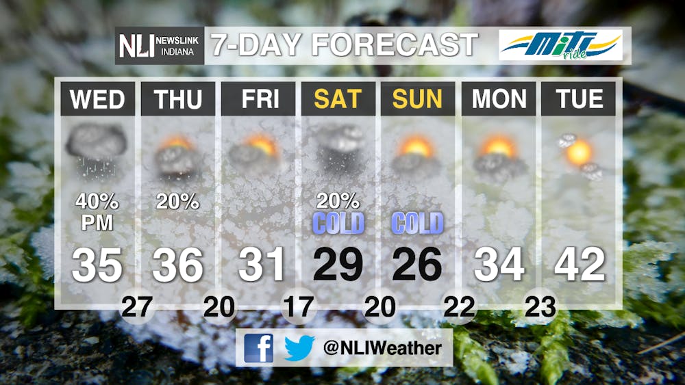
7-day Forecast: The coldest temperatures of the season look to arrive on the heels of our active weather from today into tomorrow night before we are expected to make an attempt to return to colser to normal weather towards the end of the 7-day. Early indications are that Thanksgiving could be warmer with a chance of rain as the long range forecasts suggest that ridging at the end of our 7-day forecast period will become more prominent with models coming into agreement on that around the 25th, but we will have to monitor that closely as it is possible this pattern may not budge too easily -stay tuned!
- NewsLink Indiana Weather Forecaster Ryan Hill
Follow us on Twitter @NLIWeather for breaking weather updates.
NewsLink Indiana is a proud Ambassador for the NOAA Weather-Ready Nation program.
For more information about the Weather-Ready Nation program please click HERE


