


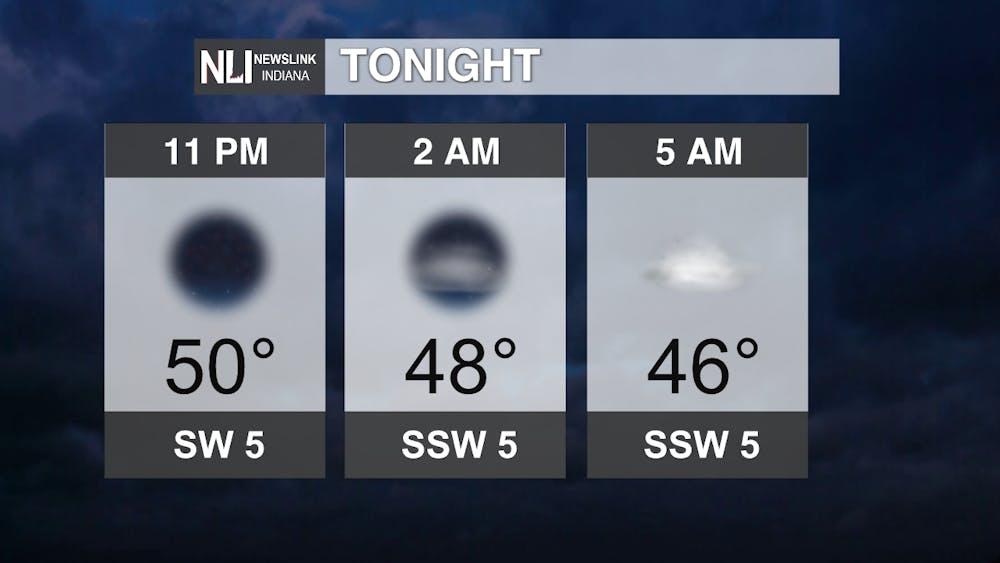
Tonight: Clear skies and light winds should abound throughout the night, but behind these weather elements with a layer of warming air just above the ground and some low-level moisture still around from recent rains will contribute to some patchy/locally dense fog in spots throughout the region developing towards morning. Otherwise, things will be mainly on the chilly side with some lower-40s not out of the question.
Tomorrow: Another sensational day like earlier today, but a bit warmer as high pressure and warm SW winds continue to become a dominant weather feature. These winds could gradually increase as we close out the day, and we are expecting a clearer night ahead as well.

7-day: Break out those shorts, especially Thursday into Friday! Stronger SW winds and our high most firmly in control (and the support of similar climatology from late October of the "triple-dip" La Nina year of 1975) favor temperatures to reach into the mid-70s as we close out the week, great for those outdoor hammocking & dinning plans! We will have to watch out for a potent system Saturday into Sunday where strong winds and bursts of heavy rainfall may be in the offing for a time in that period. Keep an eye through the rest of the week and even into the weekend for further updates!

-Weather Forecaster Ryan Hill
Follow us on Twitter @NLIWeather for breaking weather updates.
NewsLink Indiana is a proud Ambassador for the NOAA Weather-Ready Nation program.
For more information about the Weather-Ready Nation program please click HERE


