


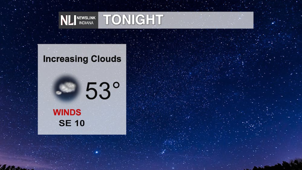
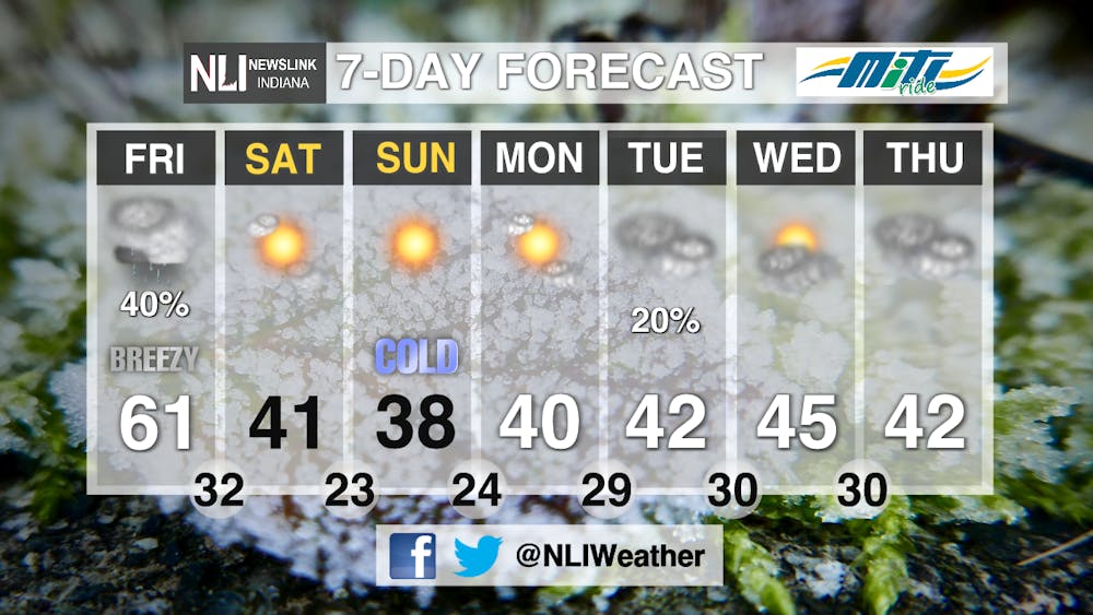
Tonight - Winds will start increasing tonight with winds coming out of the southeast at 10 MPH. Clouds will begin increasing, limiting out overnight low to 53 degrees.
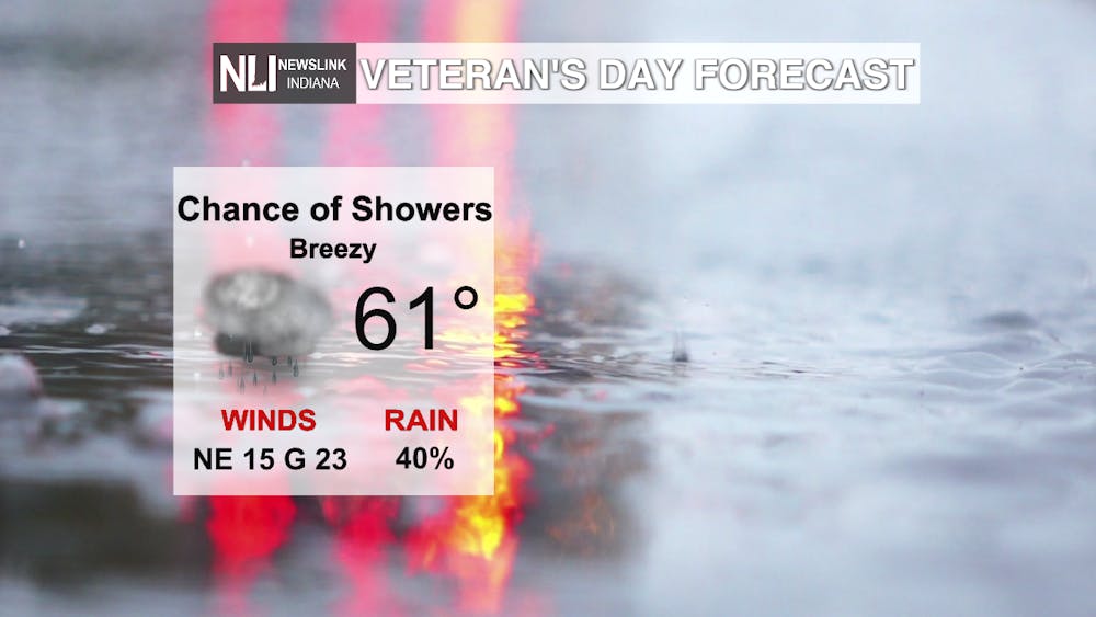
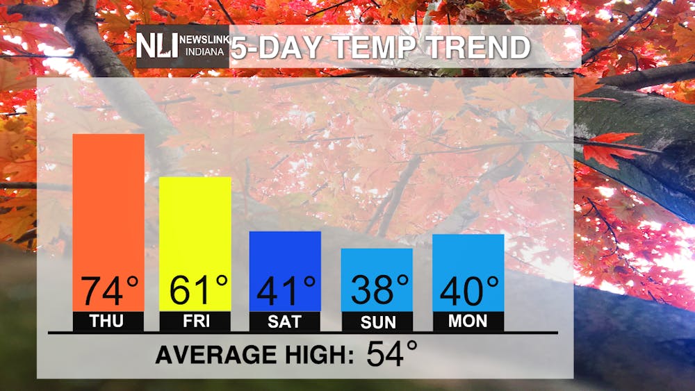
Tomorrow - A chance of rain will begin moving through our area tomorrow as Tropical Storm Nicole's outer bands make their way northward. Winds will be gusty with sustained winds of 15 MPH and gusts of 23 MPH. A high temperature of 61 is likely to conclude the warmer temperature stretch for the year.
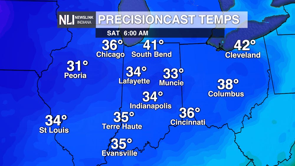
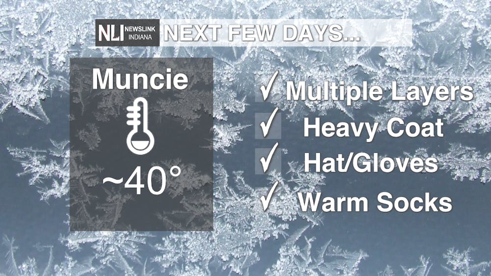
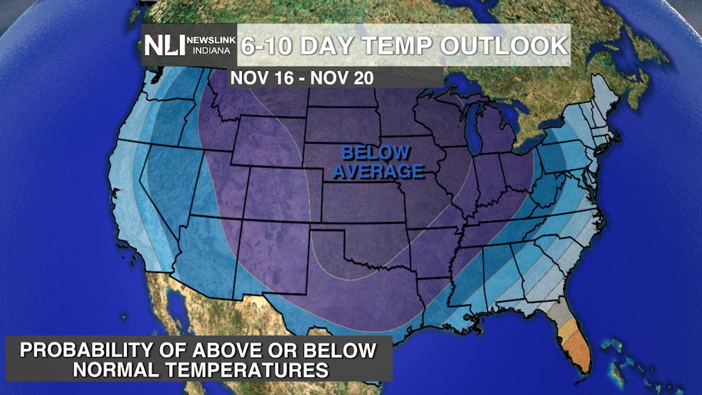
Weekend - Temperatures will start to plummet this weekend, dropping 36 degrees over 3 days, landing at a high of 38 degrees on Sunday. The Climate Prediction Center issued their 6-10 day outlook and the whole country is sitting in the below average category for next week. Make sure you dress extra warm next week with hats and warm socks included in your outfits!
7-day - Temperatures will average 40 degrees next week with chances of rain on Friday and Tuesday. Overnight lows will drop into the lower 20s meaning there will be chances of frost in the early mornings.
--Weather Forecaster Rachel Wynalda
Follow us on Twitter @NLIWeather for breaking weather updates.
NewsLink Indiana is a proud Ambassador for the NOAA Weather-Ready Nation program.
For more information about the Weather-Ready Nation program please click HERE


