


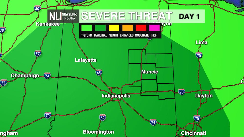
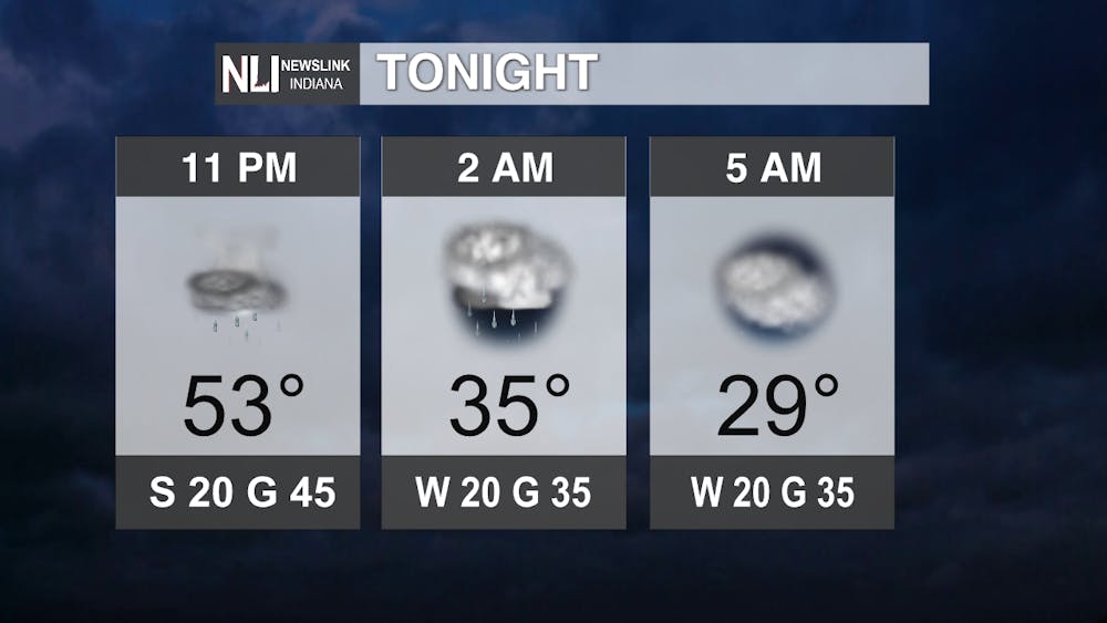
Tonight: A strong cold front will first bring some strong thunderstorms with some isolated 60 mph gusts possible out of them, then blustery and cold into the early morning hours. Have multiple ways of getting warnings in case we get severe weather, and be prepared to bundle up if you have very late/early plans!
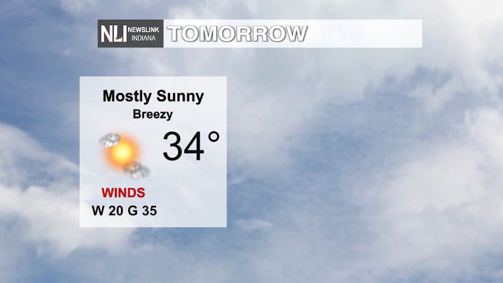
Tomorrow: Blustery conditions continue with bitter cold that will feel like the low teens with the wind still gusting 30-35 mph through the day. These conditions are expected to persist one more day, but then a brief ridge of high pressure and warmer air sets up as we roll closer to the weekend.
7-day Forecast: A few shots at some much-needed precipitation pop up over the weekend into next week as we set up an active weather pattern along the jet stream - the river of air that separates warmer weather from cold and directs storms' paths - dives south and may allow for colder air beyond the 7-day... Getting the Christmas feel in the air as we get closer to the holiday, perhaps?

--Weather Forecaster Ryan Hill
Follow us on Twitter @NLIWeather for breaking weather updates.
NewsLink Indiana is a proud Ambassador for the NOAA Weather-Ready Nation program. For more information about the Weather-Ready Nation program please click HERE


