


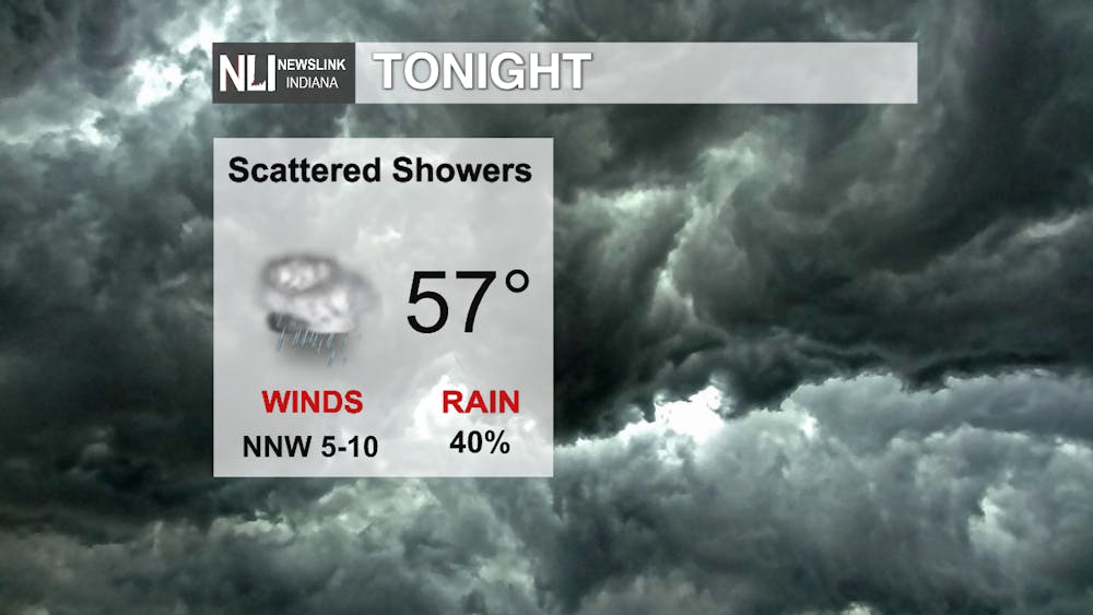
Tonight
For the Rest of tonight we will be seeing scattered showers linger around. As the Cold front to our west starts to make its way into the viewing area temperatures will start to collapse. The low tonight is going to be 57 with the winds blowing from the NNW from 5 to 10 miles an hour.
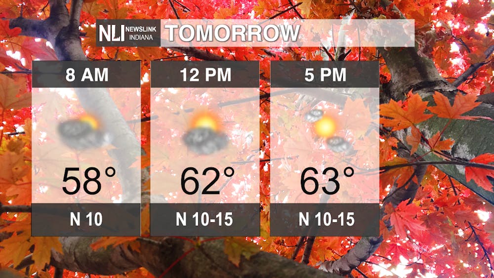
Tomorrow
As we usher in the first day of fall tomorrow we will see very much fall like temperatures. The morning will start out at 58 degrees and will warm to a high of only 63 by mid afternoon. In addition to the low temperatures tomorrow we will also be seeing winds blowing out of the N at 10 to 15 miles an hour. The Clouds in the morning will give way to mostly sunny skies by 5pm.
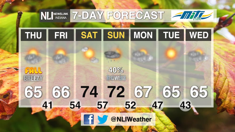
7-Day
The cool 60 that we end the work week with will slightly warm up into the 70s for the weekend. There is a chance for a scattered thunderstorm late on Sunday as temperatures dip back down to the mid 60s for the beginning of next week.
- Weather Forecaster Jack Van Meter
Follow us on Twitter @NLIWeather for breaking weather updates.
NewsLink Indiana is a proud Ambassador for the NOAA Weather-Ready Nation program. For more information about the Weather-Ready Nation program please click HERE
