


Tonight: After such a miserable day with rain and cold temperatures, it couldn't get any more winter-like right? Unfortunately, there is the potential for snow tonight into Saturday. Rain is expected to transition into snow at around 11:00 PM tonight. The low will be around 32 degrees with winds from the west at about 10-15 mph, with gusts of around 20-25 mph.
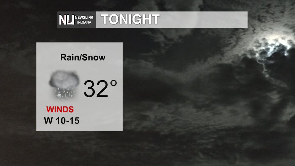
Photo Provided By the NewsLink Indiana Team
Weekend: Saturday is going to be a bit colder than what Muncie experienced today, withy highs near 41 degrees, with snow showers throughout most of the day. These snow showers are expected to transition back into snow before tapering off in the evening hours. Expect winds from the west at about 10-15 mph. Sunday, much better. Sunday will be mostly sunny with a high near 60 degrees. Winds will be from the south at about 5-10 mph, which will help to bring in warm air.
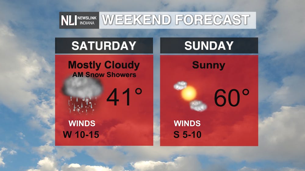
Photo Provided By the NewsLink Indiana Team
7-Day: It is looking quite hopeful for warm weather in the 7-day forecast. Monday through Thursday could bring highs at or around 70 degrees. The warmer weather does bring chance for showers and thunderstorms however. The warmth is bittersweet, but is much better than it being cold and snowy in April. Friday will see a bit of a cool down as the system that will bring the potential for showers and storms moves past the region.
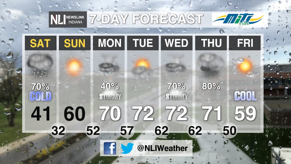
Photo Provided By the NewsLink Indiana Team
--Weather Forecaster Lance Huffman
Follow us on Twitter @NLIWeather for breaking weather updates.
NewsLink Indiana is a proud Ambassador for the NOAA Weather-Ready Nation program.
For more information about the Weather-Ready Nation program please click HERE


