


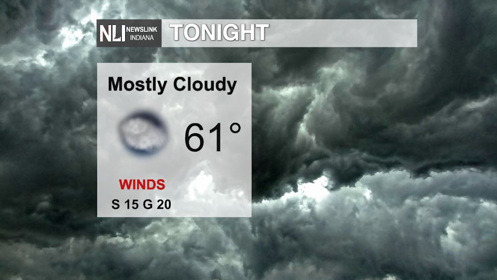
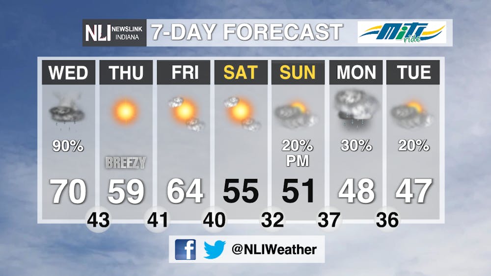
Tonight: Mild temperatures hang around as we drop to a low of 61 for the night. Clouds will increase, becoming mostly cloudy by early morning. Winds will pick up, coming out of the south around 15 MPH.
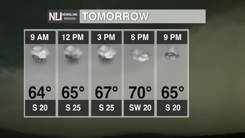
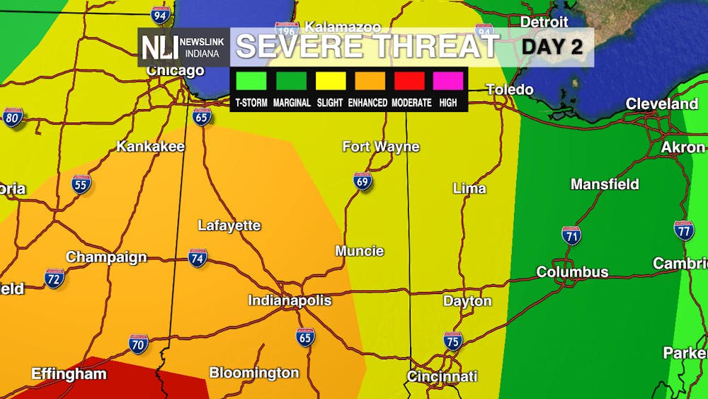
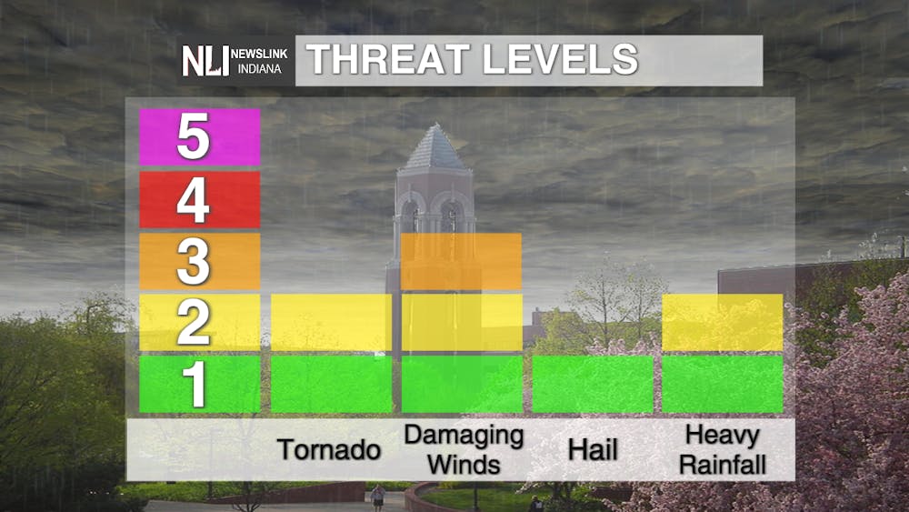
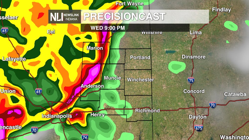
Tomorrow: Another 70 degree day in store. Although temperatures will be on the mild side, rain showers will persist throughout the day. A few thunderstorms could be embedded throughout the day, but the severe chance does not come in until the late evening hours. We are expected the strongest storms to enter the viewing area sometime between 8PM and midnight. The greatest threat will be damaging winds as we could see gusts up to 75 MPH, although the threat of heavy rain and an isolated tornado does remain.
Seven-Day Forecast: Breezy conditions and much cooler temperatures for the day on Thursday once the threat of storms push east. We will dry out for the weekend until more rain chances enter the picture for the start of next week.
---Weather Forecaster Hope Kleitsch
Follow us on Twitter and Facebook @NLIWeather for breaking weather updates.
NewsLink Indiana is a proud Ambassador for the NOAA Weather-Ready Nation program.
For more information about the Weather-Ready Nation program please click HERE


