


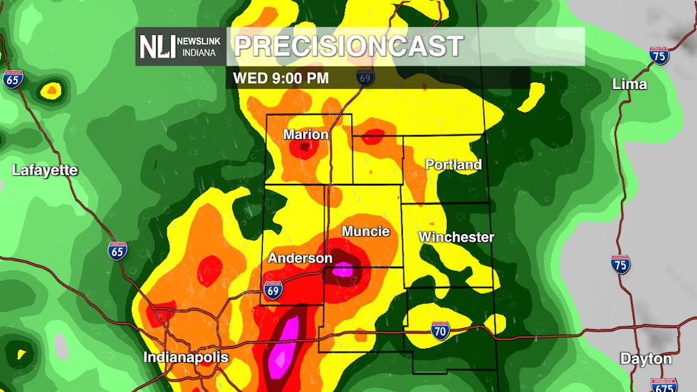
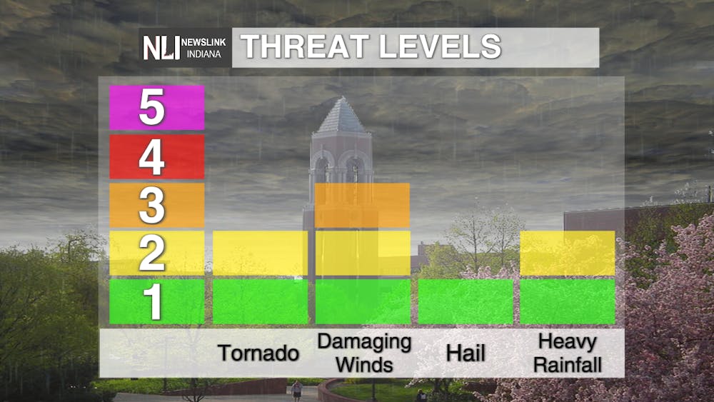
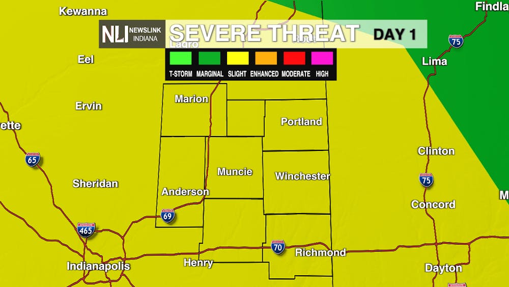
Tonight: Storms will start to move through around 8PM and these could be severe. Depending on how much clearing we see over the next few hours, storms could get stronger. We are under a Slight Risk which is a level two out of five for severe weather. Our main threats will be damaging wind gusts of up to 75 mph and an isolated tornado cannot be ruled out. Temperatures will cool down to the lower 40s as this rain moves through overnight.
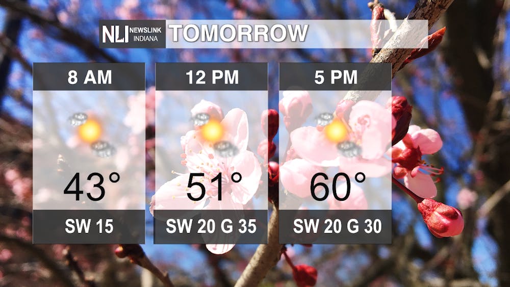
Tomorrow: Rain will move out of the area by the early morning hours. Some cloud cover will be left over, skies will clear for the rest of the day. Temperatures will start off cool, but warm up to around 60 degrees for our high. While it will be a clear day tomorrow, winds will be breezy. We could see gusts up to 35 mph.
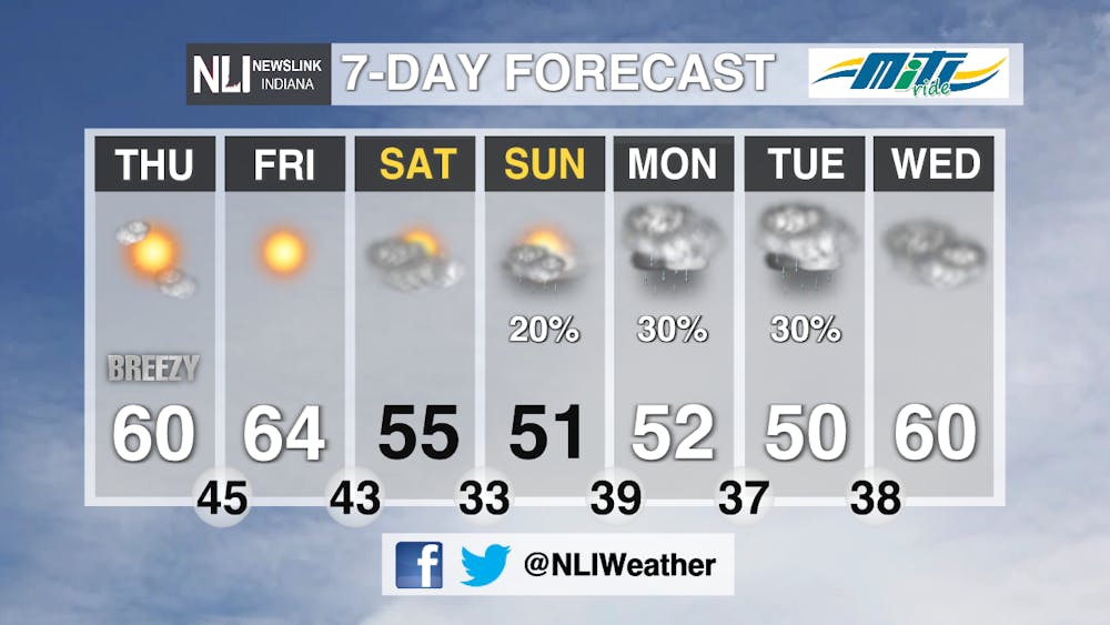
7-Day Forecast: Our rain chances diminish as we get into the early morning hours tomorrow. Tomorrow will be a different story with plenty of sunshine. We will see gusty conditions for tomorrow with a clearing for a couple of days. We drop off to the mid 50s for Saturday and rain chances return as we move into next week. Temperatures stay cool for next week with temperatures staying in the 50s.
-Weather Forecaster Rachel Stinger
Follow us on Twitter and Facebook @NLIWeather for breaking weather updates.
NewsLink Indiana is a proud Ambassador for the NOAA Weather-Ready Nation program.
For more information about the Weather-Ready Nation program please click HERE


