


Today: Another cold day on tab for us. It will be a pretty overcast day with temperatures struggling to stay in the mid 40s.
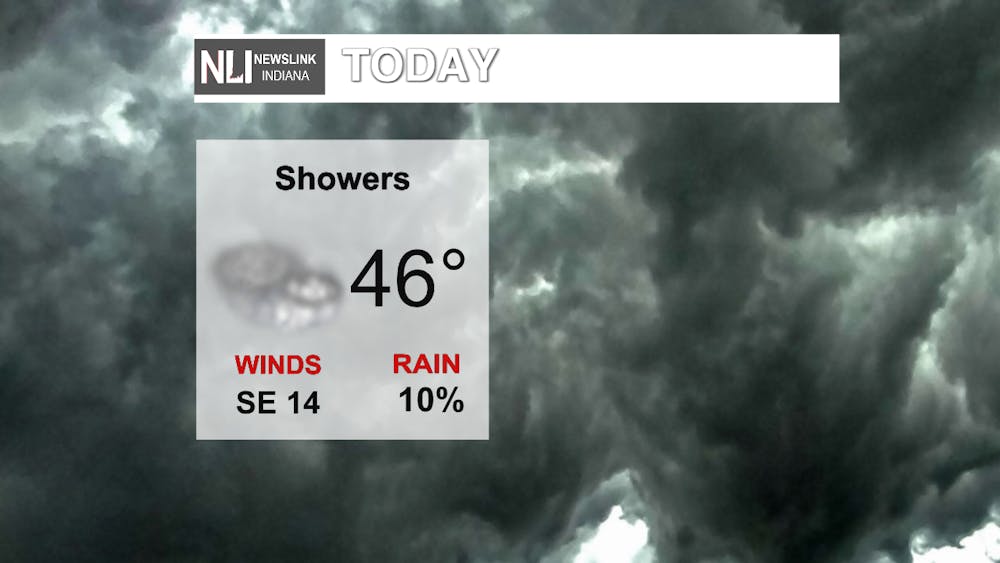
Tonight: There is a chance of having some pop up showers as the warm front approaches late tonight with winds moving SE 14mph!

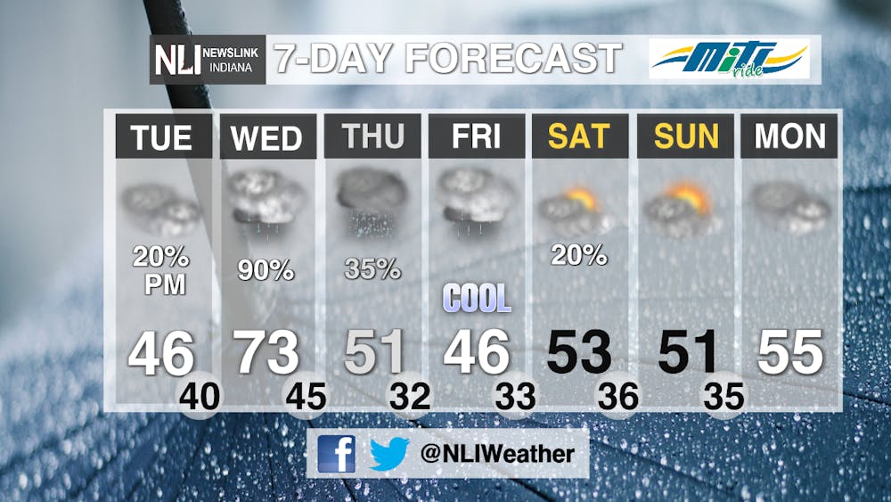
Severe Weather: Wednesday we will be under a Marginal Risk of Severe Weather for our entire viewing area. Looking at strong winds, and heavy rain, while further south of Indiana is under a slight risk.

7-Day Forecast: On Wednesday, temperatures climb all the way to 73 degrees, before crashing down to a high of 50 on Thursday and falling throughout the day. The greatest chances for rain and some thunderstorms between 6-9PM Wednesday night into Thursday morning. Rain lingers into the day on Thursday, and possibly may turn to snow as temperatures get colder. We are left with below average temperatures this weekend and into the first week of April. We are looking at some warmer temps in the coming week!
---Weather Forecaster Hunter Luzadder
Follow us on Twitter and Facebook @NLIWeather for breaking weather updates.
NewsLink Indiana is a proud Ambassador for the NOAA Weather-Ready Nation program.
For more information about the Weather-Ready Nation program please click HERE


