


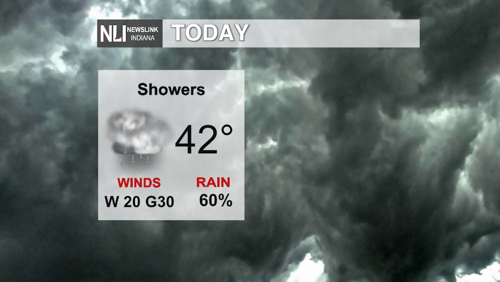
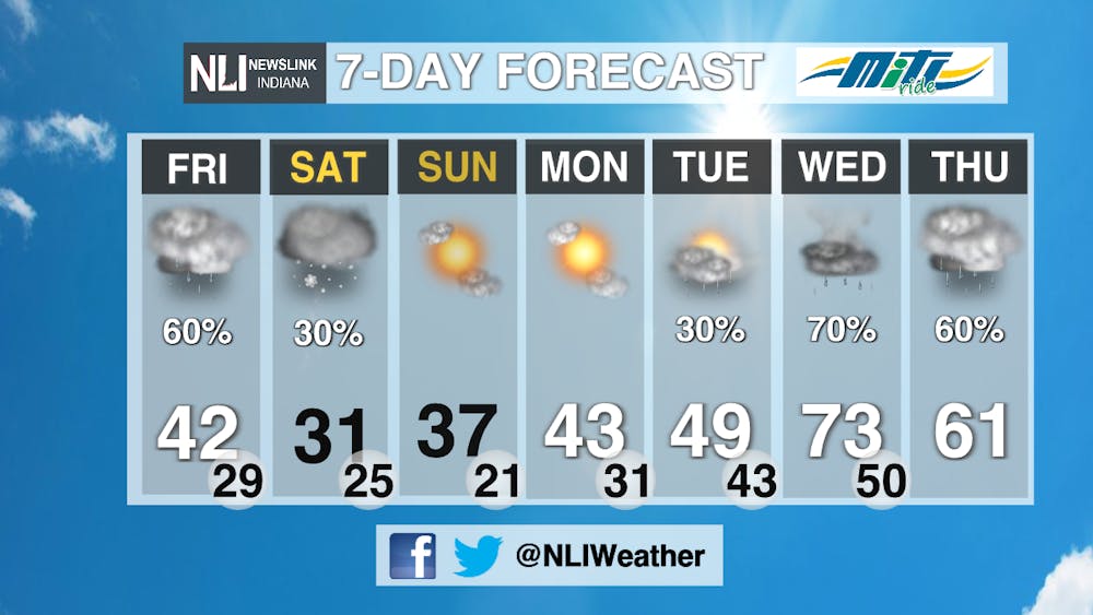
Today: We keep plenty of clouds around for today with showery conditions continuing into the evening. Definitely a great day to make those indoor plans as cloudy, showery and even breezy conditions roll through!
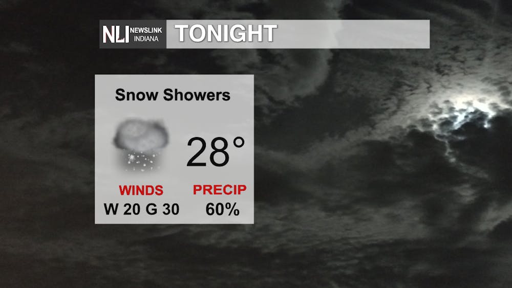
Tonight: Winter returns as an Alberta Clipper system approaches from the northwest. It looks like it will be carrying with it enough cold air and moisture for the chance of snow showers - some sporadically heavy - as we work through the overnight and into even the early morning hours. Be safe out on the roads if you have any early morning plans as well since roads could become slippery and visibilities will lower fast in the heavier snow showers!
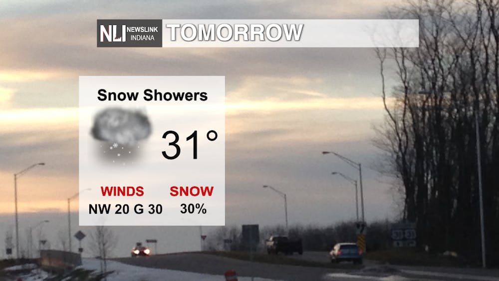
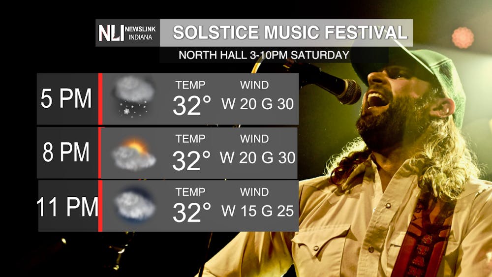
Tomorrow: Our snow showers continue via some weak lake effect bands may roll through, however we are thinking that these will be more widely scattered. Otherwise, cloudy, chilly, and wind conditions rule most of the day. Not fun, but great for some music to soothe the soul via a music fest at the North Dorms!
7-Day Forecast: Ah, yes, the light at the end of the tunnel! We see a gradual increase in our temperatures as high pressure ridges eastward, but watch for the threat of some showers and storms Tuesday into Wednesday as a potent low moves towards the area.
Weather Forecaster Ryan Hill
Follow us on Twitter @NLIWeather for breaking weather updates.
NewsLink Indiana is a proud Ambassador for the NOAA Weather-Ready Nation program.
For more information about the Weather-Ready Nation program please click HERE
