


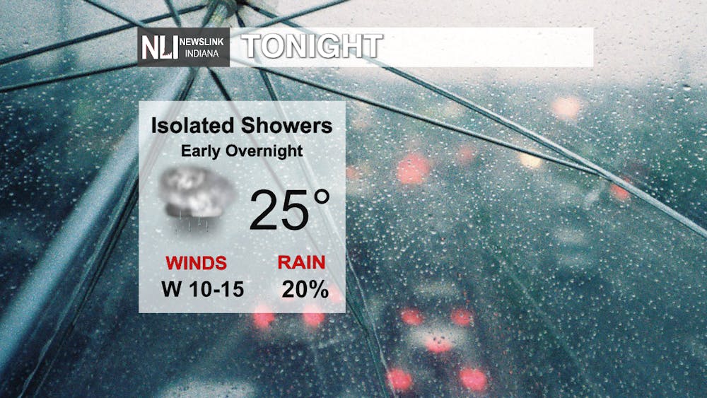
Tonight: Scattered showers are possible as we move through the overnight hours. Temperatures will dip down into the mid 30s with the winds coming out of the west at 10-15 mph.
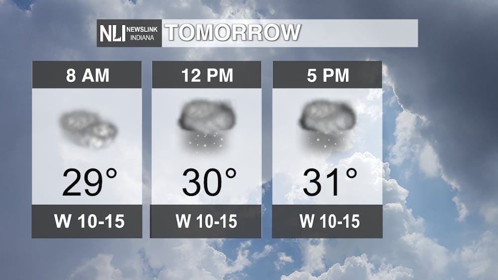
Tomorrow: As we move into the afternoon hours, we will see a chance for snow flurries. Accumulation will not be great enough to impact the roads. Moving throughout the day, temperatures will only warm up to 23 degrees. Chances for snow flurries will remain the area until later tomorrow night. Winds will start to become breezy as we move into tomorrow night.
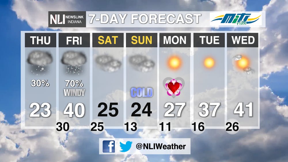
7-Day Forecast: Thursday expect to see isolated chances for snow flurries with cooler temperatures. For Friday, we will see a quick warm up to 40 degrees with a much greater chance for a rain/snow mix. Friday's system will also bring high wind gusts to our area and surrounding areas. We will quickly cool down again for the weekend with dry conditions. Colder temperatures remain in the area for Valentine's Day on Monday, but another warm up is in store for us next week.

--Weather Forecaster Rachel Stinger
Follow us on Twitter @NLIWeather for breaking weather updates.
NewsLink Indiana is a proud Ambassador for the NOAA Weather-Ready Nation program.
For more information about the Weather-Ready Nation
program please click HERE


