


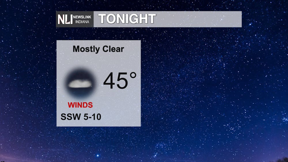
Tonight: Mostly clear skies with a low in the mid 40's which is much warmer for our lows than we saw last week. Winds will remain calm and these cool temperatures will stick around into tomorrow morning.
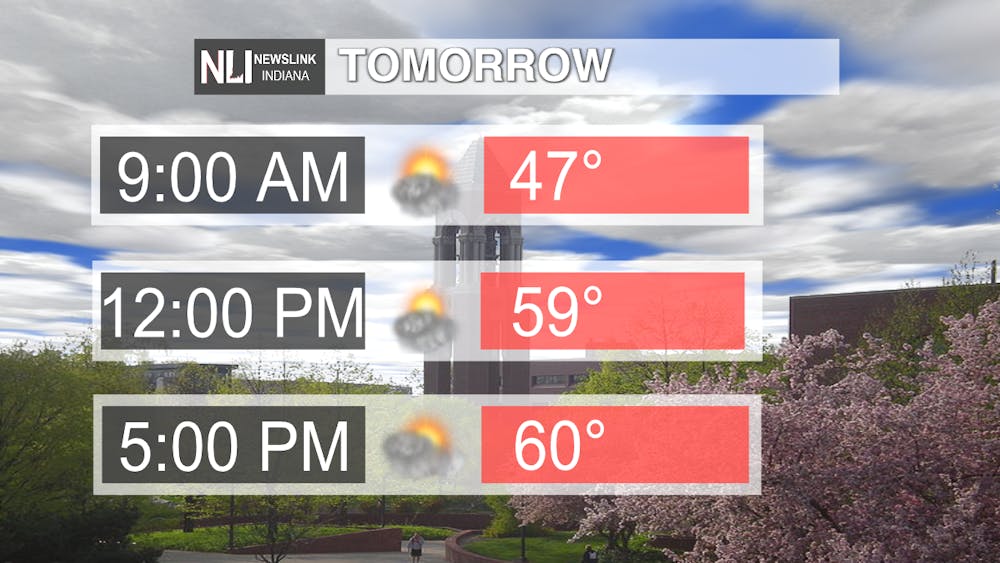
Tomorrow: Clouds will increase, causing partly to mostly cloudy skies throughout the day. Temperatures will reach upper 50's to lower 60's as our high. Much warmer temperatures during the day than we have seen last week and above average for this time of year.
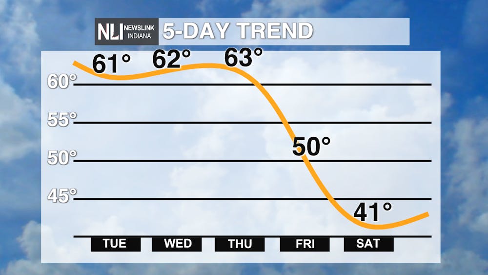
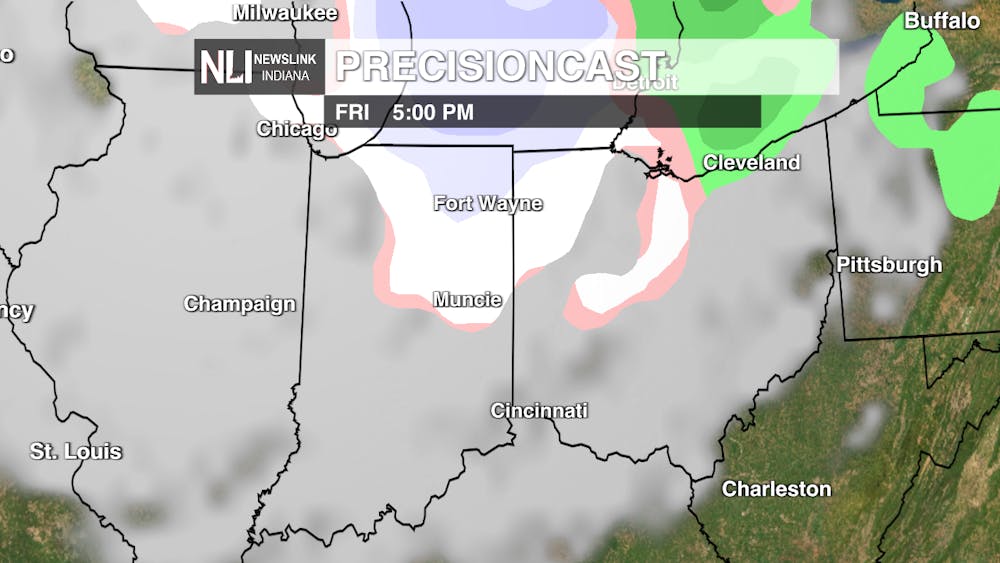
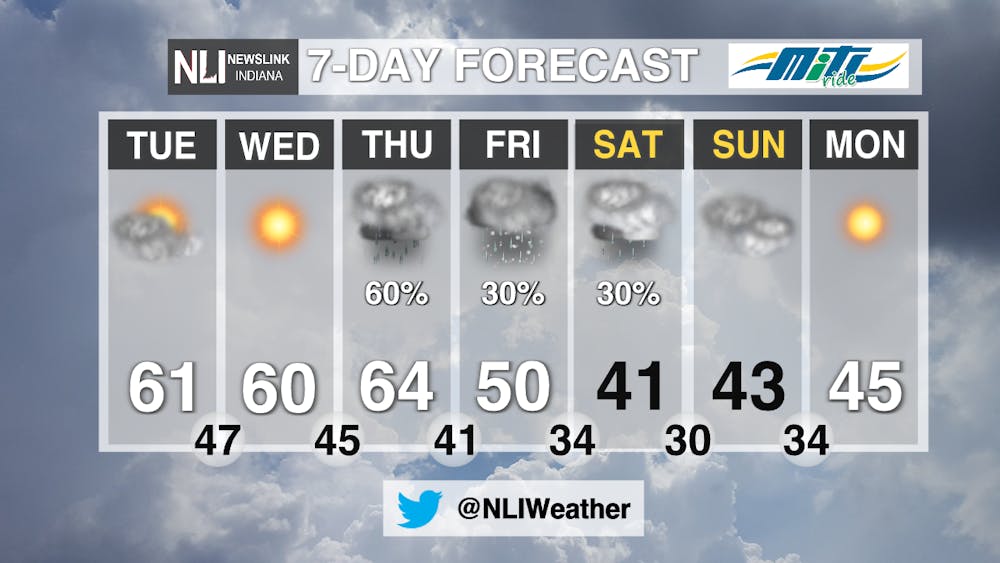
7-Day Forecast: Temperatures will dramatically decrease by the end of the week, falling back into the lower 40's by Saturday. Following an overcast on Wednesday, chances of rain are high Thursday early evening as a band of showers move across the state. Friday evening, possible snow and mixed precipitation is forecasted for the northern parts of Indiana. This snow will not amount to much, but it will be our first snowfall of the season.
-Weather Forecaster Vanessa Hintz
Follow us on Twitter @NLIWeather for breaking weather updates.
NewsLink Indiana is a proud Ambassador for the NOAA Weather-Ready Nation program.
For more information about the Weather-Ready Nation
program please click HERE


