


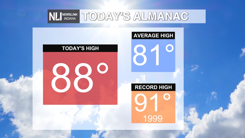
Welcome back to NewsLink Indiana for the Fall 2021 semester! What a way to kick off the semester, with the high temperature in Muncie reaching 88 degrees today! This is 3 degrees shy of the record of 91 degrees set back in 1999. Although we did not reach 90 today, we have seen 23 days this year so far of 90+ degree temperatures.

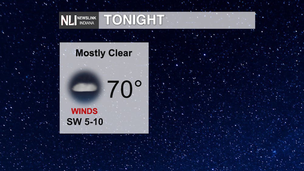
Tonight: Tonight, expect mild conditions, with low temperatures settling near 70. This is nearly 15 degrees warmer than where we should be in terms of low temperatures for this time of year! It will stay dry tonight, with partly cloudy skies and southwesterly winds of 5-10 MPH expected.
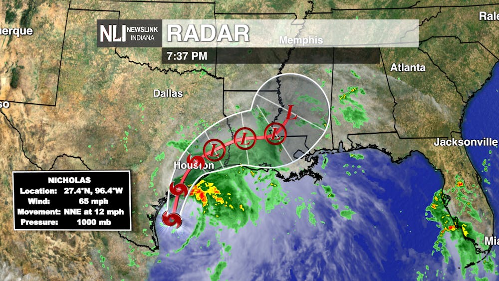
On the Gulf Coast, however, they are dealing with much more active conditions. Tropical Storm Nicholas, a high end tropical storm with sustained winds of 65 MPH, is expected to make landfall on Texas Gulf Coast tonight, somewhere between Houston and Corpus Christi. This storm will bring rainfall amounts of 10-15", storm surge of 2-4 FT, and flash flooding to Texas and Louisiana over the next few days. At this time, we are not expecting any impacts from Nicholas in East Central Indiana.
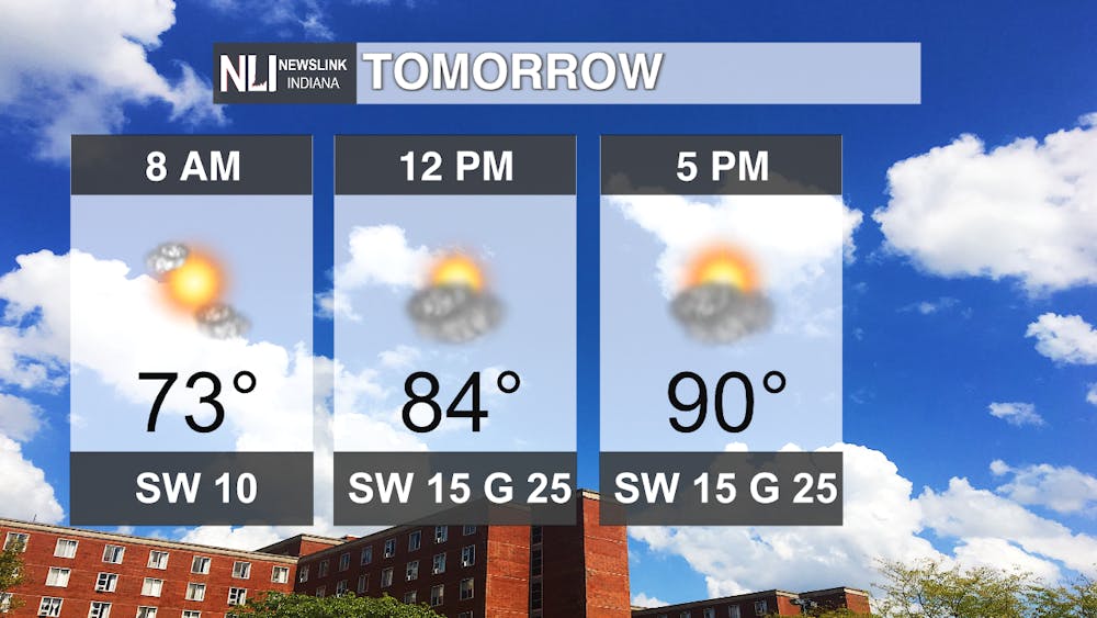
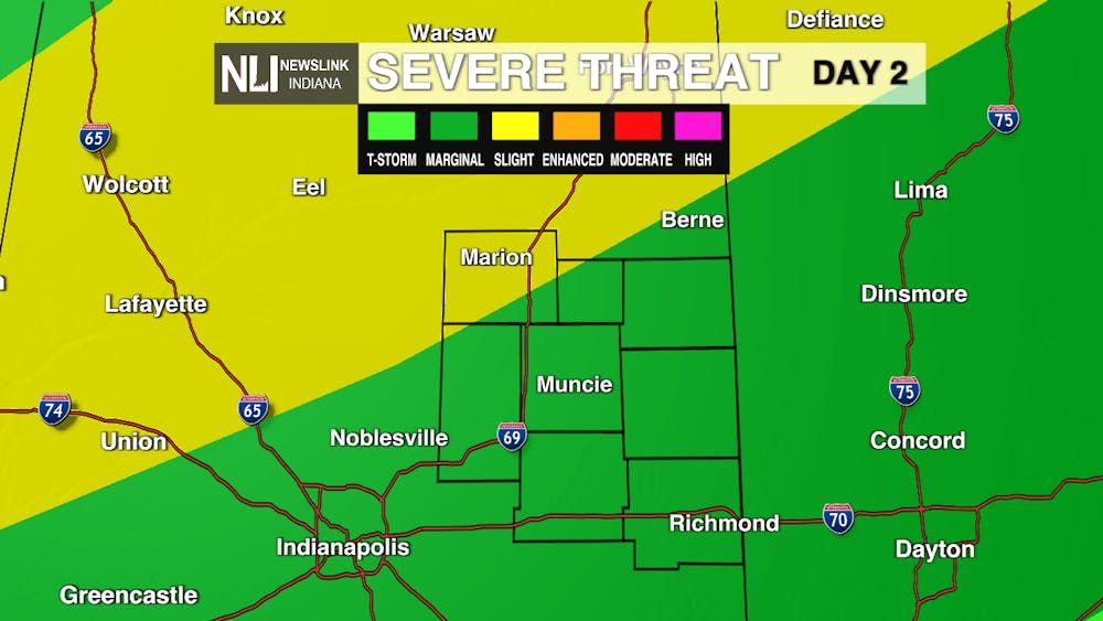
Tomorrow: Tomorrow, a much more active weather pattern sets up. An area of low pressure is set to move through Ontario, Canada tomorrow, and it’s associated cold front will bring chances for severe weather to Indiana. We are under a Marginal Risk (level 1 out of 5) for severe weather across our entire viewing area, with greater chances for severe weather off to our north and west. The best chances for severe weather will be after sunset, with the greatest threats being damaging winds, brief heavy downpours, and flash flooding. The NewsLink Indiana Weather team will continue to track these storms as they move closer to the area tomorrow, and will bring you all the latest updates online and on Twitter. Stay weather aware and have multiple ways to receive weather warnings tomorrow night!
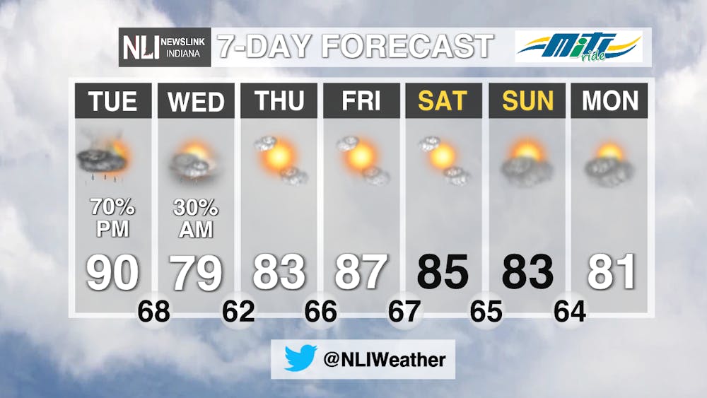
7-Day: After the cold front passes Tuesday, we look to remain mostly dry for the rest of the week, with just a slight chance that a shower or two lingers into Wednesday morning. The relentless heat and humidity show no signs of stopping, as the Climate Prediction Center’s 6-10 day outlook places much of the continental United States in a high probability of seeing above average temperatures. Temperatures will remain above our seasonal average of 81, into the mid and upper 80s to round out the week.

NewsLink Indiana Chief Weather Forecaster Maddi Johnson
Follow us on Twitter @NLIWeather for breaking weather updates.
NewsLink Indiana is a proud Ambassador for the NOAA Weather-Ready Nation program.
For more information about the Weather-Ready Nation program please click HERE.


