


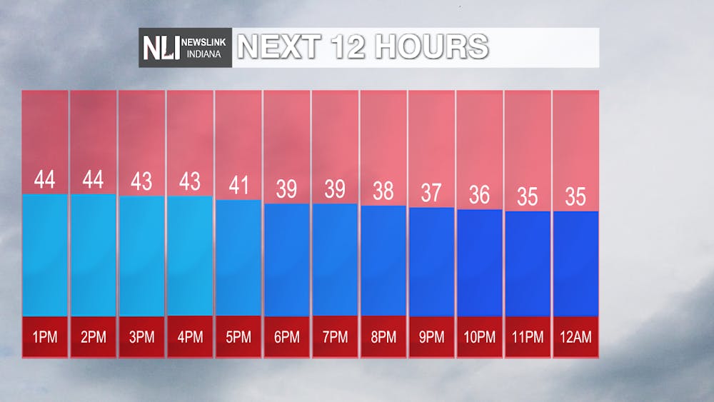
Today: Temperatures will start to drop into the 30s starting at around 4pm and this is when the system will move into the area. As temperatures drop, rain will change to snow. Today winds will stay calm out of the North Northeast at around 5-10 mph.
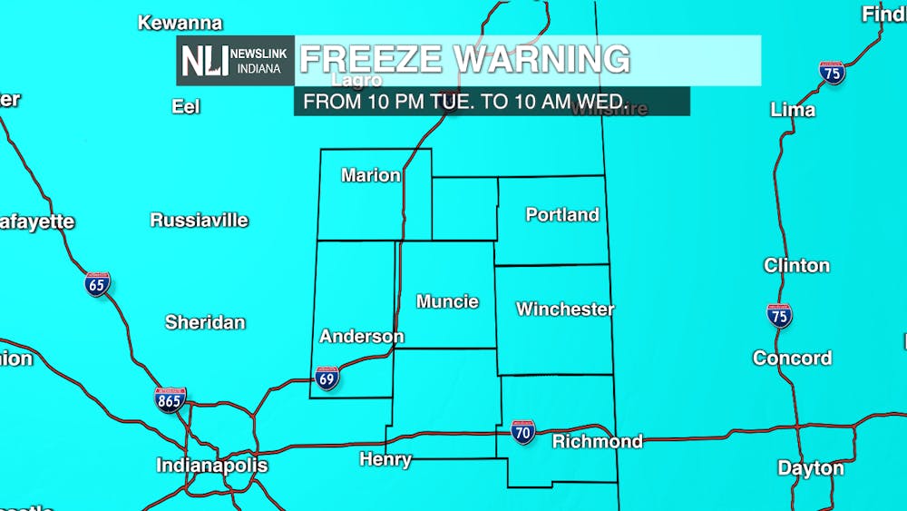
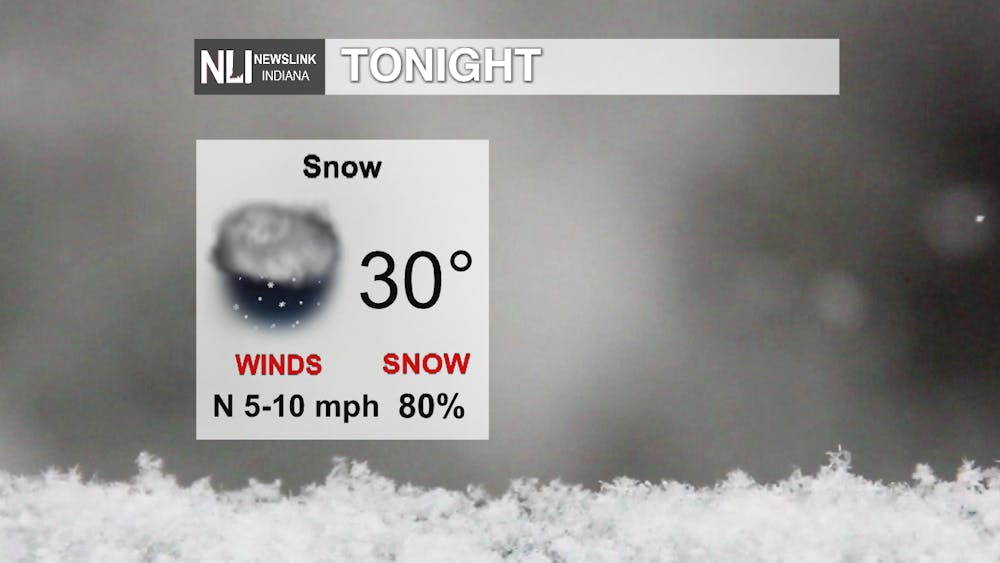
Tonight: Snow will start to become more widespread by the late evening hours. Be careful if you are driving on the roads, as they could become slick tonight. Muncie and several surrounding areas will be under a freeze warning beginning at 10pm and this will not be uplifted until tomorrow morning at 10 am. Be sure to cover any exposed plants. Blackford, Grant, and Jay are the only counties currently that will be under a winter weather advisory starting at 7 pm tonight and ending at 7 am tomorrow. This advisory is not currently in place for Muncie. Tonight temperatures will drop to the lower 30s and winds will stay calm.

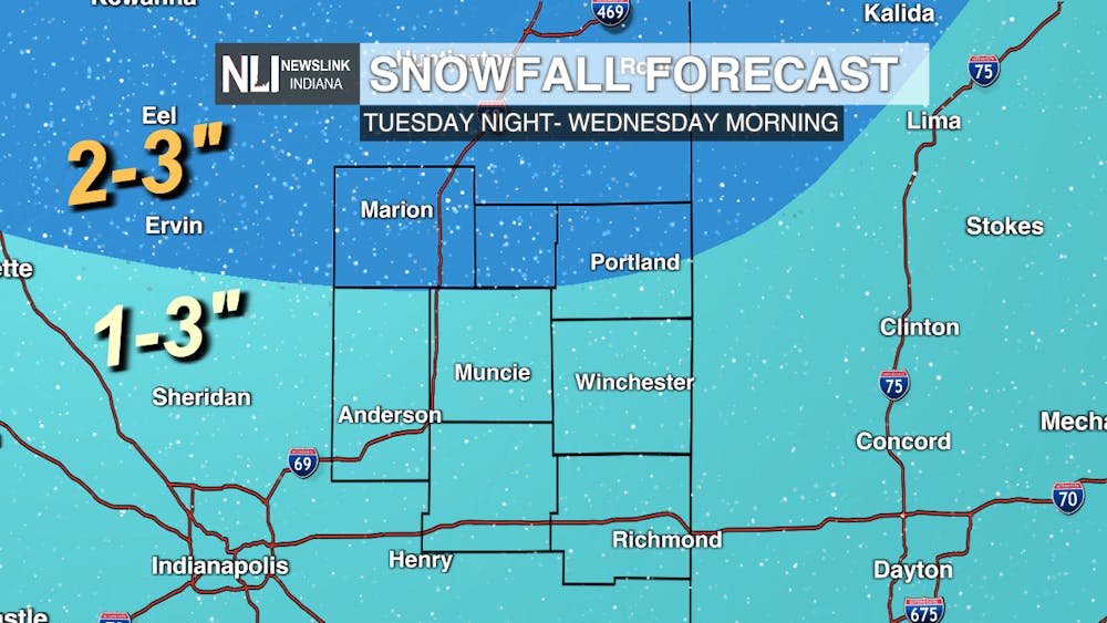
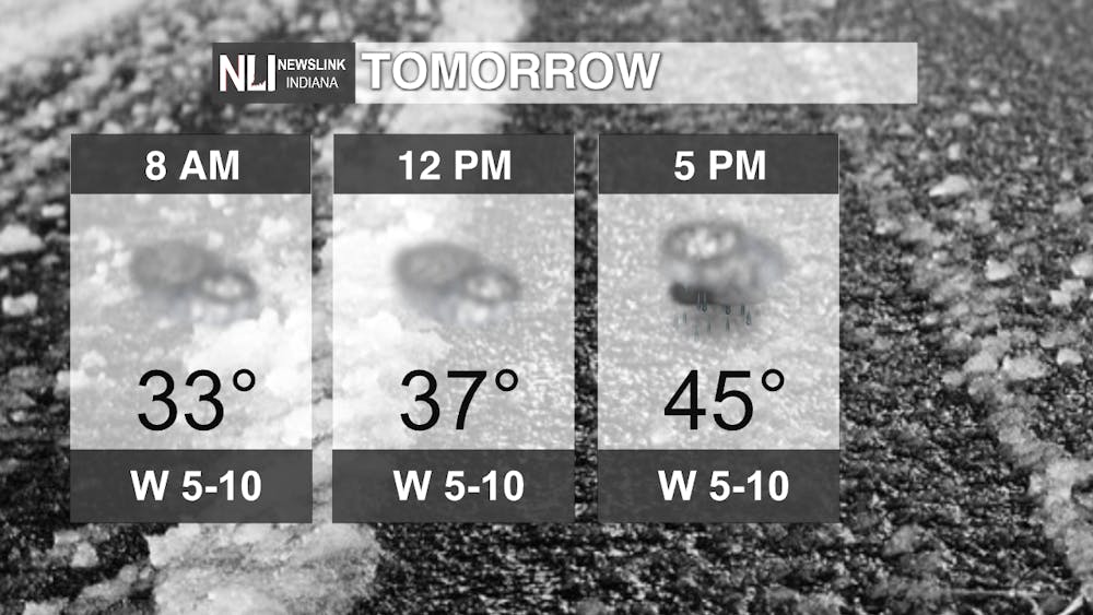
Tomorrow: By early Wednesday morning, the system will have moved out of the area. Snowfall total amounts will vary for areas. Southern portions of our area will likely receive 1-3 inches. Northern counties like Blackford, Grant, and portions of Jay will receive slightly more snow. Most of this snow will not last on the ground because of the warmer temperatures from previous days. Temperatures will still remain on the cold side. Rain chances are possible in the evening hours and winds will stay calm out of the West at 5-10 mph.
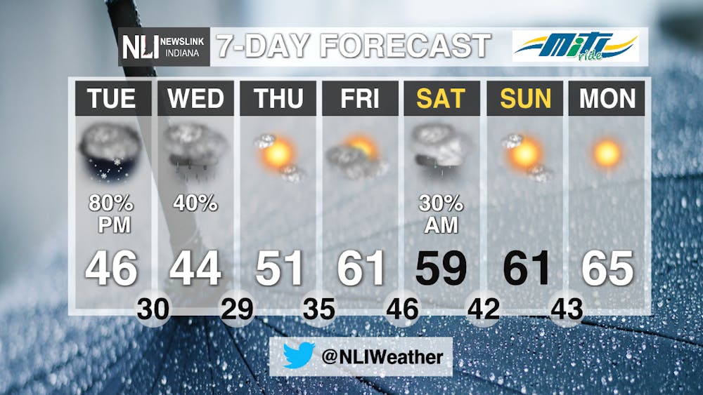
7-Day Forecast: While temperatures remain cold for today and tomorrow, a warm up is on the way for the weekend. The system will move out of the area by tomorrow morning, but some rainfall is possible for tomorrow in the evening. Thursday and Friday remain dry with rain chances returning Saturday. Temperatures start to warm after Saturday and sunny skies return.
---Weather Forecaster Rachel Stinger
Follow us on Twitter @NLIWeather for breaking weather updates.
NewsLink Indiana is a proud Ambassador for the NOAA Weather-Ready Nation program.
For more information about the Weather-Ready Nation program please click HERE


