


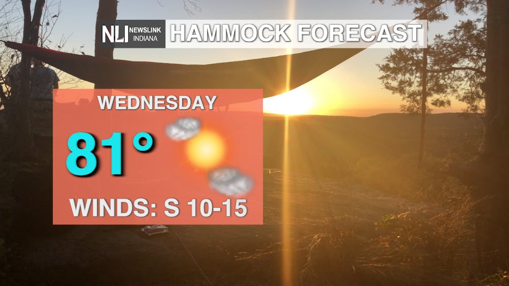
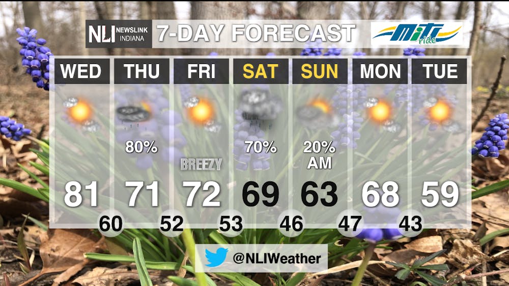
Today: Near record breaking temperatures today, with a high of 81. The record high is 85 and was set back in 2001. Plenty of sunshine through the afternoon, but clouds will increase going into this evening and tonight as the next rain chance pushes into our area. Winds remain on the calmer side coming out of the south at 10-15mph.
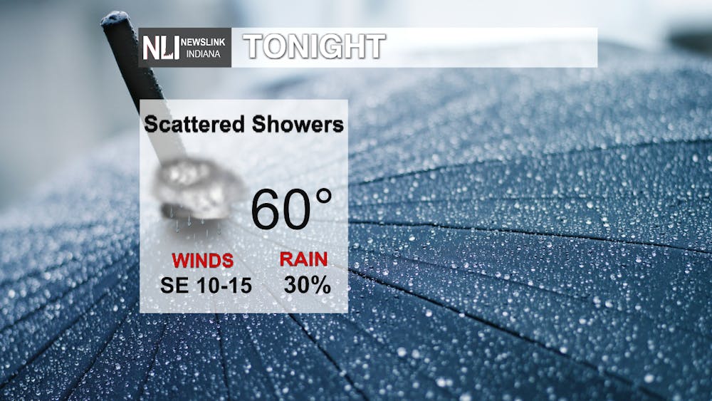
Tonight: Scattered rain showers through the night. Temperatures remain in the 60s with a low of 60 degrees. Winds will pick up just a bit as the system moves into our area, coming out of the southeast at 15-20mph, gusts up to 30.
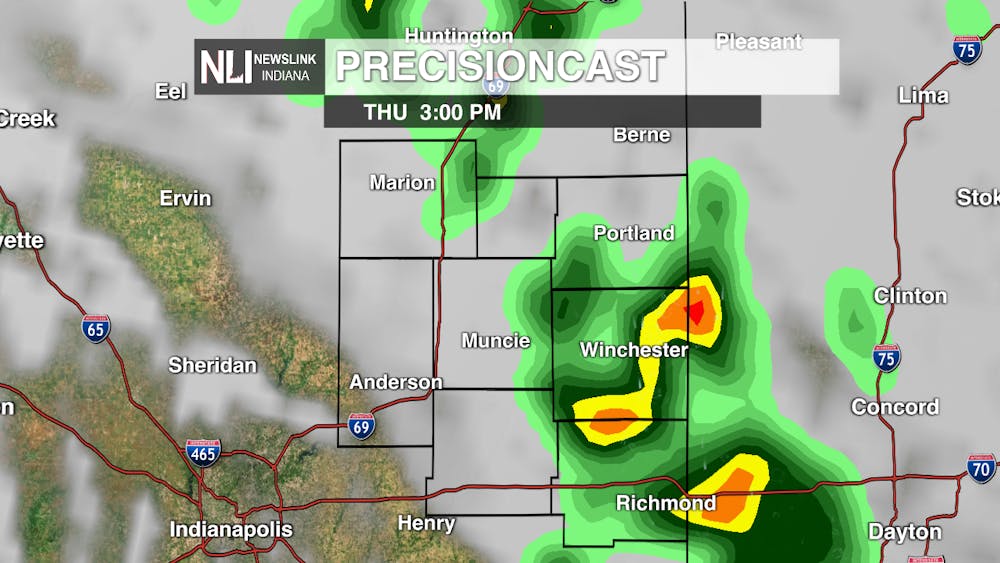
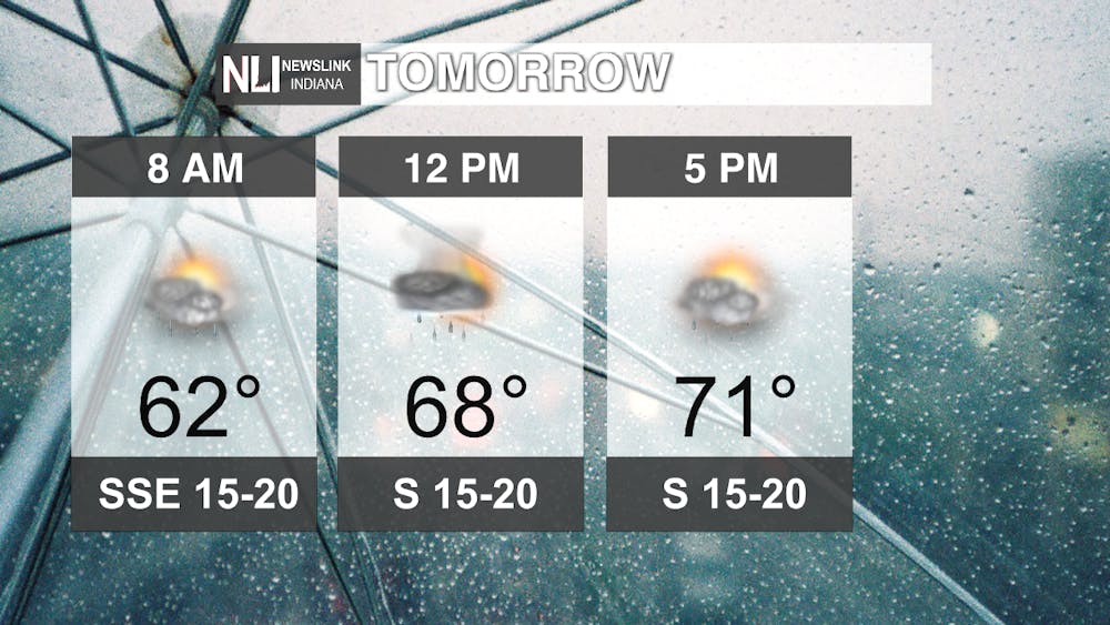
Tomorrow: Rain will become more widespread, especially once the lunchtime hour rolls around. We may even have some thundershowers in the afternoon. By the evening commute, showers will start to taper off. A high of 71 for the day with winds staying breezy at 15-20mph, gusts up to 30.
7-Day Forecast: A big cool down on the way! This weekend will remain above average, with highs in the mid to upper 60s. Rain showers for Saturday and Sunday morning, but will clear out for the start of next week. Behind the rain is a cold front that will bring highs only in the upper 50s for mid-week next week.
-Weather Forecaster Hope Kleitsch
Follow us on Twitter @NLIWeather for breaking weather updates.
NewsLink Indiana is a proud Ambassador for the NOAA Weather-Ready Nation program.
For more information about the Weather-Ready Nation
program please click HERE


