


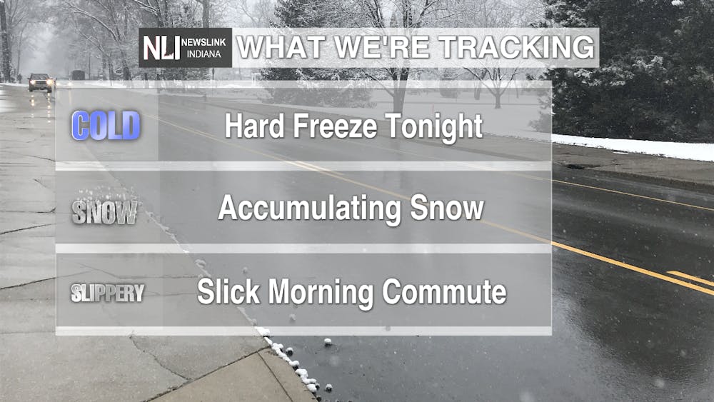
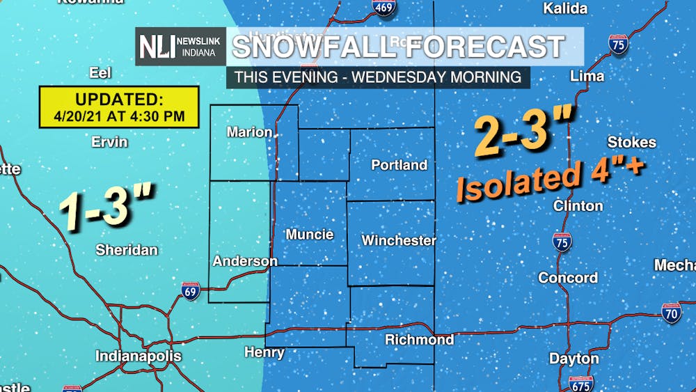
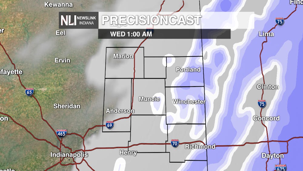
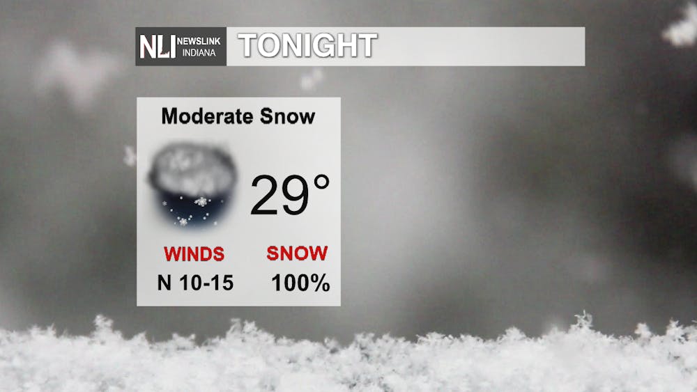
Tonight: Expect rain to continue to changeover to snow this evening as our next weather system moves in from the northwest. By the time we get to daybreak, snow accumulations will total 1-3" for areas west of I-69, and 2-3" to the east, with isolated areas seeing 4"+. Travel impacts will be minimal tonight, but as the temperatures drop below freezing and the snow begins to stick, travel will become more slick overnight. Take it slow and stay safe on your Wednesday morning commute!
In addition to accumulating snow, there is a Freeze Warning in place tonight beginning at 10pm lasting until 10am tomorrow morning. Make sure to cover plants or bring them inside, and drip water from faucets to prevent pipes from freezing overnight. Expect low temperatures to drop into the upper 20s by daybreak, with clearing conditions as the snow tapers off after midnight.


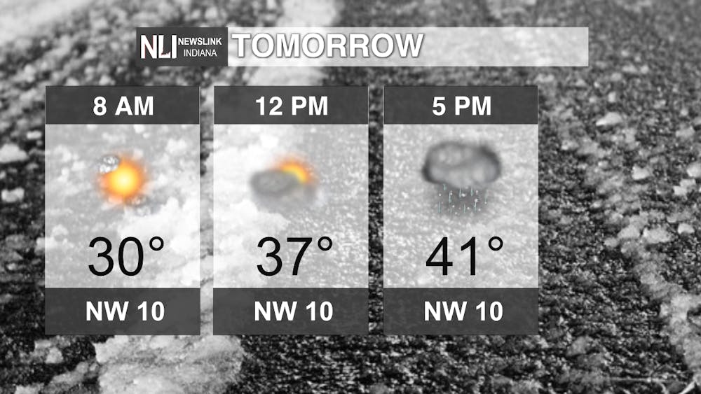
Tomorrow: Expect a break in the clouds by the time we get to sunrise on Wednesday morning. It will be a COLD start for a mid-April morning, with temperatures near 30 to start the day. The Freeze Warning will still be in effect until 10am. Take it slow on the roads tomorrow morning, as conditions will be slick and slippery, thanks to snow melt and temperatures below freezing. We look to be nearly 20 degrees below average for this time of year tomorrow, with temperatures only climbing into the lower 40s by the evening. Clouds thicken throughout the day, and we could see scattered rain/snow showers just in time for the evening commute.
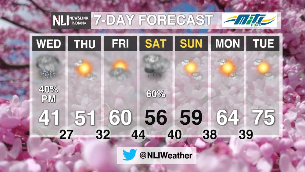
7-Day Forecast: A Freeze Watch is in effect on Thursday from 1AM-10AM as temperatures will drop below freezing once again. We will see a few nights of near or sub-freezing temperatures over the next few days, as high temperatures gradually rebound into the 60s. Another chance for rain is possible on Saturday, but other than that, the rest of the 7 day will be dry. Temperatures will be seasonable, even climbing back to above average into the mid 70s by this time next week!

---Assistant Chief Weather Forecaster Maddi Johnson
Follow us on Twitter @NLIWeather for breaking weather updates.
NewsLink Indiana is a proud Ambassador for the NOAA Weather-Ready Nation program.
For more information about the Weather-Ready Nation program please click HERE


