


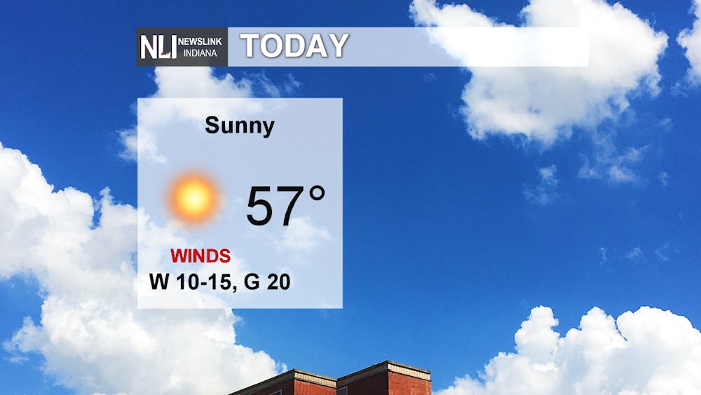
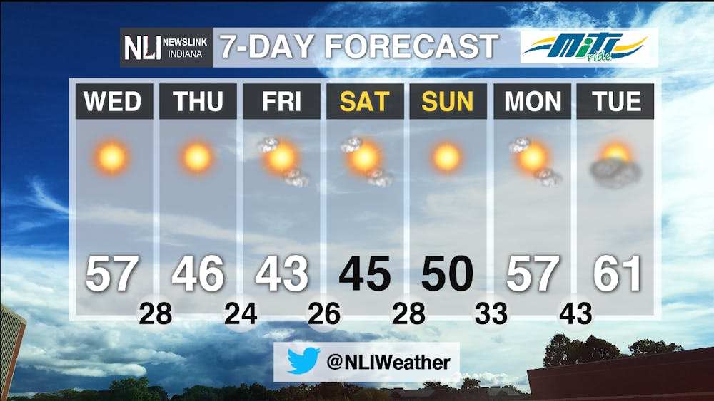
Today: Sunshine once again prevails, and temperatures are teasing a little bit of spring. Highs today will reach into the mid to upper 50s, though 60 isn't out of the question. Winds will be a bit strong from the west at 10-15 mph with some gusts reaching 20 mph.
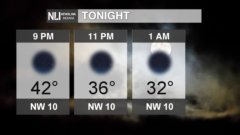
Tonight: Winds will begin to shift northwest but calm a bit at 5-10 mph. The northerly winds will bring us cooler temperatures for the overnight and next couple days, but it is also carrying a high-pressure system (that means more sunshine!) that will settle in later this week. The low falls into the upper 20s, and skies remain mostly clear. A few clouds could pop up later in the night, but it won't be enough to hide the moon.
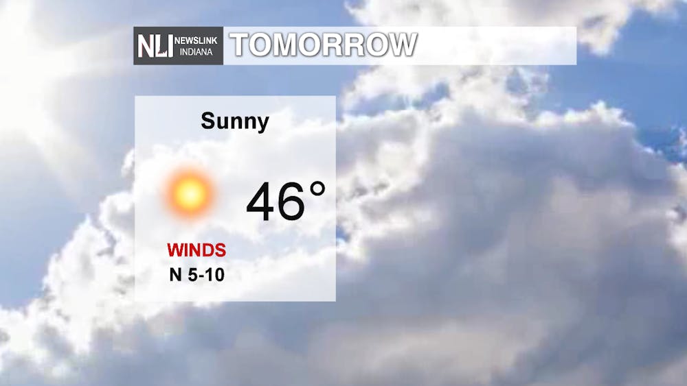
Tomorrow: It will be colder as northerly winds bring in a taste of polar air. The high will be in the mid-40s with winds from the north at 5-10 mph. Sunshine will still be in the picture, especially as that high-pressure builds in.
7-Day: There is a bit of a trend with the high-pressure prevalent this week. Sunshine and temperatures in the 40s will be the case for the rest of the workweek into the weekend. By Sunday, above-average temperatures are expected with highs in the 50s. We might even hit 60 by Tuesday! Still, sunshine with a few more clouds mixed in there will stay with us for the beginning of next week. Though the seven day doesn't show it, our next chance of rain looks to come towards the middle of next week; right now, it is looking like Tuesday night into Wednesday. Of course, this system could move through earlier or later than expected at this point, so we will see what happens as that comes closer. Future temperatures are still looking to be above average.
-Weather Forecaster Natasha Leland
Follow us on Twitter @NLIWeather for breaking weather updates.
NewsLink Indiana is a proud Ambassador for the NOAA Weather-Ready Nation program.
For more information about the Weather-Ready Nation program please click HERE
