


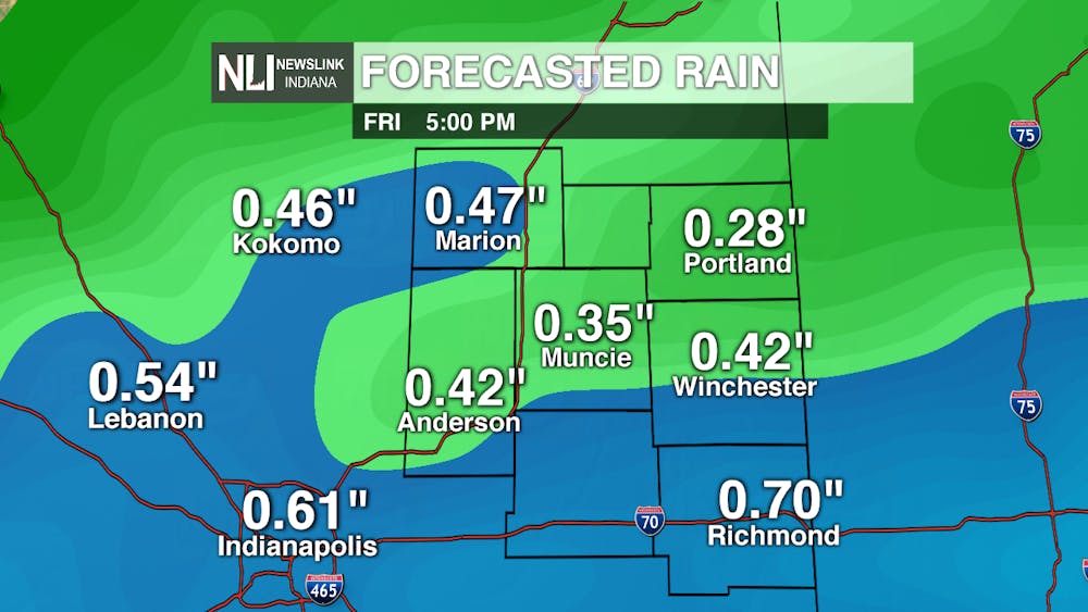
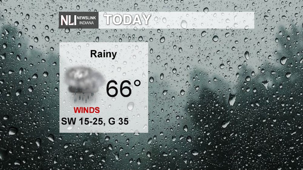
Today: Heavier pockets of rain move in early this afternoon but will quickly move off to the southwest. Lighter showers are to stick around throughout the day. Gusty winds continue to come out of the southwest at 15-25mph with gusts up to 35mph.
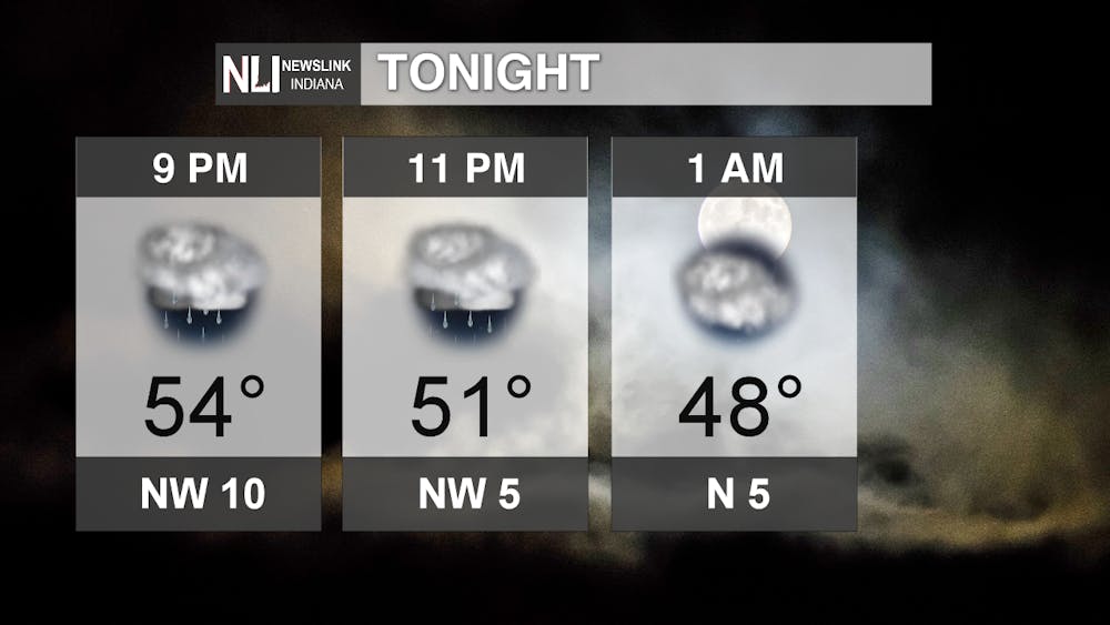
Tonight: Winds die down after the evening commute and will flip around, coming out of the northwest. This will bring cooler winds and will drop our temperatures throughout the night into the 40s. Rain will taper out after midnight, bringing clearing skies for the early morning.
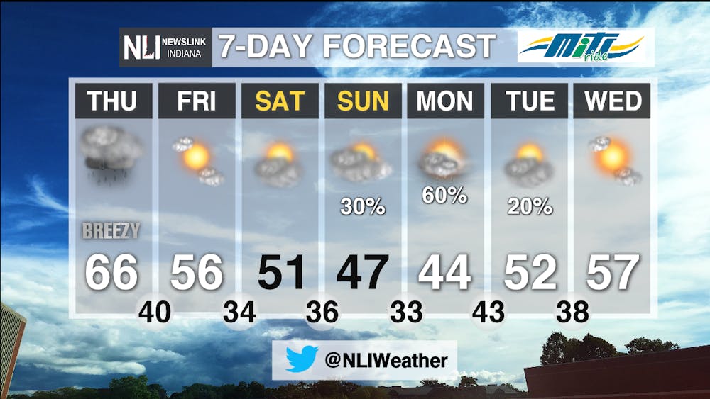
7-Day Forecast: Friday and Saturday stay well above average with mostly clear skies, but another round of rain moves in by Sunday night. Temperatures drop back down to the 40s for Sunday and Monday. Monday morning will bring a chance of a quick round of snow showers. Yes, you read right, snow showers! The ground will be too warm for anything to stick, but we could see some snowflakes mixed in with the rain. Rain will continue through the day Monday and into Tuesday morning.
--Weather Forecaster Hope Kleitsch
Follow us on Twitter @NLIWeather for breaking weather updates.
NewsLink Indiana is a proud Ambassador for the NOAA Weather-Ready Nation program.
For more information about the Weather-Ready Nation program please click HERE


