


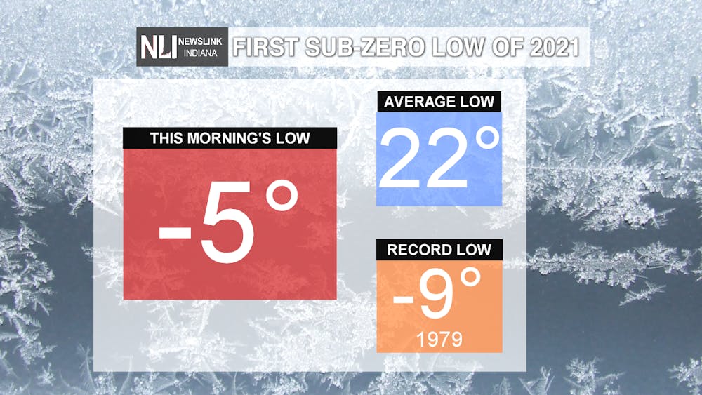
Today was the first day in Muncie that temperatures dropped below zero in more than 2 years! The last time we saw a sub-zero temperature was January 31, 2019 when the low was -6 degrees. Our average low this time of year is 22, so this morning's low was 27 degrees below average! Cold temperatures are still in the forecast to end the week, but they won't be anywhere near as cold as what we saw this morning.
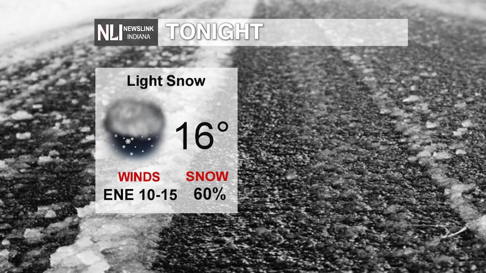
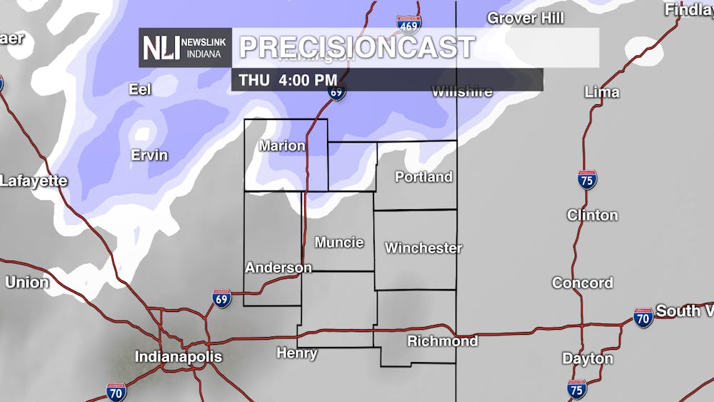
Tonight: Tonight's low, while still below average, is nearly 20 degrees warmer than this morning's temperatures! Snow moves in after midnight, gradually becoming more widespread by daybreak. Give yourself a few extra minutes tomorrow morning to scrape ice off your car and get to your destination. Roads and sidewalks could be slick. The low tonight is 16 degrees, but with winds coming out of the east northeast at 10-15mph it will feel colder.
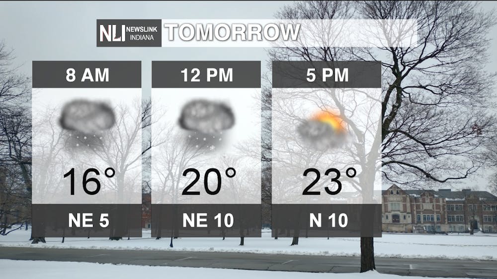
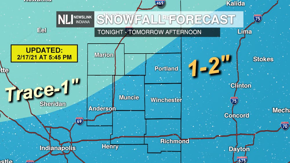
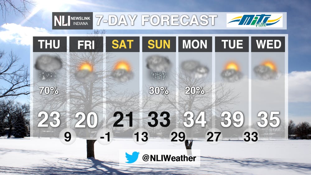
Tomorrow: Temperatures stay relatively steady tomorrow in the upper teens to the lower 20s. Snow will be widespread in the morning, tapering off to scattered showers by the afternoon. The evening commute tomorrow could be slick, as roads and sidewalks will be snow-covered. Much like the morning commute, give yourself a few extra minutes for travel in the evening. However, snow totals will pale in comparison to what we saw earlier in the week. By the time the snow wraps up, expect 1-2" across much of the viewing area, with lower totals to the northwest. Stay safe and weather aware tomorrow throughout the day!

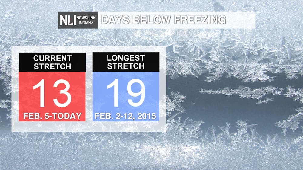
7-day: Today marks our 13th consecutive day of temperatures below freezing in Muncie. The last day we saw temperatures above 32 degrees was February 4th, almost two weeks ago! This stretch of 13 days is getting closer to our longest stretch of below freezing days, which is 19 set back in February of 2015. However, we do expect to break this stretch in the coming days as temperatures are forecast to be back above freezing on Sunday. A mixture of snow and rain moves in to end the weekend, as temperatures steady out in the upper 30s next week, which is much closer to where our temperatures should be for mid-February.
---Assistant Chief Weather Forecaster Maddi Johnson
Follow us on Twitter @NLIWeather for breaking weather updates.
NewsLink Indiana is a proud Ambassador for the NOAA Weather-Ready Nation program.
For more information about the Weather-Ready Nation program please click HERE


