


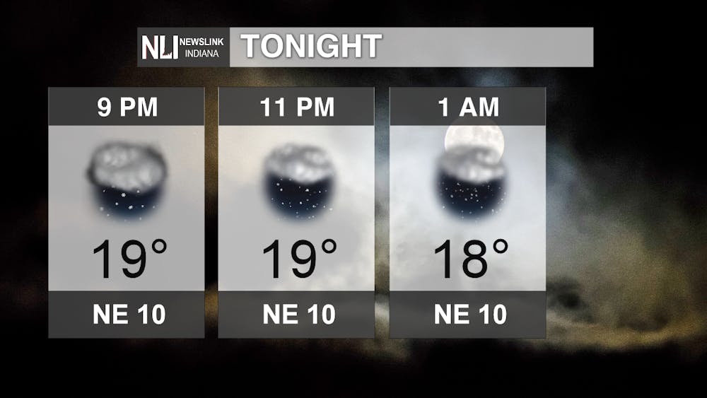
Tonight: Snow showers continue into this evening, but will begin to taper out after midnight. Temperatures stay cold, in the upper teens, but the wind will drop the wind chills into the single digits.
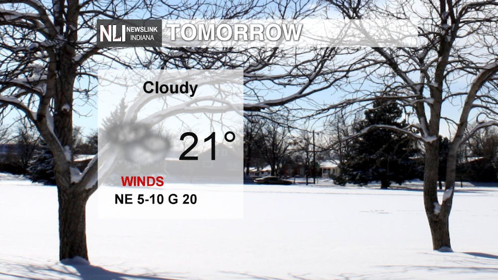
Tomorrow: Snow flurries may stick around in the morning hours, but will clear out leaving cloudy skies for the remainder of the day. A high of 21 with breezy winds of 5-10mph, gusts up to 20mph.
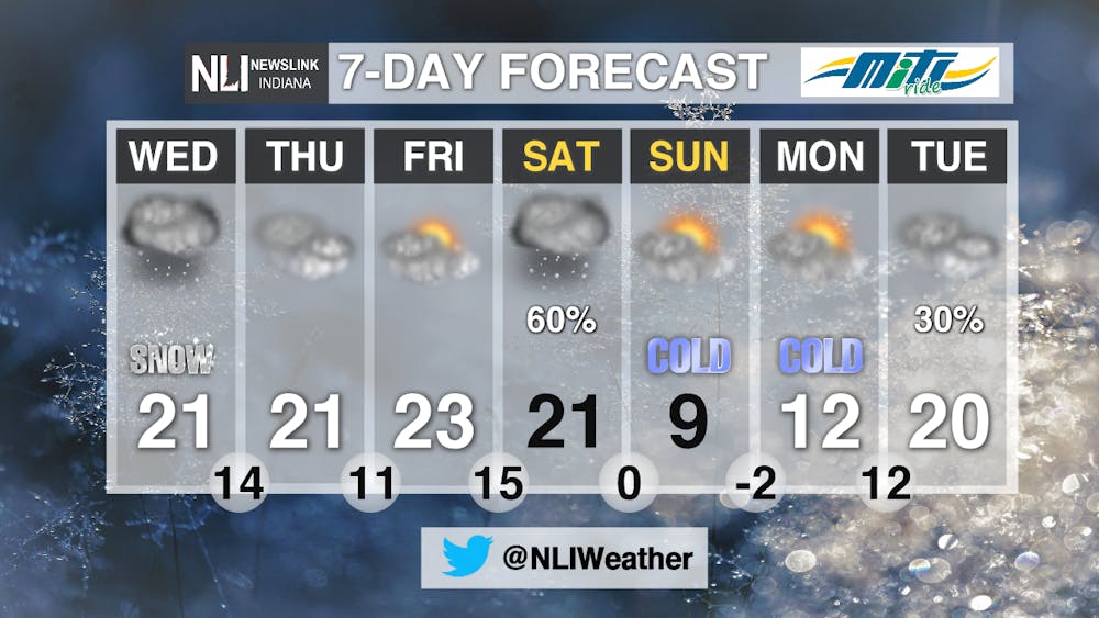
7-Day Forecast: Cold temperatures continue as the artic blast from the north remains stagnate across most of the nation. Another snow system is to move into the region on Saturday, leaving us with another round of accumulating snow. Temperatures drop for Valentine's Day with a high of only 9 degrees. Watch for lows of below zero Sunday night with wind chills dropping even further.
--Weather Forecaster Hope Kleitsch
Follow us on Twitter @NLIWeather for breaking weather updates.
NewsLink Indiana is a proud Ambassador for the NOAA Weather-Ready Nation program.
For more information about the Weather-Ready Nation program please click HERE


