


We are currently in the stage of winter that most of us typically are not huge fans of. We love to see the snow fall and fresh snow on the ground , but generally don't really like the colder temperatures. This time of year in late winter, it is pretty common to see multiple shots of artic air from a polar vortex that dips down into lower 48 states. We saw temperatures here in Muncie dip down to 1 degree right around sunrise yesterday and temperatures dip down below 0 around the area. Not quite as cold today getting up to 25 but that is the warmest its going to be all week. On and off snow showers are also likely throughout the week bringing the possibility for multiple rounds of accumulating snow
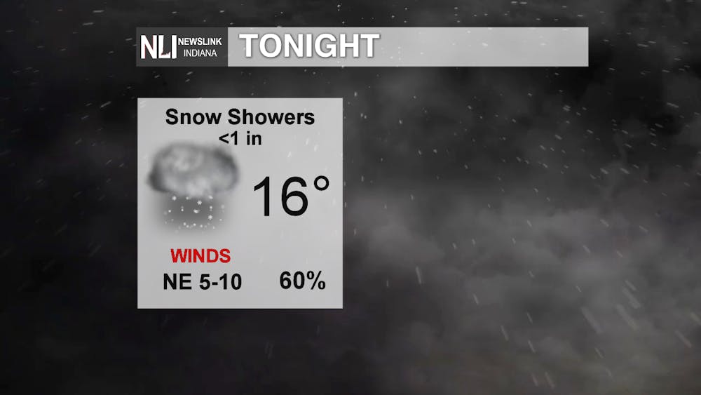
Tonight its going to get down to 16 degrees with lingering snow showers here and there through out the evening into tomorrow morning. A little accumulation is expect but nothing more than 1 inch. So don't be suprised if you take a look outside and see some snow falling or a quick coating or dusting on the side walks, roads, or your car. Winds aren't looking to be too strong tonight, but once the sun goes down and even with winds at 5-10mph you can still see windchill temperatures down to 4-8 degrees.
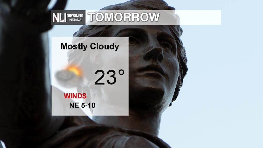
Tomorrow we will see a brief break from the snow before we have another system move through on Wednesday. Mostly cloudy conditions for the most part tomorrow but we could have times throughout the day where the sun could poke out for just a little bit. Gettting up to 23 degrees tomorrow winds North East at 5-10 mph, but we could have some wind gusts up to 25. With stronger winds comes colder wind chill values, so make sure you bundle up tomorrow since wind chill values with stronger winds can find their way into the single digits during the day time tomorrow.
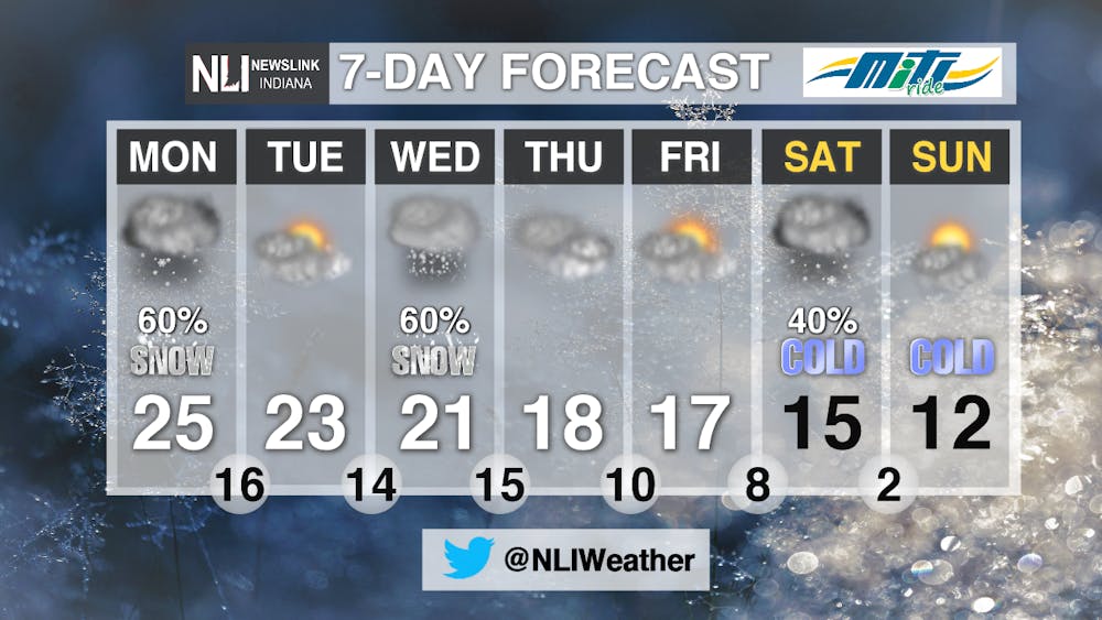
Dropping high temperatures all week this week starting at 25 degrees today and possibly getting down to the single digits on Sunday and Monday. This could bring low temperatures all the way down to -20 degrees Saurday and Sunday Evening. We are currently keeping a close eye on the midweek through early next week since another system is looking to make its way through the area and could give us a couple of rounds of multiple inches of snow. By the time the system moves out we could see a total of 8 additional inches. Not all of that snow will fall at one, it will be broken up into multiple days allow the snow to settle and compact before more snowfalls. At the moment it is looking like 2-4 inches Wednesday morning through Thursday morning, and 1-3 more inches on Friday, and 1-3 more inches Saturday morning through Sunday evening. There is potential to see even more snow on Monday and Tuesday next week but we will keep you updated as we progress through this week.
-Weather Forecaster Adam Feick


