


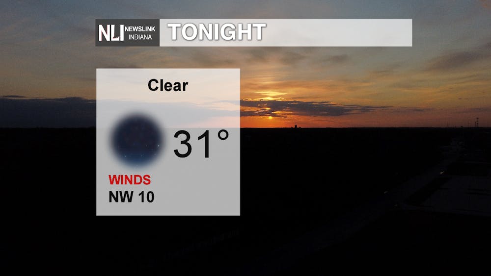
Tonight: We are going to start feeling those cold temperatures tonight. The past several days, we were breaking temperature records and now we are taking a big dip today and tonight. High pressure will bring our clear skies and the recent cold front will bring our chilly temperatures which is expected to be below freezing.
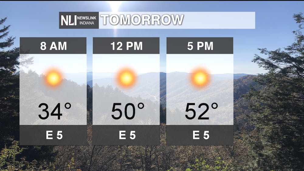
Tomorrow: We get a cold start to the day with temperatures just slightly above freezing but high pressure will lead us to sunny skies and calm winds throughout the entire day. Temperatures expected to reach in the mid 50s for our high.
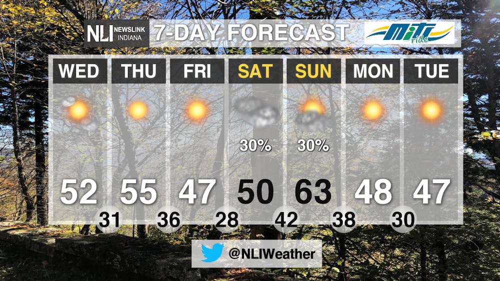
7-day: High pressure will remain around the area for the next couple days which will bring us sunny skies. Temperatures will hover around the mid to lower 50s throughout the rest of the week. What is not seen, is the slight chance of snow showers during the early morning this Saturday. Eventually then leading to cloudy skies. Starting off next week, temperatures will drop into the upper 40s as another cold front is expected move through the area.
--- Weather Forecaster Chris Guevara
Follow us on Twitter @NLIWeather for breaking weather updates.
NewsLink Indiana is a proud Ambassador for the NOAA Weather-Ready Nation program.
For more information about the Weather-Ready Nation program please click HERE


