


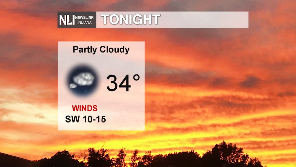
Tonight: Another chilly night ahead with a low of 34°F. Winds are calmer than yesterday, but breezier conditions are prevailing throughout the night making wind chills fall into the 20s. Partly cloudy overnight with southwest winds at 10-15 mph and gust up to 25 mph.
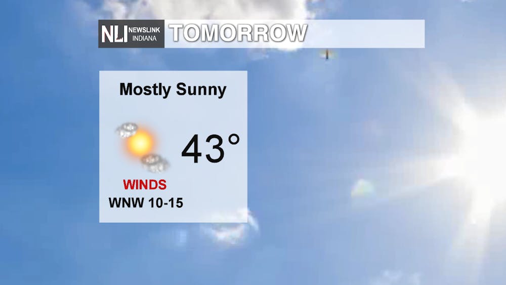
Tomorrow: A cold start for Tuesday with breezy conditions sticking around with winds transitioning to a west-northwest direction at 10-15 mph and gusting around 20 mph. During your morning commute, windchills in the upper 20s to 30s with a slight chance for a few snow flurries in the early morning. As the day goes on partly cloudy skies and high of 43°F will occur with temperatures falling back into the 30s again overnight.
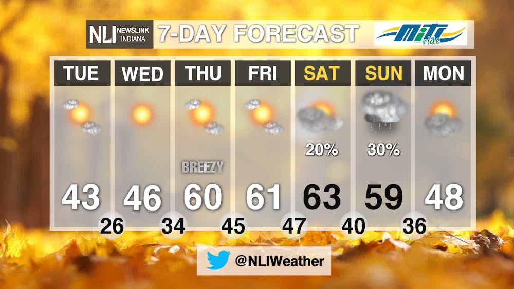
7-Day: After the cold start to the week temperature for the remainder of the week are on the rise. Wednesday night a southerly shift of wind will bring in warmer conditions and highs in the lower 60s will proceed for the latter half of the forecast. A chance for rain pops in Saturday night into Sunday and conditions become more seasonable for the beginning of next week.
-------Weather Forecaster Natalie Fitzpatrick
Follow us on Twitter @NLIWeather for breaking weather updates.
NewsLink Indiana is a proud Ambassador for the NOAA Weather-Ready Nation program.
For more information about the Weather-Ready Nation program please click HERE


