


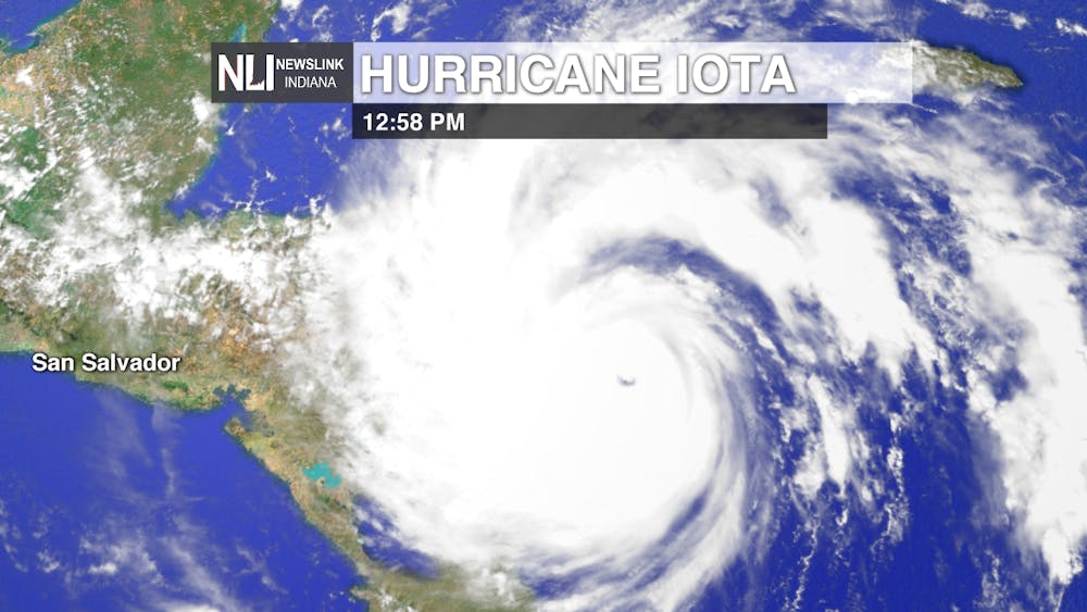
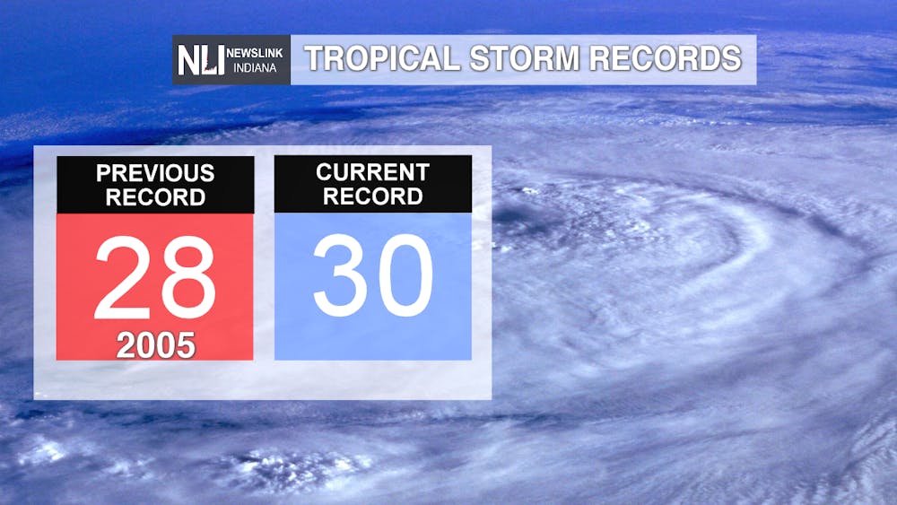
Hurricane Iota: Tracking the tropics, Hurricane Iota is expected to impact Nicaragua this afternoon as a rare Category 5 hurricane for the month of November. Last time November saw a Category 5 hurricane was back in 1932. Iota is expected to follow the same path as Hurricane Eta; which hit as a Category 4 hurricane. Adding on to be being a rare Category 5 November hurricane, Iota adds on to the record breaking hurricane season for 2020 making it the 30th named storm this year.
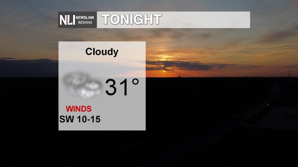
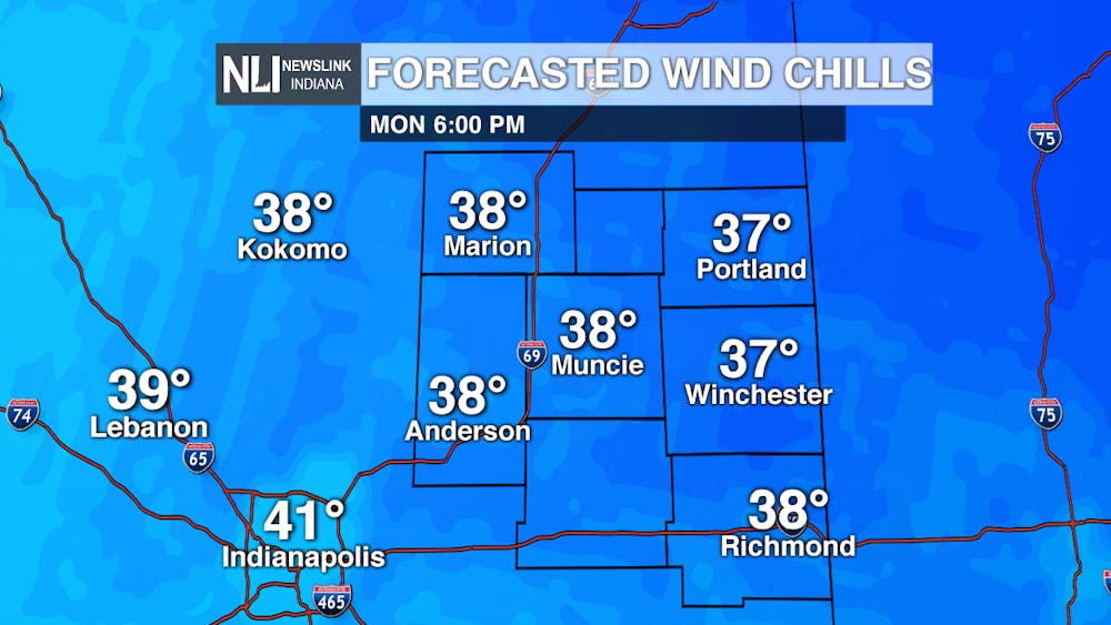
Tonight: Windy conditions are going to be expected throughout the evening into the overnight hours. Wind gusts can reach up to 34 mph which can make feel like temperatures down by 8 degrees than from the current temperatures. Hovering in the lower 30s, wind chills can drop into the lower 20s for overnight hours and for the evening, hovering in the upper 30s.
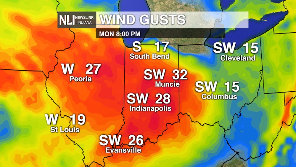
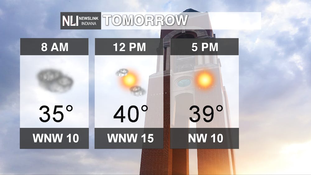
Tomorrow: Getting a chilly start to the day with breezy winds continuing from the previous day. With temperatures hovering in the mid 30s for the morning hours. Factoring in the wind gusts, temperatures can feel like they are in the upper 20s to lower 30s. We can also see a slight chance of a few flurries to snow showers during the morning commute but will move out of the area as the day progresses which will lead to sunny skies.
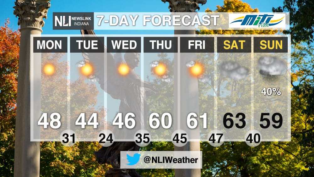
7-Day: It will continue to feel like late fall to early winter but eventually another warm up is on the way. By Thursday and leading into the weekend, temperatures are expected to climb into the lower 60s. By the weekend, an increase in clouds will move in with also a chance of some showers to end off the week before temperatures start to fall again.
--- Weather Forecaster Chris Guevara
Follow us on Twitter @NLIWeather for breaking weather updates.
NewsLink Indiana is a proud Ambassador for the NOAA Weather-Ready Nation program.
For more information about the Weather-Ready Nation program please click HERE


