


As of 7pm EDT, Hurricane Delta has made landfall in Creole, Louisiana as a category 2 hurricane with maximum sustained winds of 100 mph. This is the same region that was devastated (and is still recovering) from Hurricane Laura just 6 weeks ago. Storm surge of 10ft+ in coastal regions, as well as flash flooding and hurricane-force wind gusts continue to be the main concerns associated with Delta. As it makes its way inward, Delta will continue to produce widespread rain and storms throughout the south. Portions of Texas and most of Louisiana have already seen heavy rainfall associated with Delta throughout the day today, however, total amounts could end up between 6-10 inches. Arkansas, Mississippi, Alabama, and Tennessee could also see rainfall totals of up to 4 inches as the system continues to move northeastward.
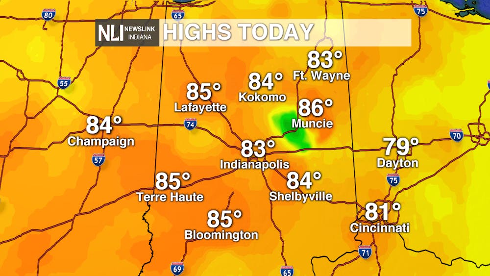
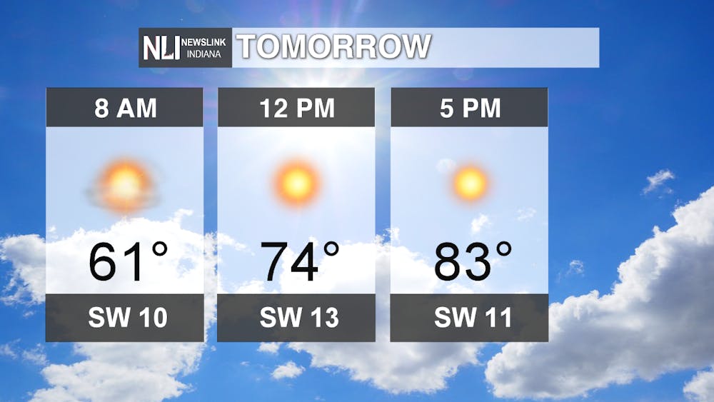
Today: We began the work week in the mid 60s and end it today in the upper 80s. While it is not unusual to see high temperatures in the 80s during October, it does mean that temperatures are well above average. In fact, today in Muncie, the official high temperature was 87, around 20 degrees above average for this time of year! It certainly feels more like the middle of summer rather than the start of fall!

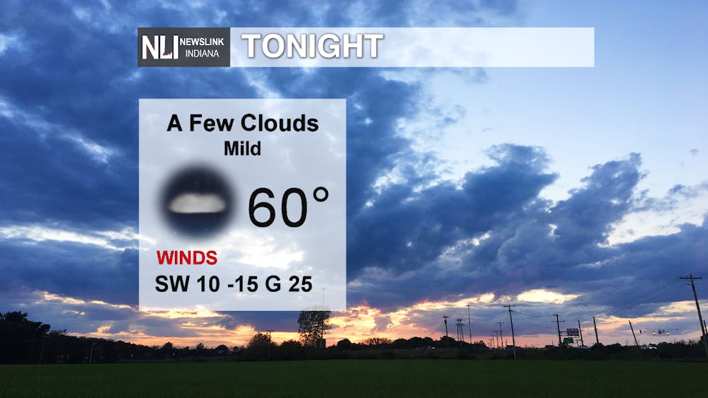
Tonight: Expect breezy conditions to continue, with winds gusting up to 25 mph at times. Skies will be mostly clear, with only a few, occasional clouds. Quite a mild, above average October night is in store, with low temperatures only reaching down to 60!
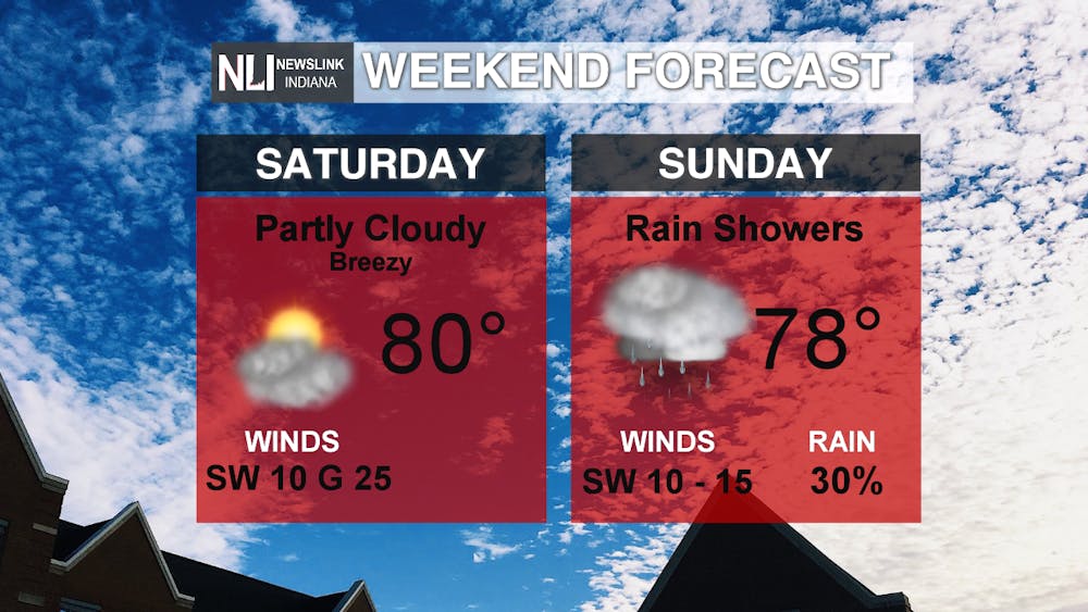
This Weekend: Saturday looks to be pretty similar to today, with temperatures warming into the 80s once again. Breezy conditions continue, with southwesterly winds of 10-15mph, gusting up to 25mph during the afternoon. Expect plenty of sunshine with just a few scattered clouds to start out the morning. Make sure to get outside and take advantage of the beautiful, summer-like weather on Saturday! As for Sunday, we will see a slight chance for rain from the remnants of Hurricane Delta, especially to the South of Muncie. The best chances for some scattered showers come Sunday afternoon and evening. It won't be as windy, with winds coming from the southwest at 10-15 mph.
7-day: After the remnants of Delta move through on Sunday, our next best (and only) rain chances in the extended forecast come on Monday. A low pressure system that sets up in Wisconsin and Illinois will advance through the Midwest, bringing widespread rain chances to Central Indiana late Monday evening into very early Tuesday morning. Temperatures remain above average, in the mid 80s and upper 70s, for the start of the work week. Towards the later part of next week, we return to more seasonal, average temperatures in the mid to upper 60s.
-Weather Forecaster Maddi Johnson
Follow us on Twitter @NLIWeather for breaking weather updates.
NewsLink Indiana is a proud Ambassador for the NOAA Weather-Ready Nation program.
For more information about the Weather-Ready Nation program please click HERE


