


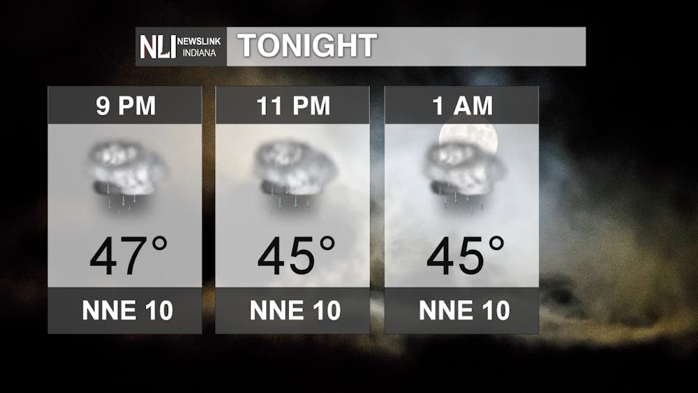
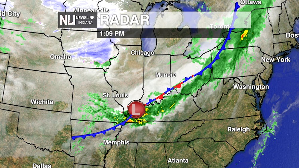
Tonight: We will still see some scattered showers and light rain throughout the night. These scattered showers are accompanied by a low pressure system just off to the southwestern portion of Indiana with a stationary front riding along the Ohio valley which is bringing a lot of rain to the south and even some scattered showers to Delaware and surrounding counties. Temperature wise, will still remain on the cooler side staying in the mid 40s which will make for a cool night.
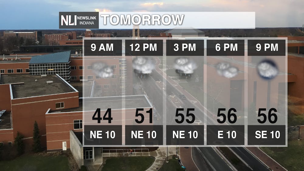
Tomorrow: Temperatures will slowly start to rise into the mid 50s which will still make for a cool day. A few scattered showers will move into the area around the afternoon hours but eventually move eastward and out of the area keeping the remaining of the day dry and cloudy.
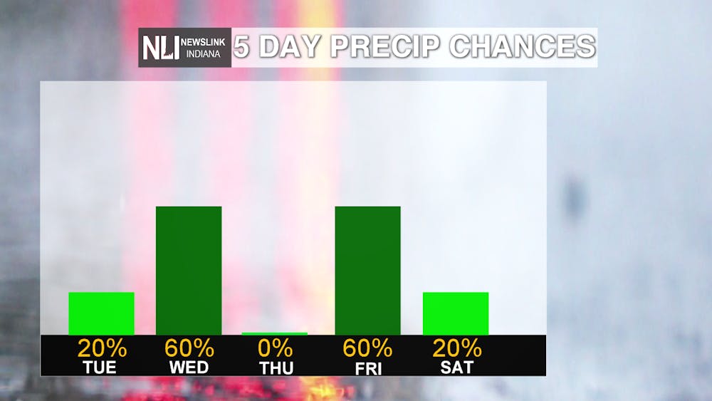
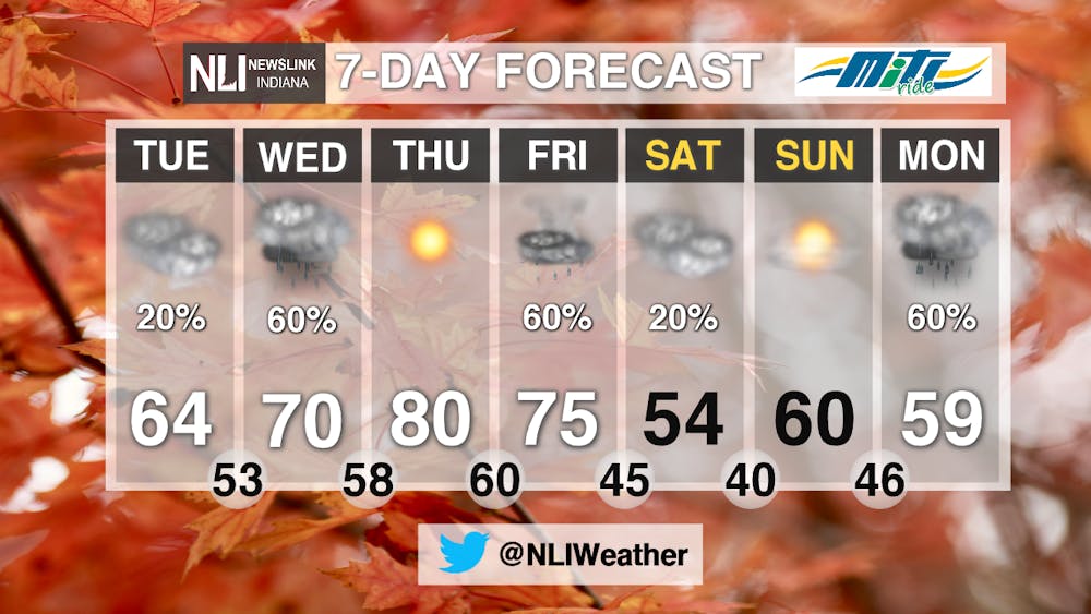
7-Day: Rain chances increase by Wednesday as well as temperatures slowly climb up to the lower 80s by Thursday. Pockets of heavier precipitation is expected around Wednesday evening hours and could bring up to 0.20 inches of rain. Thursday we clear out as we have a shift in the jet stream that will bring a lot more of the warmer, southerly air to our area. A new weather system, accompanied by a warm front and a low pressure system is expected by Friday which will bring rain and thunderstorms to the area. Conditions will dry up for the weekend with a slight chance of a few showers during the Saturday morning commute before rain returns back to the area to start off next week.
-- Weather Forecaster Chris Guevara
Follow us on Twitter @NLIWeather for breaking weather updates.
NewsLink Indiana is a proud Ambassador for the NOAA Weather-Ready Nation program.
For more information about the Weather-Ready Nation program please click HERE


