


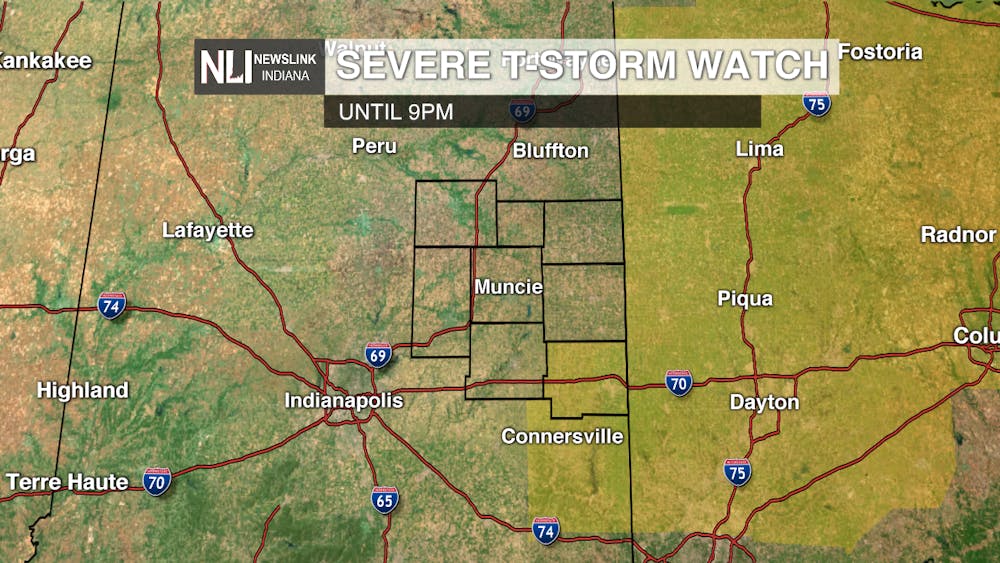
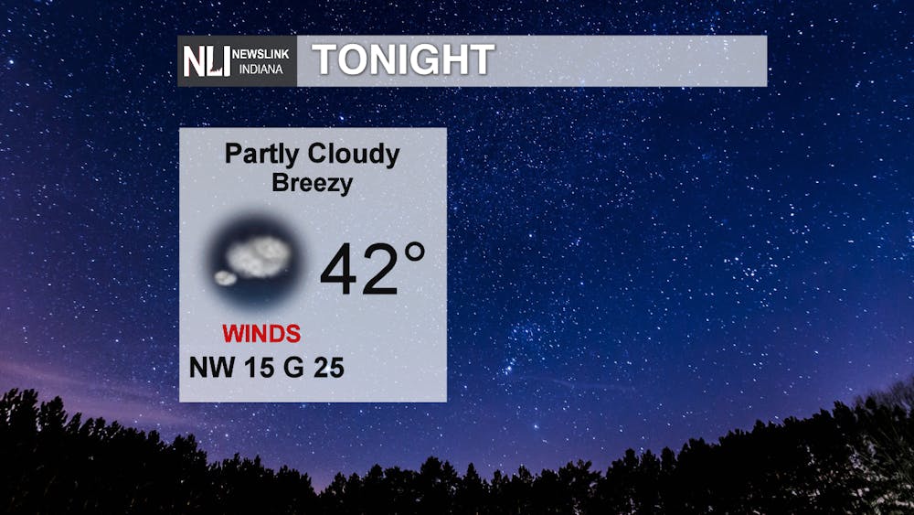
Tonight: The Severe Thunderstorm Watch has expired for most of the viewing area, although conditions still remain favorable for pop up showers this evening. Wayne county is still under a Severe Thunderstorm Watch until 9pm. Rain and storm chances will taper off by midnight, as skies become partly cloudy overnight. Low temperatures will end up in the lower 40s by daybreak. Winds will be breezy out of the northwest at 15mph, gusting up to 25mph at times overnight.
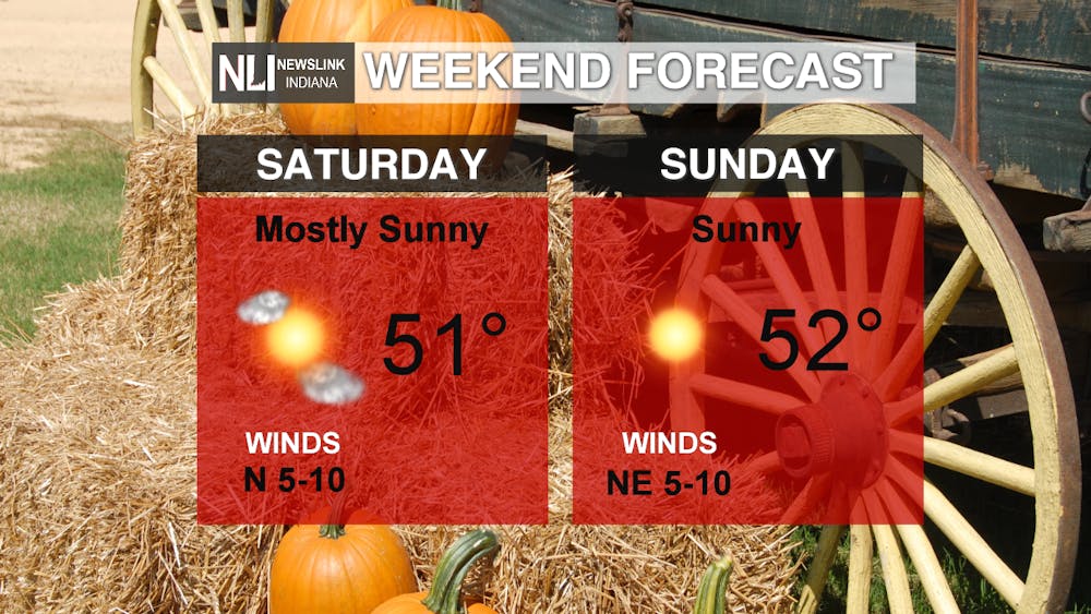
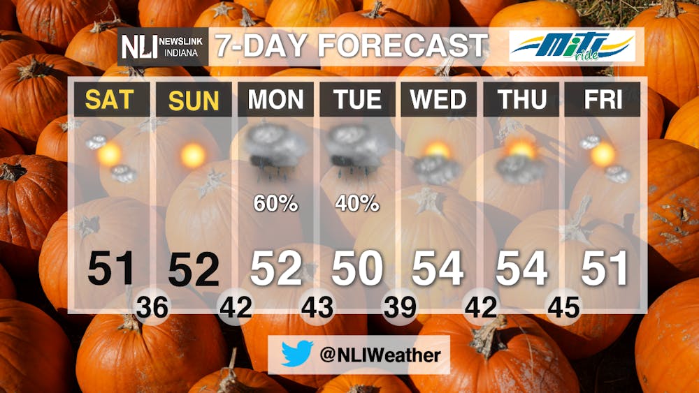
Weekend: Expect beautiful, fall-like conditions this weekend! North winds and a high pressure system from Canada will help bring in cooler, dry air, as highs on both Saturday and Sunday will struggle to reach 50. Winds slow to just 5-10mph over the weekend. Ample sunshine will be in play as that high pressure system moves in. Get outside and enjoy the fall-like weather! It will be a great weekend for any outdoor activities.
7-day: As for the 7-day forecast, the next chance for widespread rain comes Monday afternoon through Tuesday morning. After that, conditions dry out and we will see intermittent breaks of sun and clouds for the rest of the work week. As for temperatures, expect highs in the lower to mid 50s for the entire week. It seems as though fall is finally here!
-Weather Forecaster Maddi Johnson
Follow us on Twitter @NLIWeather for breaking weather updates.
NewsLink Indiana is a proud Ambassador for the NOAA Weather-Ready Nation program.
For more information about the Weather-Ready Nation program please click HERE


