


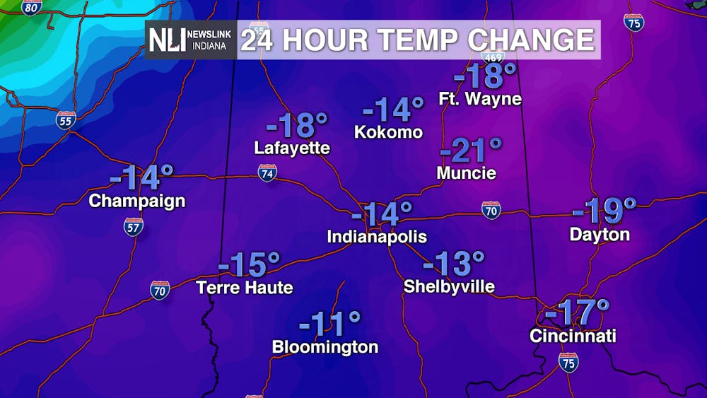
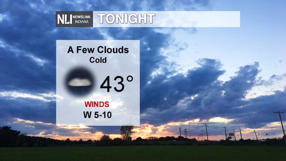
Tonight: We saw a large drop in temperatures today, thanks in part to the cold front and widespread rain that moved through early this afternoon. Highs today topped out near 70 just past midnight, with temperatures falling throughout the day. Tonight, we'll see temperatures fall into the lower 40s; it will be quite a chilly September night. Clouds continue to clear overnight with winds out of the west at 5-10mph.
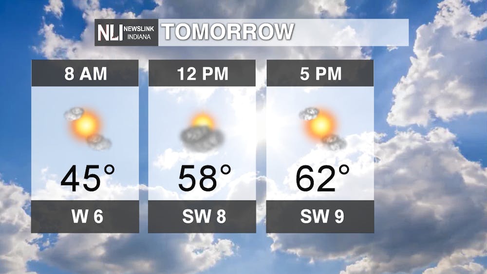
Tomorrow: Temperatures only warm to the lower 60s tomorrow. Make sure to grab a jacket on your way out the door because it will be chilly tomorrow morning! We'll see mostly sunny conditions for most of the day, as temperatures will only be the upper 50s by noon. Winds will be light from the southwest.
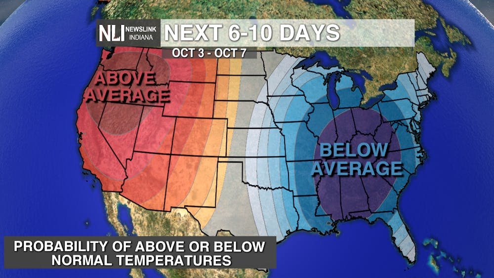
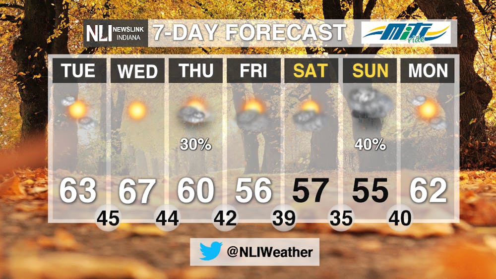
7-day: A much more seasonable, below average temperature pattern sets up as we head into October. Highs will be in the mid 60s, dropping to the mid 50s by the end of the week. There are a few precipitation chances in the extended forecast, but no widespread rain like what we saw earlier today. Enjoy the beautiful, fall-like weather this week!
-Weather Forecaster Maddi Johnson
Follow us on Twitter @NLIWeather for breaking weather updates.
NewsLink Indiana is a proud Ambassador for the NOAA Weather-Ready Nation program.
For more information about the Weather-Ready Nation program please click HERE


