
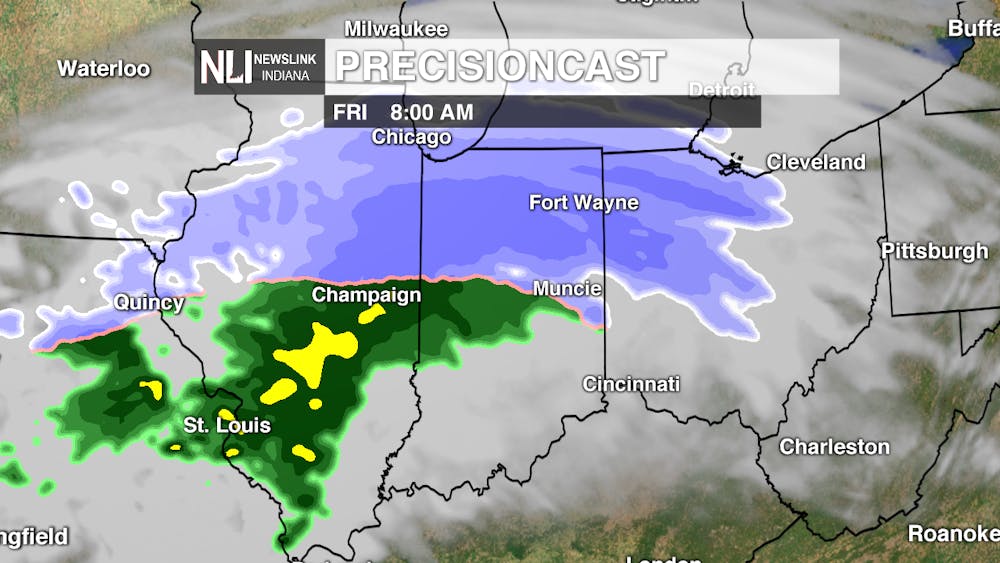
Tonight: Winter makes a return tonight, as a dynamic springtime weather system is set to move through Indiana. We are expecting rain to quickly change over to snow overnight, possibly mixed with rain at times. With the warm ground temperatures in place, we do not expect much accumulation across our area. Still be sure to allow a few extra minutes during your morning commute, as roads could be slick by the morning.

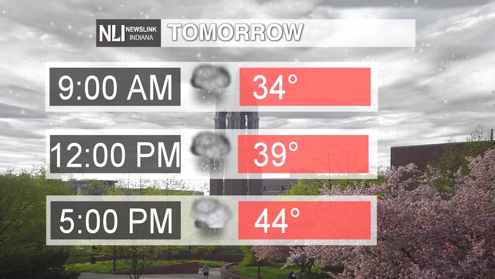
Tomorrow: Snow is expected to quickly transition over to rain during the morning before becoming all rain during the afternoon. High temperatures will reach well above freezing into the mid-40s by the evening, allowing any accumulated snow on grassy areas to quickly melt away.

7-Day Forecast: Warmer air moves in this weekend, with high temperatures reaching the mid-50s. Saturday will feature mostly sunny skies and Sunday will feature a few showers in association with a weak cold front passing through the area from the northwest. Dry conditions are expected on Monday and Tuesday, with even warmer air on the way by midweek. Wednesday and Thursday feature chances for rain showers, with highs in the 60s.

---Assistant Chief Weather Forecaster Nathan Gidley
Follow us on Twitter @NLIWeather for breaking weather updates.
NewsLink Indiana is a proud Ambassador for the NOAA Weather-Ready Nation program.
For more information about the Weather-Ready Nation program please click HERE
Read More

Muncie launches Designated Outdoor Refreshment Areas
By Staff Reports / 11 hours agoBeginning July 7, the City of Muncie announced three new Designated Outdoor Refreshment Areas (DORAs).
IPR: Gov. Mike Braun says tolling needs to be an option for Indiana’s road funding future
By Indiana Public Radio / YesterdayGov. Mike Braun was given slightly more expansive authority this year to explore tolling Indiana’s interstate highways.

Fairs, Fiction and Fun: Muncie’s Week of Events
By Ball State Daily / YesterdayMuncie is buzzing with events July 6–12 that won’t break the bank. Cheer on young talent at the Delaware County 4-H, or give back during Cardinal Greenway Volunteer. Prefer stories over sports? Don’t miss a cozy Evening with Author Robin Lee Lovelace. Then, tee off for a cause at the Liberty Township Fire Department Golf Tournament. Farm, read, or rally — whatever your vibe is, Muncie can match it.
