
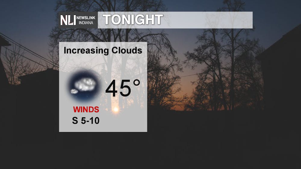
Tonight: What a gorgeous day outside! Get out and enjoy the sunshine and warm temperatures this evening, as we will start to see increasing clouds tonight and temperatures dropping into the mid-40s.
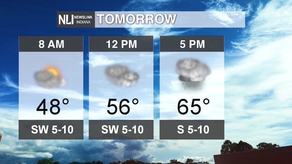
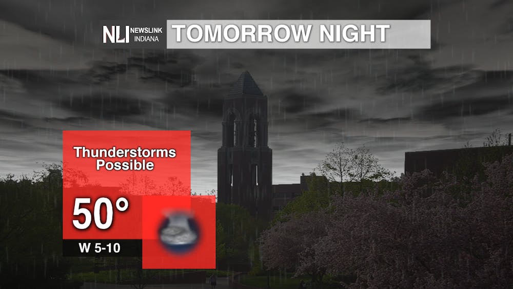
Tomorrow: Clouds will continue to increase, with chances for showers and thunderstorms arriving by the evening and overnight hours. The best chance for thunderstorms looks to lie north of our viewing area, but be prepared for some lightning and heavy downpours during this time. Severe weather is not expected.
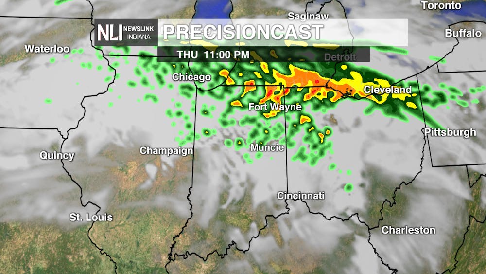
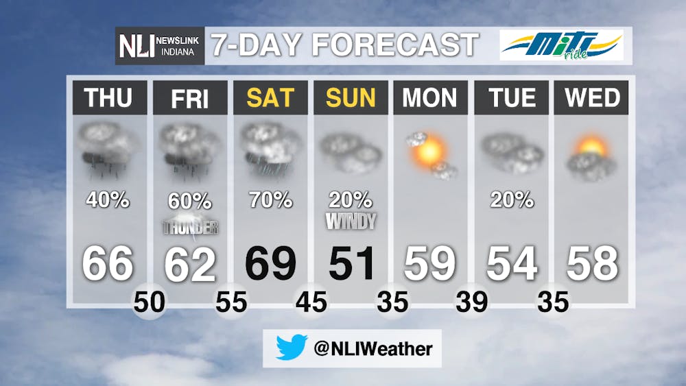
7-Day Forecast: A very busy 7-Day Forecast here, as rain chances continue Thursday, Friday, Saturday, and Sunday. Thunderstorms are possible Friday and some heavy rainfall is possible on Saturday. Total rainfall amounts of 2 to 3 inches are possible, which could lead to some localized flooding. We will get very close to our first 70-degree day of 2020 on Saturday; we will be monitoring the potential for this milestone very closely. Temperatures will fall behind a cold front Saturday night. Sunday will be chilly, with windy conditions and isolated showers across the area. Monday looks to be the pick of the week, with lots of sunshine and warm temperatures. More isolated showers are possible Tuesday before we dry out again on Wednesday.
---Assistant Chief Weather Forecaster Nathan Gidley
Follow us on Twitter @NLIWeather for breaking weather updates.
NewsLink Indiana is a proud Ambassador for the NOAA Weather-Ready Nation program.
For more information about the Weather-Ready Nation program please click HERE
Read More

9-1-1 What's Your Hot Take E12: Season 6 Recap
By Willow Emig and Sam Jasionowski / 2 hours agoIn this episode of 9-1-1 What’s Your Hot Take, Sam and Willow discuss the events of season 5 of 9-1-1.

Prairie Creek Reservoir beach cleared for reopening
By Staff Reports / 3 hours agoThe City of Muncie announced the reopening of Prairie Creek Reservoir's beach via a press release July 3, successfully passing its water quality tests.

Record Parlor of Muncie aims to create good music and good vibes
By Kylee White / 6 hours agoRecord Parlor of Muncie hopes to provide good music while highlighting local artists.
