
We are tracking the potential for severe thunderstorms Friday and Saturday in association with a large weather system impacting the Midwest.
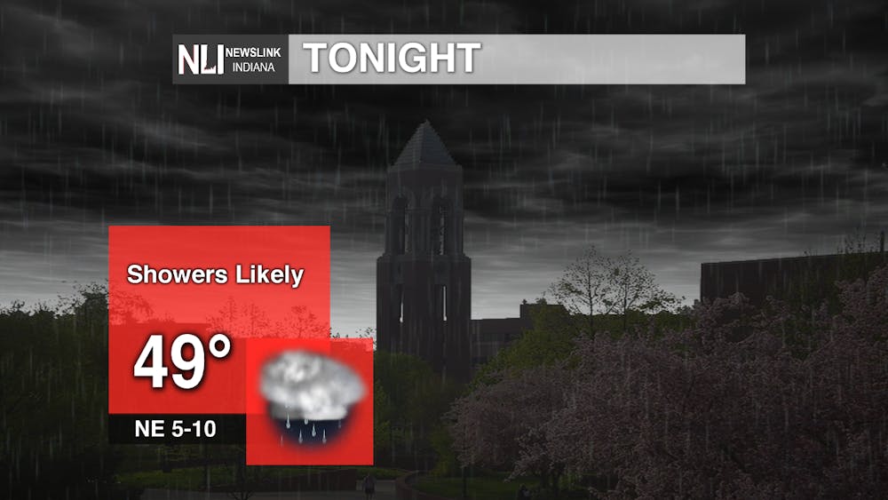
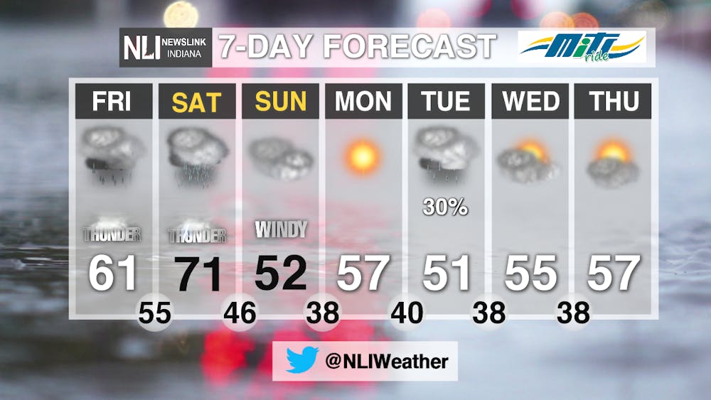
Tonight: We will see low temperatures drop into the upper 40s as showers continue to impact the region.
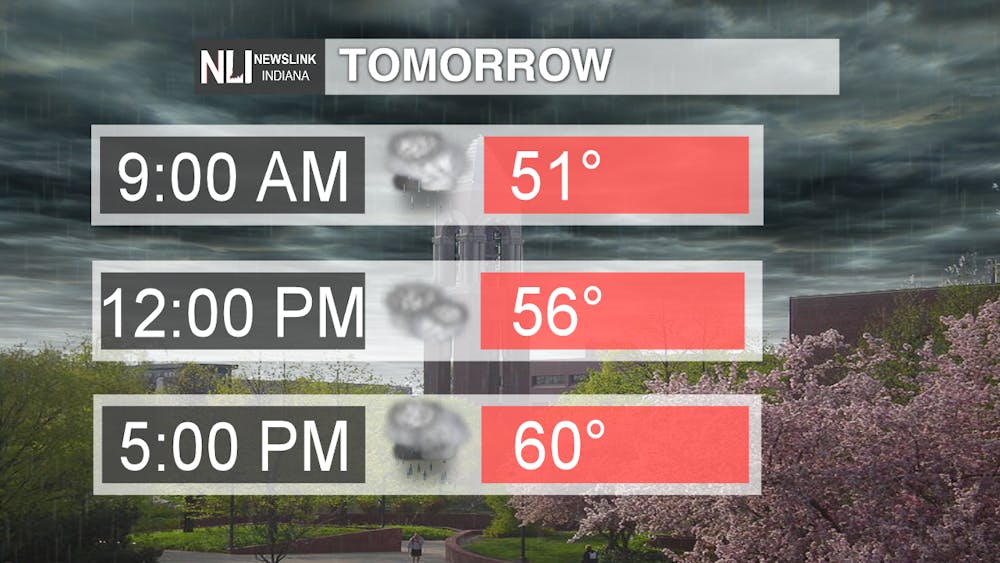
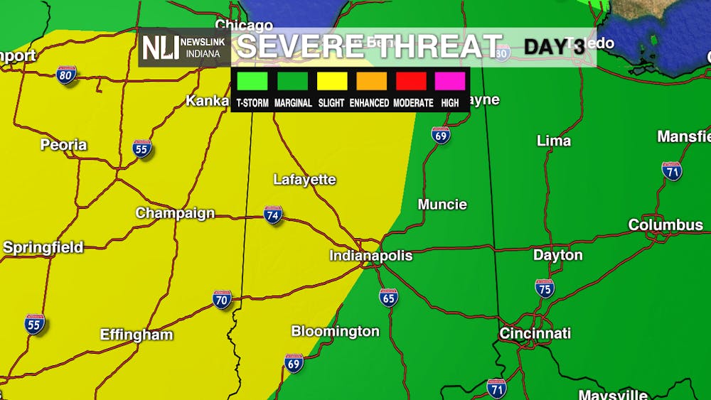
Tomorrow: Our first chance of severe weather arrives tomorrow. Much of the state is included in a level 1 out of 5 "marginal risk." Considering the cooler temperatures and relative lack of instability, tomorrow's threat is rather low. Watch out for some isolated damaging winds and large hail, as well as some localized flooding.
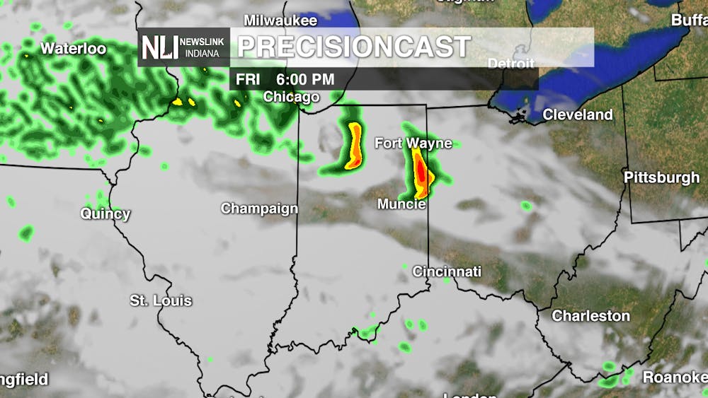
Expect scattered showers in the morning, with a break in the afternoon before thunderstorms arrive during the evening hours. The best chance for storms lies north of the area. Highs will reach the upper 50s to lower 60s.
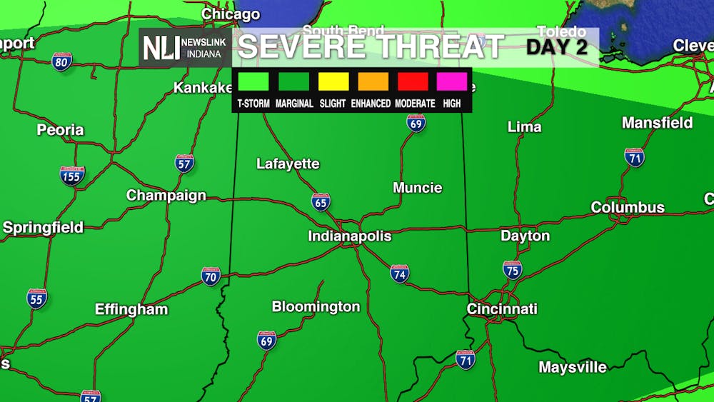
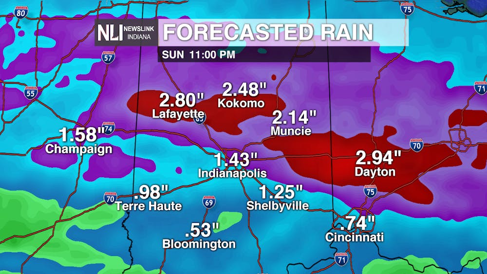
This Weekend: Our best chance for severe weather is on Saturday. A warm front will move through the area Saturday morning, bringing with it multiple waves of showers and thunderstorms. Some clearing is possible during the afternoon hours, which will allow temperatures to soar. We could be talking the warmest air of 2020 so far, with highs entering the 70s for the first time. All of this warm air, moisture, and instability will make the atmosphere prime for severe thunderstorms Saturday evening into the overnight hours. For the time being, the Storm Prediction Center has placed areas off to the west in a level 2 out of 5 "slight risk" and kept our area in the level 1 out of 5 "marginal risk." All threats are on the table Saturday, including tornadoes, as the cold front moves through Saturday night. Sunday will be windy and much cooler behind the front. When all is said and done, 2 to 3 inches of rainfall are possible by the end of the weekend. Flooding will definitely be a concern during this time. Stay tuned to our Twitter and Facebook accounts for the latest updates concerning this severe weather potential.
Rest of the 7-Day Forecast: Next week looks to start with lots of sunshine on Monday, but more rain showers are possible on Tuesday. We look to dry out, however, on Wednesday and Thursday, with temperatures in the 50s. Overall, the forecast looks to make a turn toward cooler and drier conditions to open up April.
---Assistant Chief Weather Forecaster Nathan Gidley
Follow us on Twitter @NLIWeather for breaking weather updates.
NewsLink Indiana is a proud Ambassador for the NOAA Weather-Ready Nation program.
For more information about the Weather-Ready Nation program please click HERE
Read More
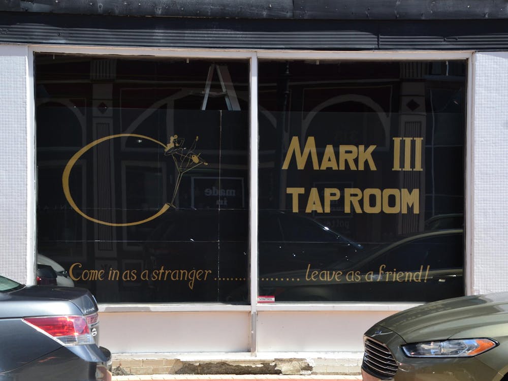
Ball State leases former Mark III Taproom space for urban design use
By Trinity Rea / 13 minutes agoBall State University has signed a two-year lease for the first floor of 306 S. Walnut Street in downtown Muncie — the former site of the Mark III Taproom, Andrew Walker, University Content and Media Strategy Manager, said in a written statement.

'Clair Obscur: Expedition 33' is a gaming tour de force.
By Ian Case / 13 minutes agoClair Obscur: Expedition 33 is a generational freshman achievement from Sandfall Interactive, a game that draws upon its inspirations whilst also making bold new innovations.

Muncie launches Designated Outdoor Refreshment Areas
By Staff Reports / YesterdayBeginning July 7, the City of Muncie announced three new Designated Outdoor Refreshment Areas (DORAs).
