
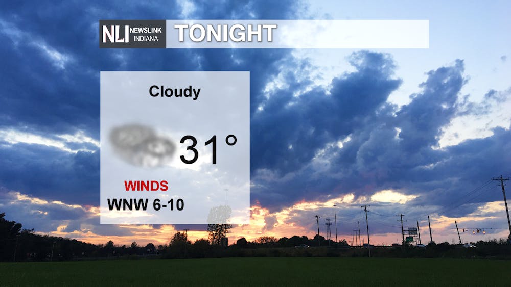
Tonight: Tonight temperatures will hover around freezing, but due to the strong winds and windchill it's likely to feel much cooler. While the weather will remain clear tonight is going to be cloudy and overcast. All counties in our viewing region are under a winter weather advisory due to the upcoming snow.
Tomorrow: Tomorrow afternoon temperatures will heat up to 35 degrees, but by mid-afternoon into the late evening snow will begin to enter our viewing region. Snow will continue through Thursday, along with rain and sleet.
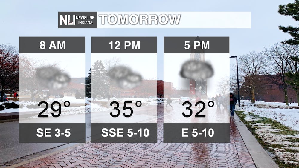
Incoming Snow: Total snowfall will range from 1-6 inches throughout our viewing region, southern or western counties are likely to receive less snow and instead more rain and sleet. Northern counties could receive more snowfall throughout the next two days.

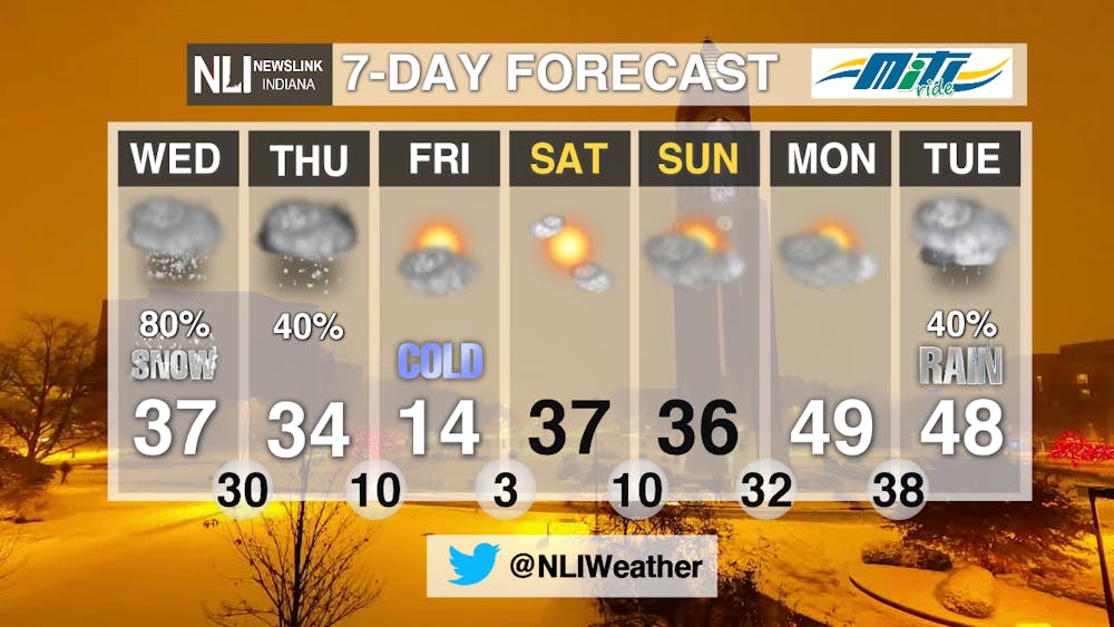
7-Day Forecast: After snow and rain passes through on Wednesday and Thursday, Friday will result in a drastic drop in temperatures with a high of 14 degrees. The weekend will quickly heat up, leading to warmer temperatures and rain going into next week.
-------Weather Forecaster Lexi Esterle
Follow us on Twitter @NLIWeather for breaking weather updates.
NewsLink Indiana is a proud Ambassador for the NOAA Weather-Ready Nation program.
For more information about the Weather-Ready Nation program please click HERE
Read More

Former Ball State Mens Tennis member Gene Orlando set to coach team
By Staff Reports / 12 hours agoFormer Ball State Men's Tennis Hall of Famer Gene Orlando has been named the new head coach of the team, according to Ball State Athletics, following the departure of long-time Head Coach Bill Richards, announced last week.

Muncie Moments: July Kick-off
By Ball State Daily / 17 hours agoLooking for free fun around Muncie? From June 29 to July 4, enjoy a creative Sunday at Stitch ‘n Bitch, connect with local health and food support at Open Door Connections, and savor powerful words at the Taste of Poetry reading. Then, explore local art during First Thursday, and wrap the week with fireworks, live music, and a foam party fun at Minnetrista’s Fourth of July Celebration.

Deena's Coffee House looks to serve a cup of community
By Kylee White / YesterdayLocated on 417 N. Reserve St, Deena’s Coffee House hopes to welcome and promote the community.
