
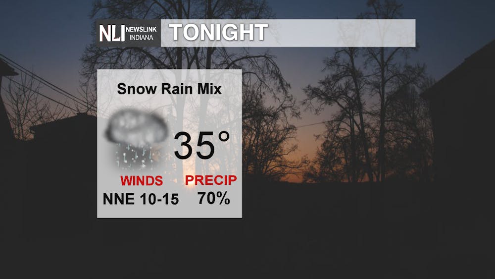
Tonight: Temperatures will begin to drop near freezing tonight as rain transitions to snow throughout the evening and early morning tomorrow. A strong wind and continued rain will make travel tonight and early tomorrow difficult.
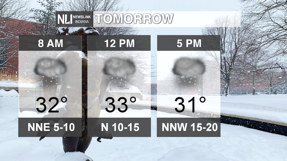
Tomorrow: Snow will continue throughout the day tomorrow, as temperatures hover around freezing strong winds will make the day feel progressively colder due to the windchill. Spotty snow coverage will transition to full coverage throughout our viewing region into the afternoon. The snow isn't expected to clear through our viewing region until late Wednesday evening.
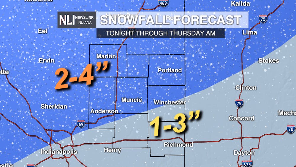
Expected Snowfall: Counties in the northern part of our viewing region can expect snowfall between 2-4 inches, counties in the southern region can expect 1-3 inches of total snowfall. Total snowfall will depend on temperature fluctuations throughout the next two days.
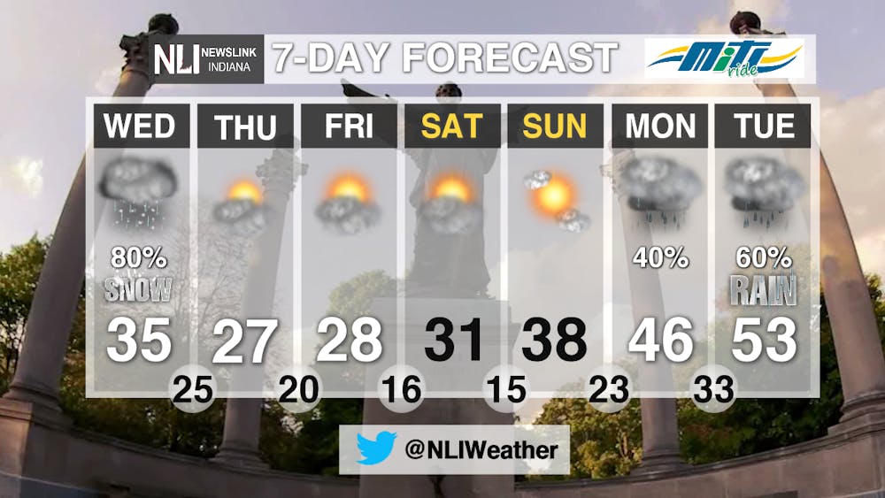
7-Day Forecast: Snow will continue through tomorrow, giving way to a cold front on Thursday. Colder temperatures will continue for the rest of the week, but highs will begin to reach above freezing this weekend. Giving students a clear and warmer start to spring break.
-------Weather Forecaster Lexi Esterle
Follow us on Twitter @NLIWeather for breaking weather updates.
NewsLink Indiana is a proud Ambassador for the NOAA Weather-Ready Nation program.
For more information about the Weather-Ready Nation program please click HERE
Read More
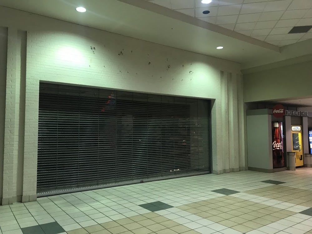
IPR: Muncie commission approves money to begin demolishing part of Muncie Mall
By Indiana Public Radio / 16 hours agoThe Muncie Redevelopment Commission will spend tax dollars earmarked for the Muncie Mall to demolish part of the mall complex.

“Every Muncie neighbor is important:” Vigil honors deported community member
By Trinity Rea / YesterdayDozens gathered for prayer, reflection and community support after a Muncie man was deported by ICE.

Former Ball State Mens Tennis member Gene Orlando set to coach team
By Staff Reports / 2 days agoFormer Ball State Men's Tennis Hall of Famer Gene Orlando has been named the new head coach of the team, according to Ball State Athletics, following the departure of long-time Head Coach Bill Richards, announced last week.
