
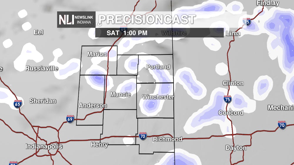
Tonight: The sun peaked out for awhile in the afternoon, but clouds will begin to creep into the area during the overnight hours. Scattered snow showers are possible, but they shouldn't be a big issue for morning commutes. Chilly temps with a low around 24 and light winds from the SW can also be expected.

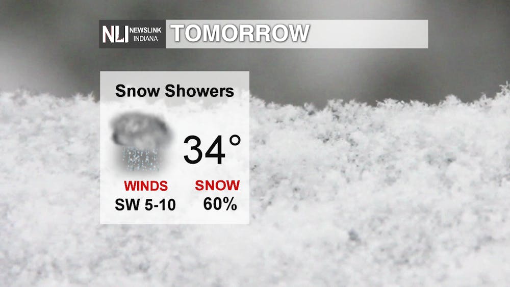
Tomorrow: A snowy start in the morning will give way to more widely scattered snow showers and cloudy skies during the afternoon. If you're commuting to a Ball State sports game, there shouldn't be any travel impacts. But be sure to grab a jacket because the high will sit around 34 with SW winds at 5-10 mph.
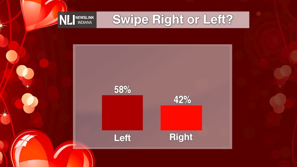
In the spirit of Valentine's Day, I posted a poll on Twitter and Instagram asking if tomorrow's forecast were on a dating app, would you swipe right (meaning you like it) or left (meaning you don't). The results show the majority of voters are not winter weather fans.
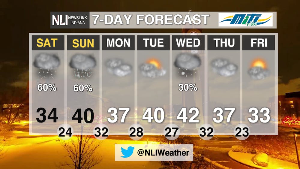
7-day: The biggest threat of precipitation lies this weekend. AM snow and scattered showers can be expected Saturday, and a rain/snow mix is possible for Sunday before transitioning to mostly rain. Valentine's week starts a bit chilly, but we could see some days reach 40.
-Weather Forecaster Natasha Leland
Follow us on Twitter @NLIWeather for breaking weather updates.
NewsLink Indiana is a proud Ambassador for the NOAA Weather-Ready Nation program.
For more information about the Weather-Ready Nation program please click HERE
Read More

Road closure between Warwick and Briar road
By Staff Reports / 11 hours agoThere is a road closure on Riverside Avenue between Warwick and Briar roads directly in front of the Cooper Science Building due to a geothermal leak.

Tagayi to Represent France at U19 Tournament Before Joining Ball State
By Staff Reports / YesterdayBefore making her debut in the Mid-American Conference, incoming Ball State women's basketball player Aniss Tagayi will compete for her home country as part of the French national team in the U19 competition.

IPR: Ball State Village hotel project granted tax abatement for 10 years
By Indiana Public Radio / YesterdayThe new hotel being built next to Ball State University in the Village has been given a tax abatement for the next decade. But as IPR’s Stephanie Wiechmann reports, an agreement with the developer means Muncie coffers will see some money from the project in that time.
