
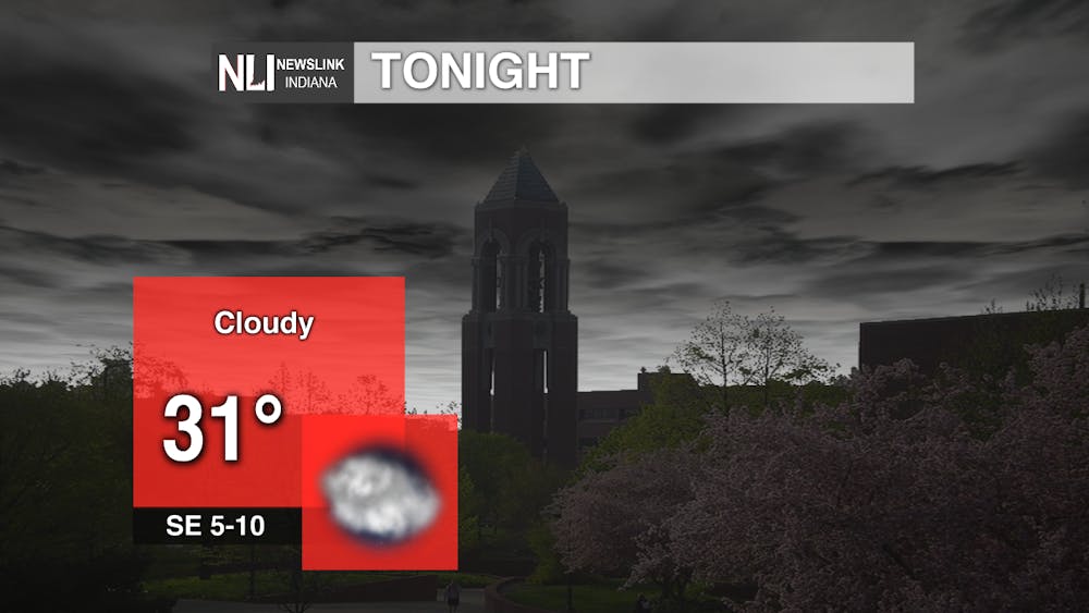
Tonight: Have you had enough of the clouds? I wish I had better news in the short-term, but the good news is some sunshine is eventually on the horizon. Those clouds are expected hang on tonight, with temperatures dropping to the lower 30s.
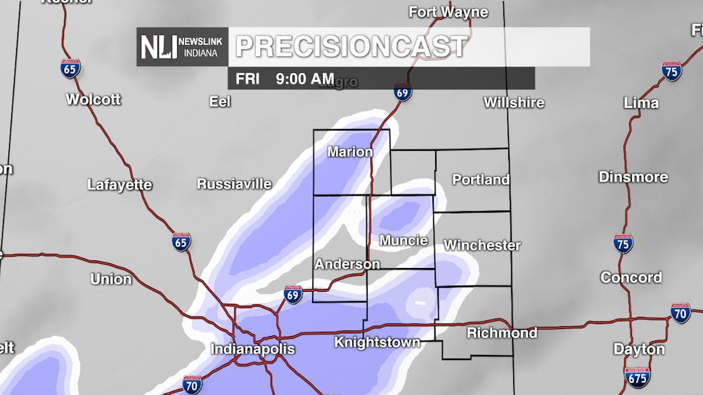
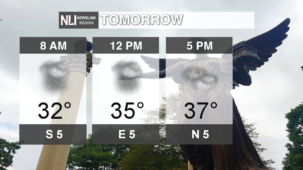
Tomorrow: Isolated rain and snow showers are possible by your morning commute tomorrow. I am not anticipating any major impacts, but be sure to allow a few extra minutes to get to work or school. We hold on to this chance of rain and snow through the rest of the day, with temperatures rising into the mid-to-upper 30s.
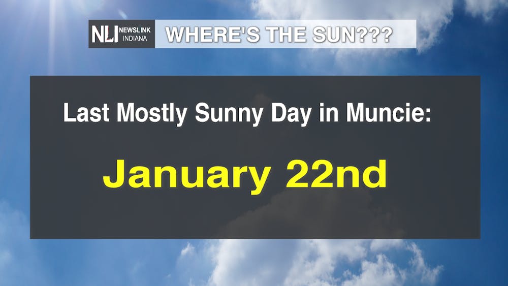
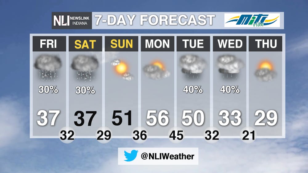
7-Day Forecast: Chances for mixed precipitation and more clouds continue to open up the weekend before big changes enter the forecast on Sunday. Yes, we finally could see a decent amount of sunshine on Sunday, as well as some much warmer temperatures! Highs are expected to soar into the 50s from Sunday through Tuesday. However, this warmth will be short-lived, as a cold front will slowly move though from Tuesday into Wednesday. This will bring rain and snow chances, as well as a return to more seasonable temperatures by late week.
---Assistant Chief Weather Forecaster Nathan Gidley
Follow us on Twitter @NLIWeather for breaking weather updates.
NewsLink Indiana is a proud Ambassador for the NOAA Weather-Ready Nation program.
For more information about the Weather-Ready Nation program please click HERE
Read More

IPR: Gov. Mike Braun says tolling needs to be an option for Indiana’s road funding future
By Indiana Public Radio / 8 hours agoGov. Mike Braun was given slightly more expansive authority this year to explore tolling Indiana’s interstate highways.

Fairs, Fiction and Fun: Muncie’s Week of Events
By Ball State Daily / 15 hours agoMuncie is buzzing with events July 6–12 that won’t break the bank. Cheer on young talent at the Delaware County 4-H, or give back during Cardinal Greenway Volunteer. Prefer stories over sports? Don’t miss a cozy Evening with Author Robin Lee Lovelace. Then, tee off for a cause at the Liberty Township Fire Department Golf Tournament. Farm, read, or rally — whatever your vibe is, Muncie can match it.

Mental health care and facilities are almost non-existent in rural communities
By Trinity Rea / YesterdayFor a large number of Indiana’s rural residents, access to specialty care — specifically that for psychiatry and mental health — is a struggle.
