
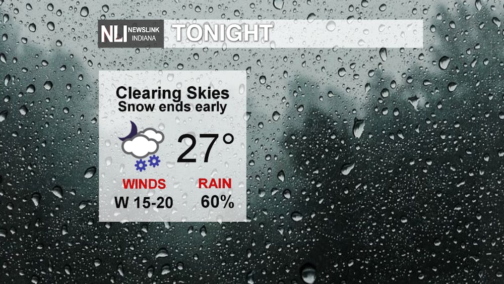
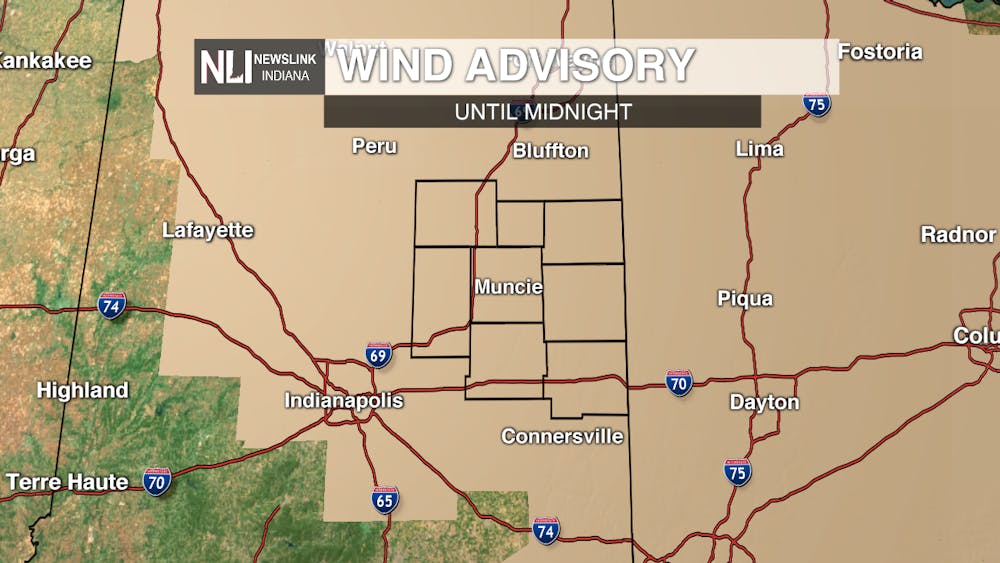
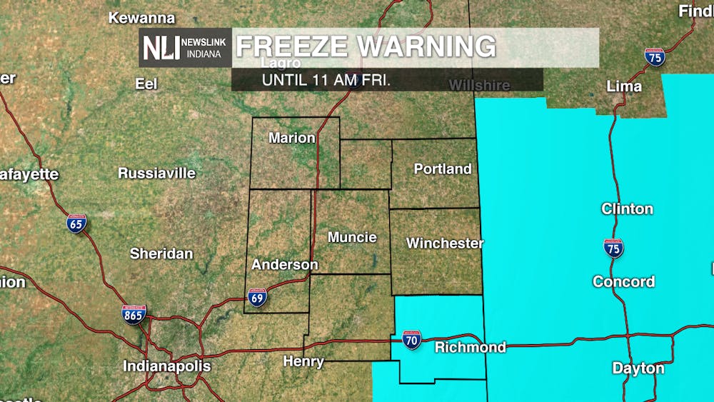
Tonight: The rain/snow mix looks to end before midnight with skies clearing out overnight. Wind gusts will continue to be high as they could approach 40 mph. Our low temperatures will bottom out to around 27 degrees. Our ***WIND ADVISORY*** will continue until midnight tonight. Wayne county will be under a ***FREEZE WARNING*** from 11 PM tonight until 11 AM tomorrow morning.
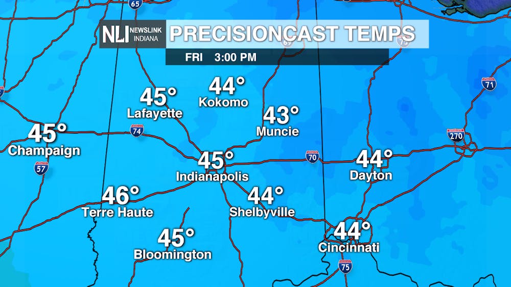
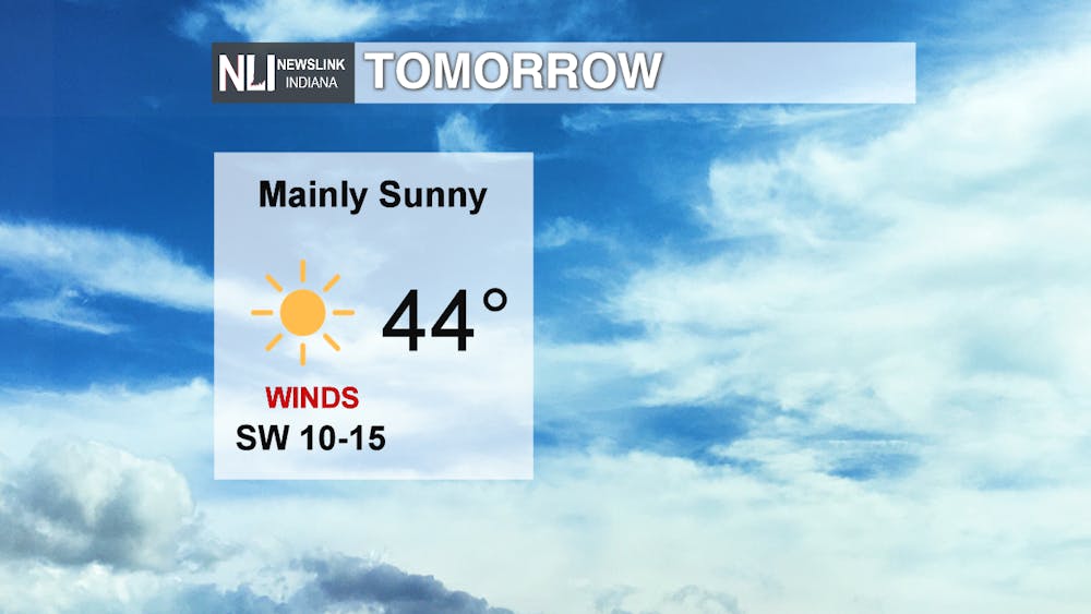
Tomorrow: We will end the work week dry, but our high temperatures will only get into the mid-40's. Mainly sunny skies will be present throughout the day with breezy southwesterly winds.
Scarecast for Trick-or-Treaters: Muncie's trick-or-treat hours are on Friday night. It will be chilly when trick-or-treating begins with mostly clear skies. If you are heading out tomorrow night, be sure to have a couple of warm layers.

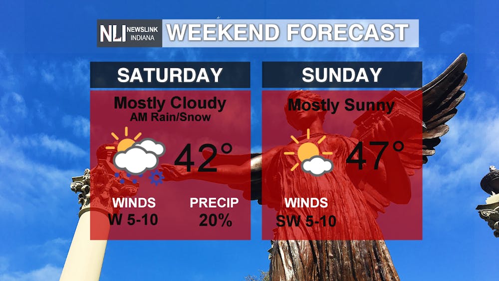
Weekend Forecast: The coldest air of the season will begin this evening and carry through the entire weekend as temperatures will sit in the low to mid-40's for the highs. We could see an isolated rain/snow mix Saturday morning. The rest of the weekend will be dry.
7-Day Forecast: We look to rebound into the mid 50's for our high temperatures in the beginning of the new work week before we have a wave of small chances for showers in the middle of the week. We may see another rain/snow mix next Wednesday and Thursday as highs dip back into the 40's.

Read More

Former Ball State Mens Tennis member Gene Orlando set to coach team
By Staff Reports / 10 hours agoFormer Ball State Men's Tennis Hall of Famer Gene Orlando has been named the new head coach of the team, according to Ball State Athletics, following the departure of long-time Head Coach Bill Richards, announced last week.

Muncie Moments: July Kick-off
By Ball State Daily / 15 hours agoLooking for free fun around Muncie? From June 29 to July 4, enjoy a creative Sunday at Stitch ‘n Bitch, connect with local health and food support at Open Door Connections, and savor powerful words at the Taste of Poetry reading. Then, explore local art during First Thursday, and wrap the week with fireworks, live music, and a foam party fun at Minnetrista’s Fourth of July Celebration.

Deena's Coffee House looks to serve a cup of community
By Kylee White / YesterdayLocated on 417 N. Reserve St, Deena’s Coffee House hopes to welcome and promote the community.
