
Tonight: We will have another nice and cool refreshing night with a low of 54°. Skies will be mainly clear.

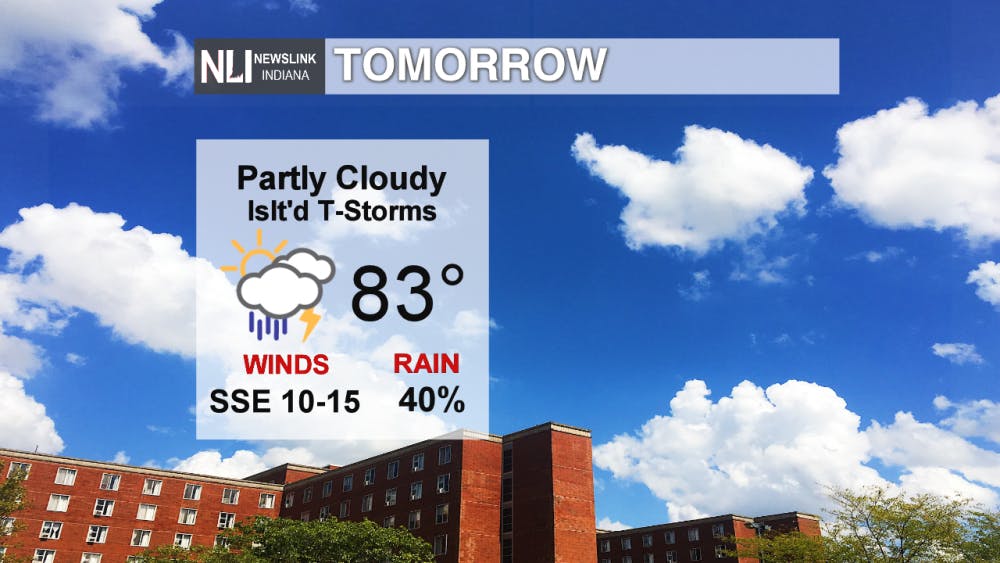
Tomorrow: We look to warm up to the low 80's for our high temperature. There is the chance for a few showers and/or thunderstorms in the late afternoon to evening hours.
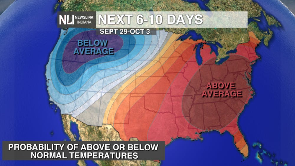
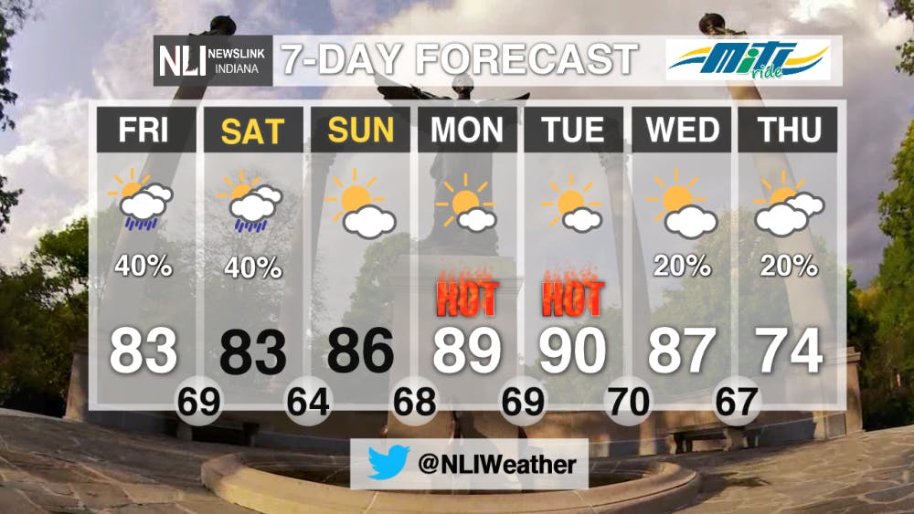
Weekend Forecast: Our temperatures will continue to slowly climb throughout the weekend. There will be the chance for another round of showers and storms very early Saturday morning, and then we will finish the weekend dry. This slow weekend warm-up will lead way to the summer like heat that is set to return by the new work week next week.

7-Day Forecast: The summer like heat will be making another grip in our area in the first half of the work week. We have a good chance of have record breaking high temperatures on Monday and Tuesday. The record highs for September 30th and October 1st are 88° and 90° respectively. A cold front looks to come in next Wednesday, which may spark the chance for an isolated shower/thunderstorm. Much better relief may follow by next Thursday with high temperatures falling to the mid 70's.
Read More

PHOTOS: Muncie holds 46th annual Iron Man Triathlon
By Kylee White / 8 hours agoOn July 12th, Muncie held its 46th annual Iron Man Triathlon at Prairie Creek Reservoir.

Rev it, Rock it and Relax: Muncie’s Week of Events
By Ball State Daily / 11 hours agoMuncie is buzzing with events this week, from thrilling Auto Cross at the Fairgrounds to stargazing at Big Astronomy. Enjoy live music on Minnetrista’s lawn or lend a hand during Horticulture Volunteer Day. Whatever your interest, there’s something for everyone!

Riverside Avenue Closed Due to 'Geothermal Leak' on Ball State's Campus
By Staff Reports / YesterdayConstruction crews were working as of Monday to reopen Riverside Avenue between Warwick and Briar roads due to a geothermal leak.
