
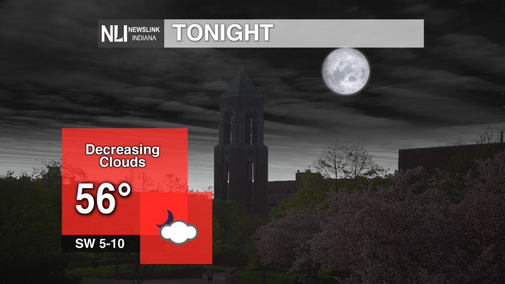
Tonight: Another beautiful evening in on tap, as lows will fall into the mid-50s with clouds decreasing overnight.
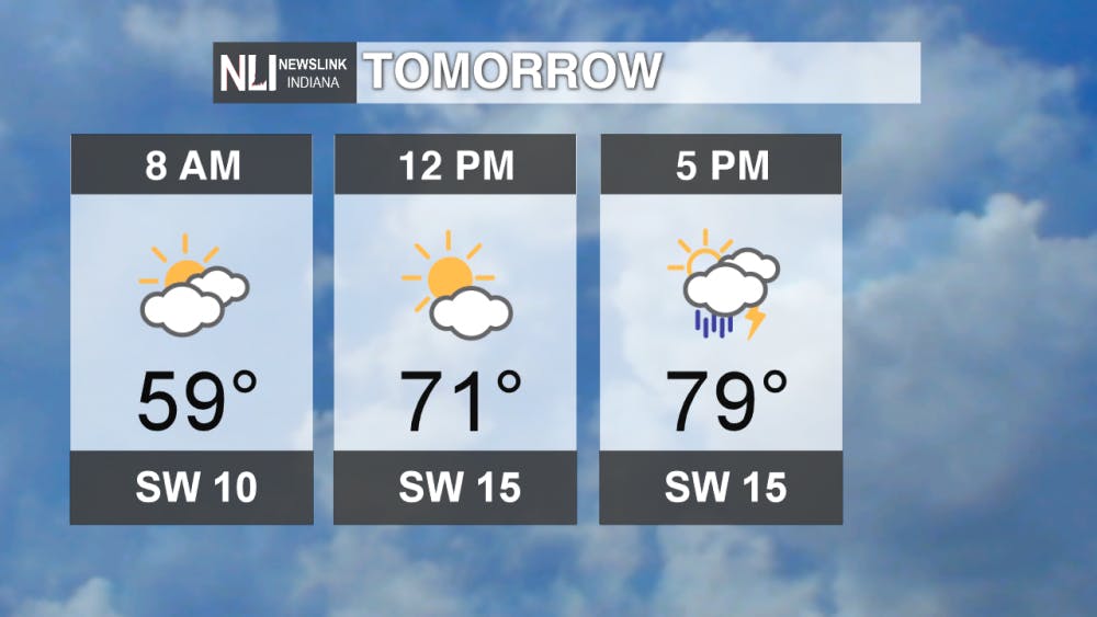
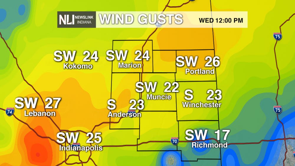
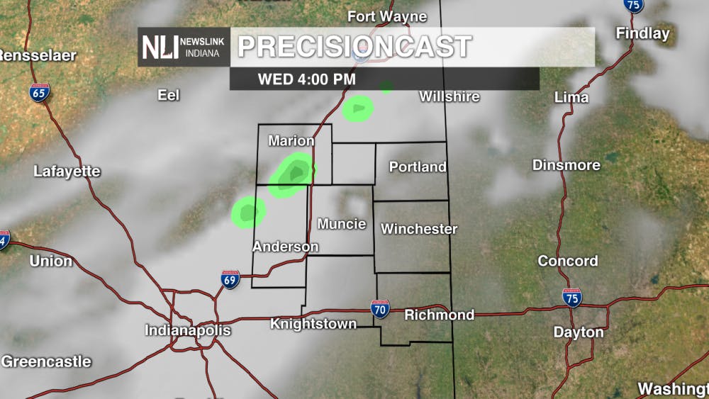
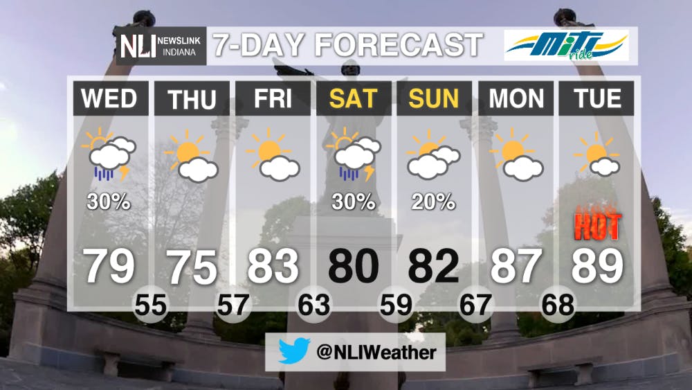
Tomorrow: There is a slight chance of isolated thunderstorms tomorrow as a weak cold front moves through the area. These storms are not likely to be widespread and the severe weather threat is very low. Expect windy conditions and high temperatures in the upper 70s before the front passes through.
7-Day Forecast: Refreshing air returns on Thursday, before the heat cranks up to end the work week. Our next rain chance arrives on Saturday as another cold front looks to pass through the area. This will briefly drop temperatures on Sunday before a warm front moves through late Sunday into Monday. This will also bring a low chance of some showers or thunderstorms. Behind the warm front, temperatures will soar to start next week. Expect high temperatures into the upper 80s, approaching record territory! Summer will just not quit around here!
---Weather Forecaster Nathan Gidley
Follow us on Twitter @NLIWeather for breaking weather updates.
NewsLink Indiana is a proud Ambassador for the NOAA Weather-Ready Nation program.
For more information about the Weather-Ready Nation program please click HERE
Read More

Fairs, Fiction and Fun: Muncie’s Week of Events
By Ball State Daily / 1 hours agoMuncie is buzzing with events July 6–12 that won’t break the bank. Cheer on young talent at the Delaware County 4-H, or give back during Cardinal Greenway Volunteer. Prefer stories over sports? Don’t miss a cozy Evening with Author Robin Lee Lovelace. Then, tee off for a cause at the Liberty Township Fire Department Golf Tournament. Farm, read, or rally — whatever your vibe is, Muncie can match it.

Mental health care and facilities are almost non-existent in rural communities
By Trinity Rea / 23 hours agoFor a large number of Indiana’s rural residents, access to specialty care — specifically that for psychiatry and mental health — is a struggle.

PHOTOS: Fourth of July 2025
By Staff Reports / YesterdayIndependence day in Muncie featured celebratory events at Minnetrista Museum and Gardens and Muncie Central Highschool.
