
This Afternoon: This afternoon, we will see high temperatures climb into the mid to upper 80s, with winds bringing that warm, dry air from the Southwest at 5-10 mph.
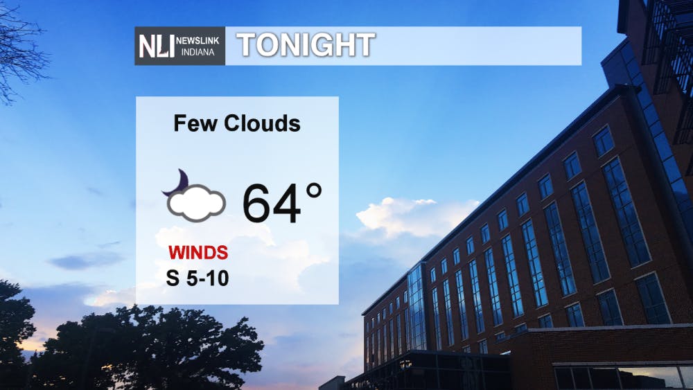
Tonight: Overnight tonight we will be seeing temperatures drop into the mid 60s, and mostly clear skies continue into the evening as well. Winds will be present, 5-10 mph out of the South.
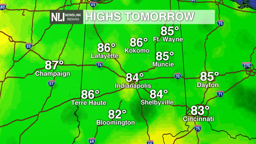
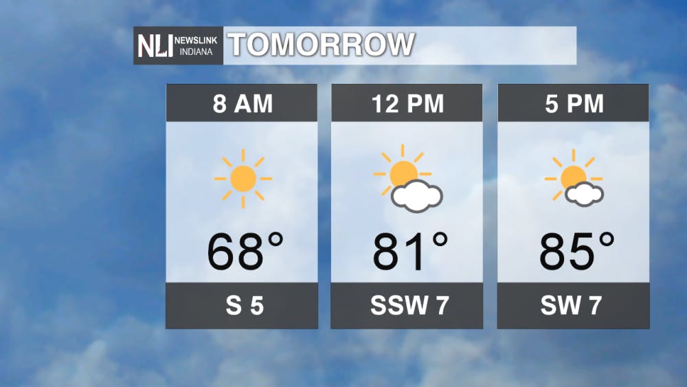
Tomorrow: Tomorrow is another warm, summer-like day almost identical to today. Temperatures will climb above 80 degrees by noon, and will continue to rise to the mid 80s by the late afternoon. Winds out of the SW at 5-10 mph continue through tomorrow as well.
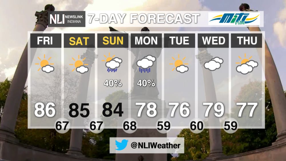
7-Day Forecast: Over the rest of this week and into the next week, we continue to see warm conditions through the weekend, with cooler temps finally coming at the beginning of next week. The end of the weekend is where our rain chances will occur, with a 40% chance of thunderstorms on Sunday and 40% chance of rain on Monday, followed by temps in the mid to upper 70s for the first half of next week.
-Weather Forecaster Jordan Wolfe
Follow us on Twitter @NLIWeather for breaking weather updates.
NewsLink Indiana is a proud Ambassador for the NOAA Weather-Ready Nation program.
For more information about the Weather-Ready Nation program please click HERE
Read More

PHOTOS: The 173rd Delaware County Fair
13 hours agoThe 173rd Delaware County Fair is in full swing, bringing a week of rides, food, and hometown tradition to the Delaware County Fairgrounds.

IPR: Prairie Creek trails to permanently close to ATVs and horses August 1
By Indiana Public Radio / YesterdayThe Muncie parks board will permanently close trails on Prairie Creek Reservoir’s west side to ATV and horse riders on August 1 after the closure was requested by the property’s owner, Indiana American Water.

9-1-1 What's Your Hot Take E13: The Buddie Episode
By Willow Emig and Sam Jasionowski / YesterdayIn this episode of 9-1-1 What’s Your Hot Take, Sam and Willow discuss all things Buck & Eddie.
