
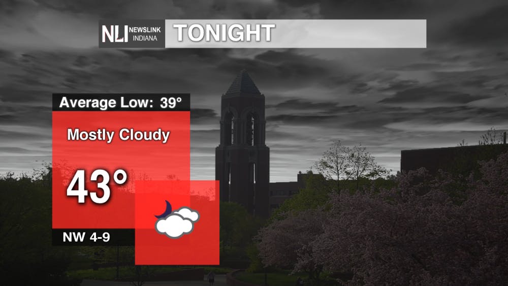
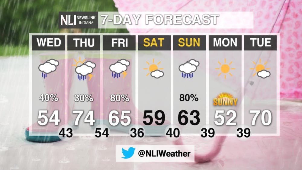
Tonight: Clouds move in overnight as rain tries to pushing our area from the Northwest. These clouds will keep us warmer tonight than we usually are this time of year.
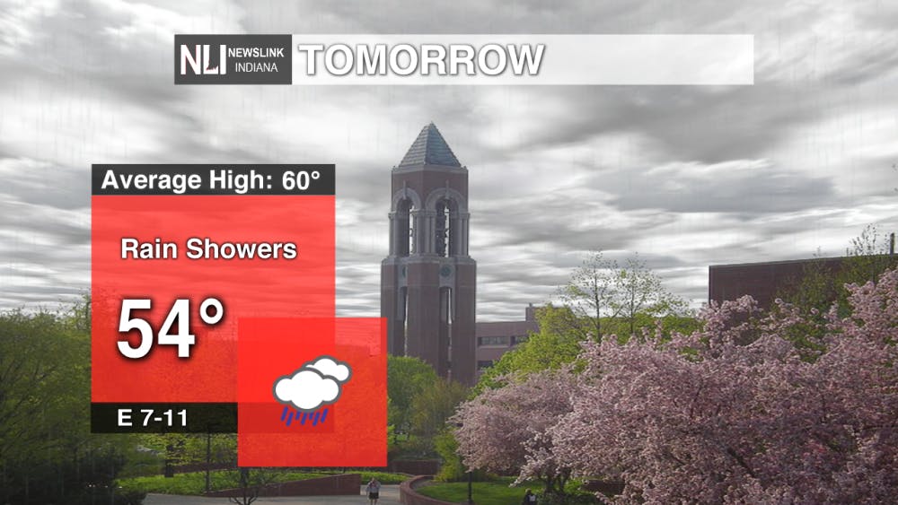
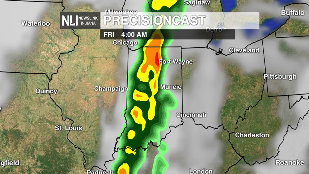
Tomorrow: Rain showers are possible during the afternoon on Wednesday as a warm front sits stationary to the south. What really determines if we see rain or not tomorrow is how dry the lower atmosphere is. If we see the dew points in the lower 30's or upper 20's it will be less likely that we see showers at all as the rain will have evaporated before reaching the ground.
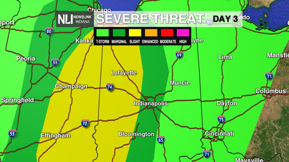
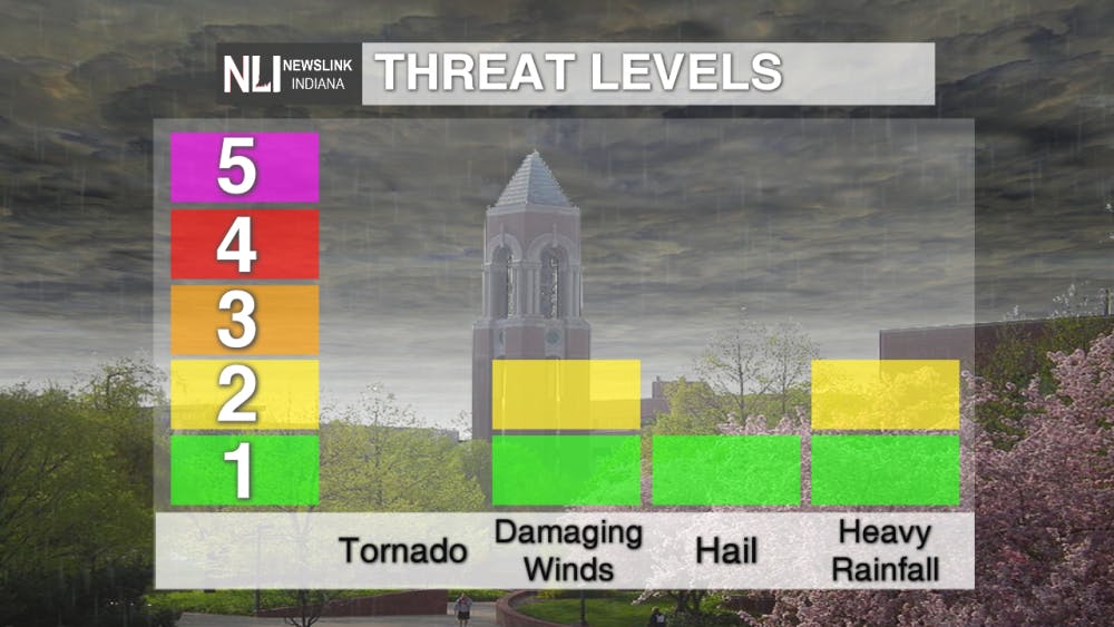
7-Day: We are close to the risk of severe weather for tomorrow. It is possible that we see some damaging winds or some hail as the long line of storms moves through our area overnight Thursday. There is a possibility that this area expands tomorrow but we won't have an update until early tomorrow morning. After this cold front moves through we get set up in this storms dry slot allowing us to get sunny skies for the carnival on Friday. This will also allow temperatures to climb back into the middle 60's. We see another system bring us some rain on Sunday and we quickly rebound back into the 70's by Tuesday.
--Newslink Indiana Weather Forecaster Jordan Nienaber
Follow us on Twitter @NLIWeather for breaking weather updates.
NewsLink Indiana is a proud Ambassador for the NOAA Weather-Ready Nation program.
For more information about the Weather-Ready Nation program please click HERE
Read More

Ball State celebrates 2025 summer graduates at commencement ceremony
By Trinity Rea / 8 hours agoBall State's summer commencement honored graduates with speakers delivering messages of creativity, courage, and the power of vulnerability.

ICC: Defense letter confirms Indiana’s Camp Atterbury to be used for immigrant detention
By Indiana Capital Chronicle / 14 hours agoIndiana’s Camp Atterbury will be used to detain immigrant detainees under a new federal plan revealed this week by Defense Secretary Pete Hegseth.

ICC: ‘Good trouble’: Hoosiers rally against Trump, honor late US Rep. John Lewis
By Indiana Capital Chronicle / YesterdayHundreds of people rallied outside the Indiana Statehouse on Thursday to protest President Donald Trump and pay tribute to U.S. Rep. John Lewis of Georgia.
