
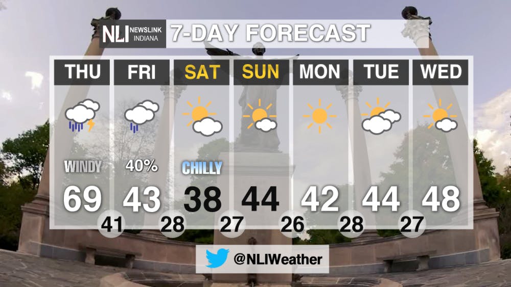
Tonight: Temperatures are going to drop down to a low of 53. Clouds are going to continue to move in and we will see mostly cloudy skies. Winds will begin to pick up coming out of the S at 20-25 mph.

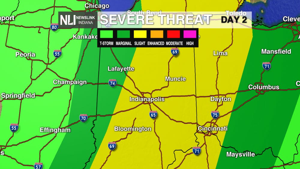
Thursday: Winds will continue to pick up as we are under a WIND ADVISORY from 11AM to 8PM tomorrow evening. Winds will be coming out of the SW at 25-30 mph with wind gusts up to 55 mph possible. Storms will be likely during the afternoon hours as a cold front moves through the area. We could see some strong storms as we are under a SLIGHT risk for severe weather. The main threat is damaging winds, but large hail and an isolated tornado can't be ruled out. We will be warmer with high temperatures near 70.


7-Day Forecast: We will cool down to the upper 30's and low 40's for the weekend. Temperatures will stay in the 40's for the beginning and middle of next week. We will also stay dry for the weekend and next week.
--NewsLink Indiana Weather Forecaster Hannah Stutler
Follow us on Twitter @NLIWeather for breaking weather updates
NewsLink Indiana is a proud Ambassador for the NOAA Weather-Ready Nation program
For more information about the Weather-Ready Nation program please click HERE
Read More

West University Avenue closed through October 2025
By Ball State Daily / 11 hours agoAccording to an email communication from Ball State Facilities Planning and Management, Ball State University has agreed to partially close the Westbound lane of West University Avenue between North McKinley Avenue and North Calvert Street.

Ball State holds Spring 2025 Commencement Ceremony
By Jessica Bergfors / 2 days agoBall State University celebrated its 201st commencement ceremony on May 3 at Worthen Arena, where thousands of guests gathered to honor the graduating class of 2025.
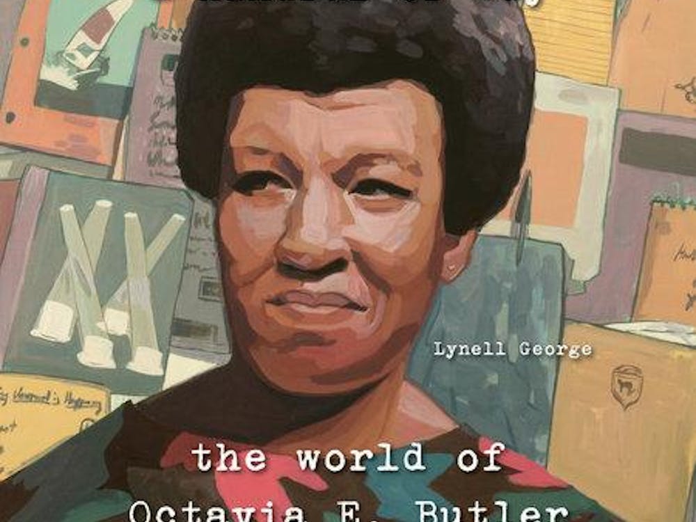
The discovery of a beautiful afrofuturist: Octavia E. Butler
By Amira Alquraishy / 2 days agoAward-winning essayist, journalist, and nonfiction author Lynell George gives us a glimpse into the esteemed writer Octavia E. Butler’s origins of becoming one. Going into her personal confides of her very own journals, we get a crash course into her psyche, and how she overcame the highs and lows of becoming the first African American woman to break into the science fiction genre.
