
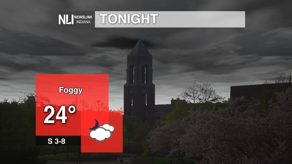
Tonight: Overnight temperatures sink back down to the lower 20s. More clouds begin to develop thru the night with relatively calm winds causing windchill to drop into the teens. Fog begins to develop late in the evening into Saturday morning.
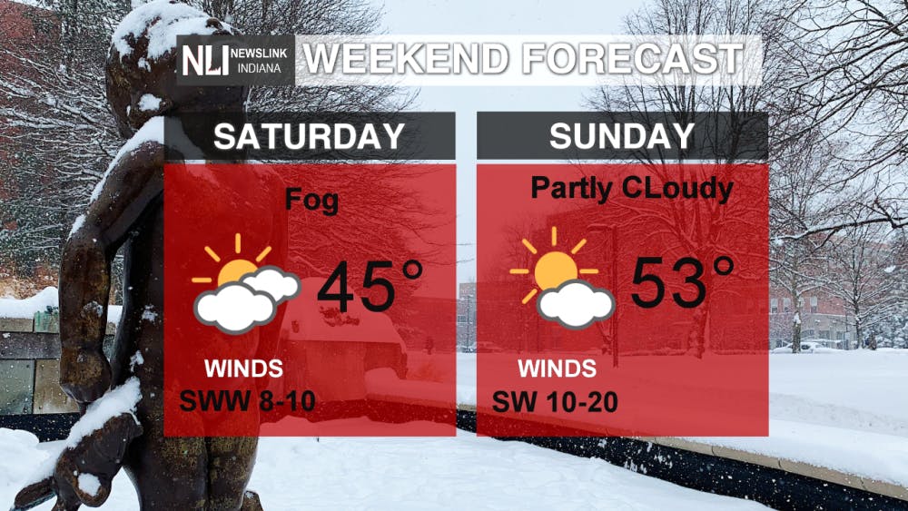
Tomorrow: Foggy morning to start Groundhog Day 2019. Winds form the SWW bring in warmer conditions reaching a high of 45°F during the Ball State Vs Kent State basketball game. Later, that evening temperatures sink down into the 20s for another chilly night.
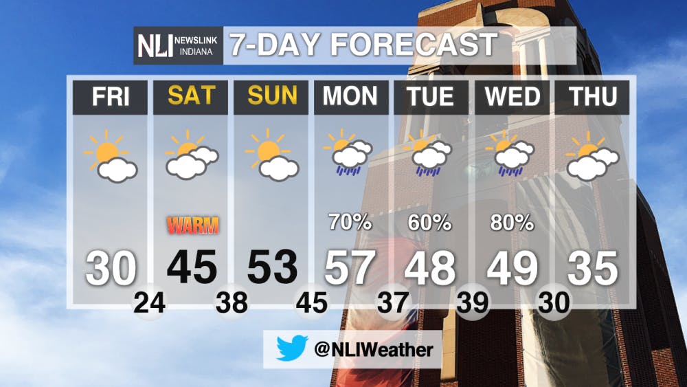
7-Day Forecast: Over the next few days temperature reach above the average of 35°F as warmer air continues its way North. Along with temperatures in the 50s Monday brings back a likely chance of precipitation continuing thru Wednesday.
-------Weather Forecaster Natalie Fitzpatrick
Follow us on Twitter @NLIWeather for breaking weather updates.
NewsLink Indiana is a proud Ambassador for the NOAA Weather-Ready Nation program.
For more information about the Weather-Ready Nation program please click HERE
Read More

Public invited to update on The Village revitalization plan
By Ball State Daily / 44 minutes agoPresident Mearns will host a public update on Ball State's revitalization plan for The Village at 6 p.m. on Wednesday, June 4, at Cornerstone Center for the Arts in the Legacy Room on the third floor. Parking is available in Cornerstone’s lots off Washington Street. The event will offer the latest on Ball State’s plan to revitalize The Village.

IPR: Arts funding stripped from numerous Indiana organizations
6 hours agoFederal funding that supports artists across Indiana has been terminated by the Trump Administration. The National Endowment for the Arts has pulled funding from art organizations across the country, including in Indiana. The NEA awarded $265,000 to 13 art organizations in the state for the 2025 fiscal year.

Start your summer with enjoying events in Muncie
By Ball State Daily / YesterdayLooking for summer fun in Muncie? The ECI events page features a variety of upcoming activities, from game nights and gardening to spaghetti dinners, model aircraft flying, and free yoga sessions, many events are free. Explore the events and discover something for everyone this season!
