
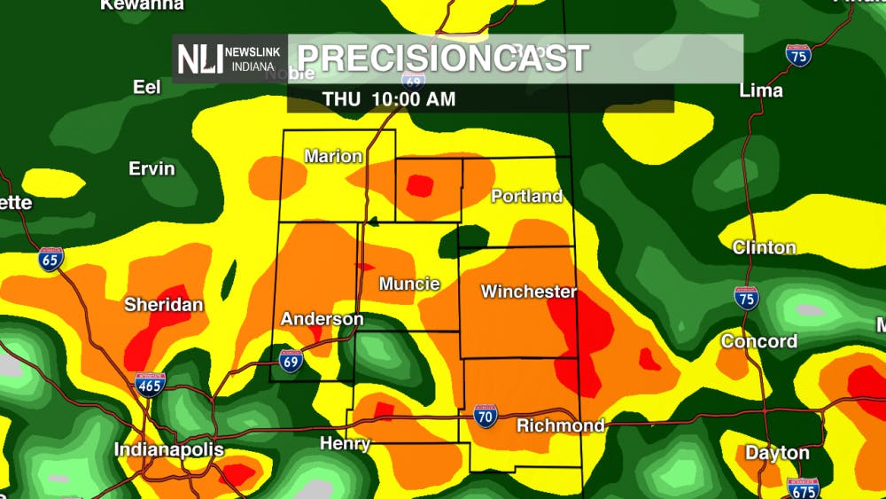
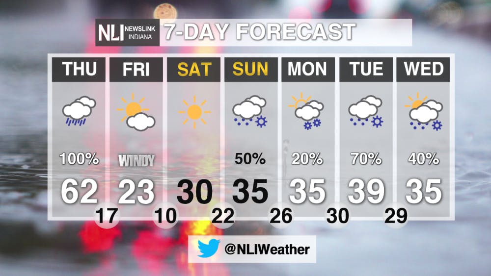
Tonight: Rain chances will return as we get into the overnight hours. Temperatures will be steady, dropping down until the mid 40s. A FLOOD WATCH is in effect until 1 AM Friday


Tomorrow: Heavy rain will be likely with thunderstorms possible. Temperatures will warm to around 60 degrees. Temperatures will rapidly fall tomorrow evening after a cold front moves through.

7-Day Forecast: Temperatures will be back into the 20s and 30s for the weekend. Rain and snow chances will return on Sunday and stick with us through Wednesday.
--NewsLink Indiana Weather Forecaster Hannah Stutler
Follow us on Twitter @NLIWeather for breaking weather updates. NewsLink Indiana is a proud Ambassador for the NOAA Weather-Ready Nation program.
Read More

Fairs, Fiction and Fun: Muncie’s Week of Events
By Ball State Daily / 36 minutes agoMuncie is buzzing with events July 6–12 that won’t break the bank. Cheer on young talent at the Delaware County 4-H, or give back during Cardinal Greenway Volunteer. Prefer stories over sports? Don’t miss a cozy Evening with Author Robin Lee Lovelace. Then, tee off for a cause at the Liberty Township Fire Department Golf Tournament. Farm, read, or rally — whatever your vibe is, Muncie can match it.

Mental health care and facilities are almost non-existent in rural communities
By Trinity Rea / 22 hours agoFor a large number of Indiana’s rural residents, access to specialty care — specifically that for psychiatry and mental health — is a struggle.

PHOTOS: Fourth of July 2025
By Staff Reports / YesterdayIndependence day in Muncie featured celebratory events at Minnetrista Museum and Gardens and Muncie Central Highschool.
