
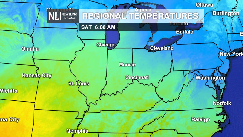
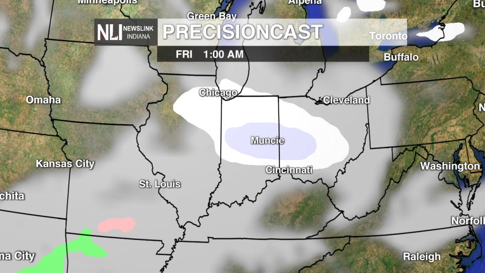
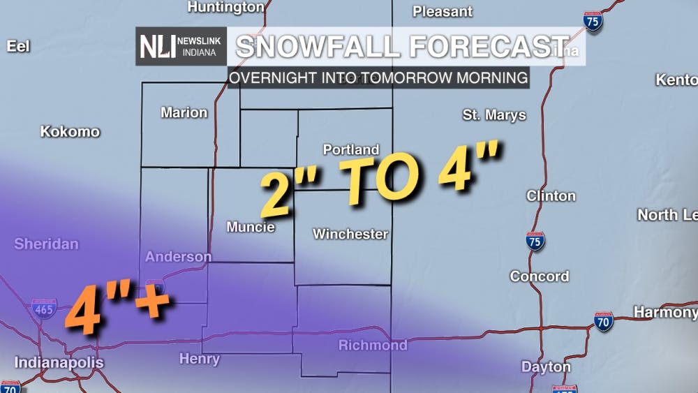
Tonight: Overnight temperatures will warm into the middle teens. Winds will remain calm. A Winter Weather Advisory is in effect for the entirety of our viewing area overnight tonight into Friday morning at 10 AM. Snow flurries will develop overnight with the heaviest snow coming shortly after midnight.
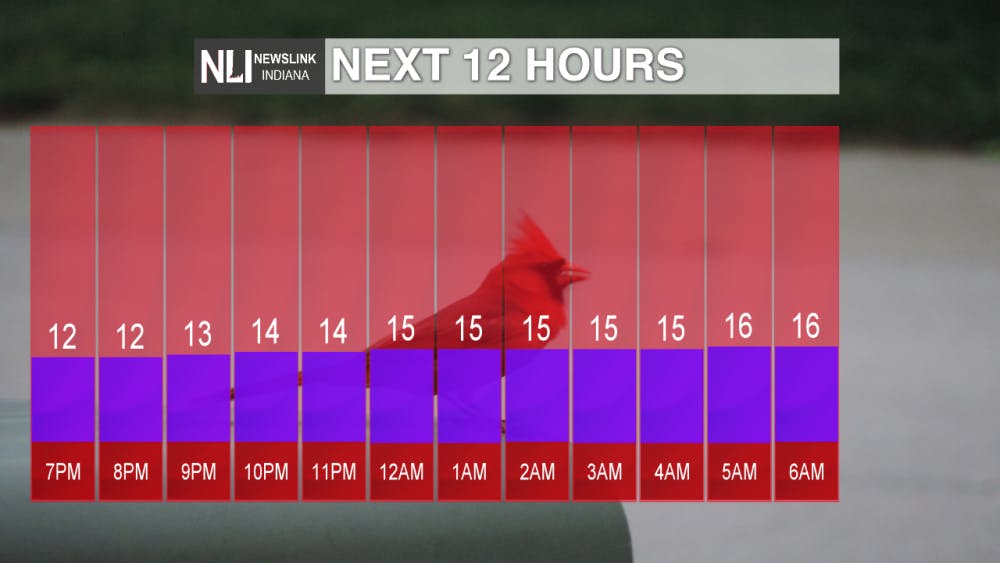
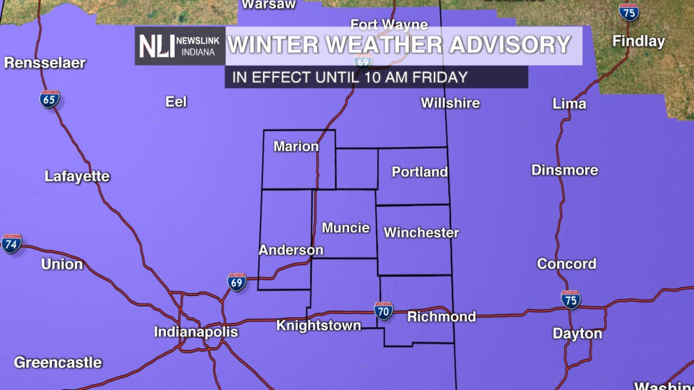
Tomorrow: Snow flurries continue into the morning hours. The morning commute will remain slick and extra time will be needed on the roadways. Most snowfall will move out of our area by the afternoon. Most of our viewing area will receive 2-4" of snow, but isolated areas south of Muncie may experience upwards of 4". The high temperature will be 31°.
7-Day Forecast: Following Friday, a break in the current atmospheric set-up will allow for more southerly flow to funnel warmer temperatures into our area. Above average temperatures will continue into the beginning part of next week. Precipitation chances will remain high in the early part of the work week.

-- Weather Forecaster Liz Szewczyk
Follow us on Twitter @NLIWeather for breaking weather updates.
NewsLink Indiana is a proud Ambassador for the NOAA Weather-Ready Nation program.
For more information about the Weather-Ready Nation program please click HERE
Read More

Muncie Ironman participant dies following race
By Staff Reports / 9 hours agoFollowing Muncie's Ironman 70.3 triathlon July 12, a race participant has passed away, according to a post made by the race's official Facebook page July 15.

PHOTOS: Muncie's new Westside Skatepark hits the ground rolling
By Staff Reports / 12 hours agoMunice's new Westside Skatepark, opened June 14, 2025, has become increasingly popular since its opening.

PHOTOS: Muncie holds 46th annual Iron Man Triathlon
By Kylee White / YesterdayOn July 12th, Muncie held its 46th annual Iron Man Triathlon at Prairie Creek Reservoir.
