
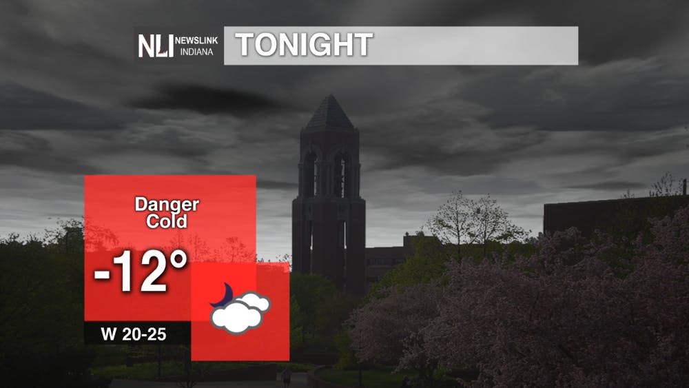
Tonight: Dangerously cold temperatures move into the area with our Wind Chill Warning taking effect tonight starting at 10 PM. Delaware County is also in a RED TRAVEL WARNING starting at 10 PM and will last until tomorrow morning around 8 AM. Low tonight will be -12° with winds from the west at 20-25 mph. Wind gusts up to 30-40 mph possible.
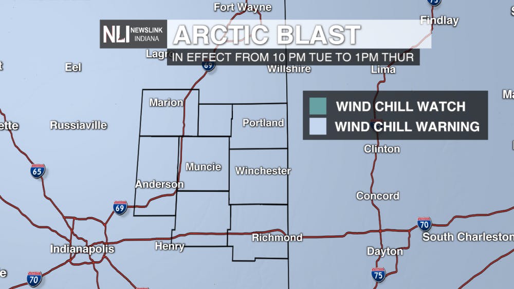
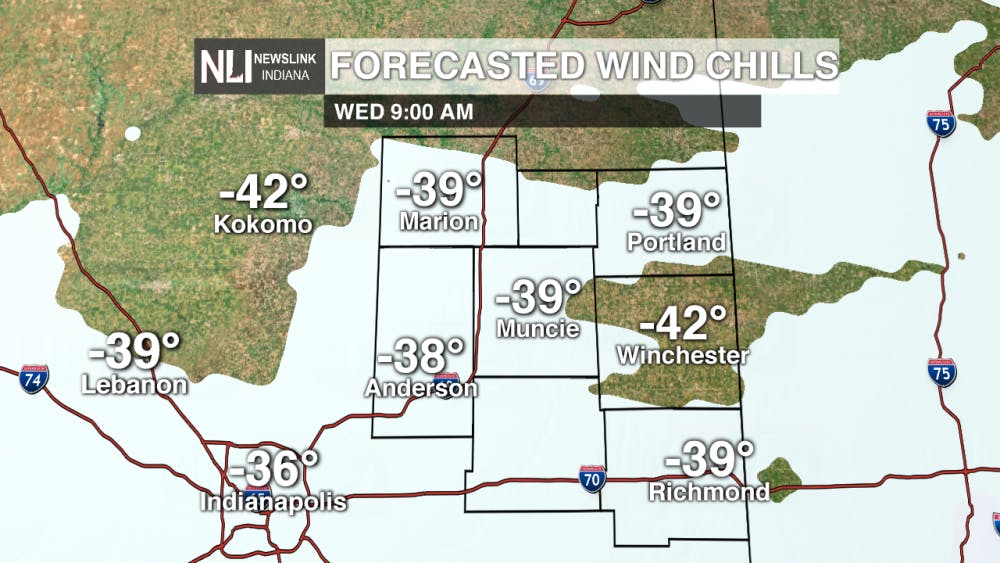
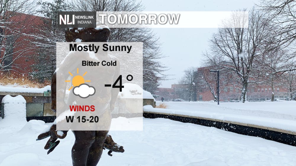
Tomorrow: Tomorrow morning we will expect to see the coldest wind chill temperatures of the day around 8 and 9 AM. Wind chill values of up to 40 below possible. High temperature tomorrow will be below 0°. Wind Chill Warning will last all through the day until Thursday morning. Take extra precautions tomorrow. Be sure to limit outdoor exposure and cover every part of skin that may be affected by cold air.
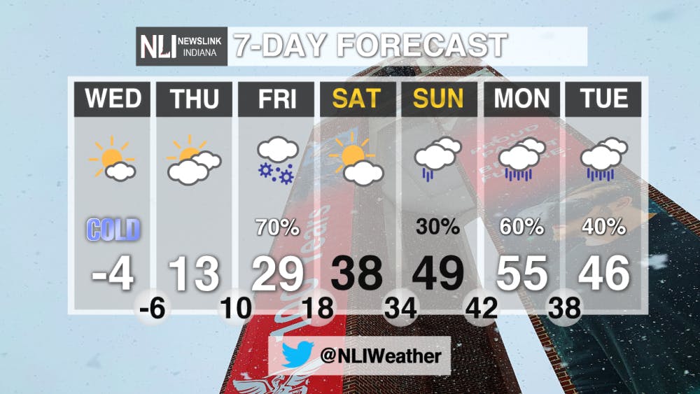
7-Day Forecast: After the arctic blast moves on, we will see an impressive rebound in temperatures heading into the weekend. A system moving in on Thursday night can bring a wintry mix and snow showers for Friday. Accumulations of around an inch can be possible. Moving through the weekend we will see the sun with upper 30s on Saturday and 50 degrees on Sunday with showers possible. The start of the work week will be above average in temperatures and some scattered showers with the warming.
-- Assistant Chief Weather Forecaster Morgan Strackbein
Follow us on Twitter @NLIWeather for breaking weather updates.
NewsLink Indiana is a proud Ambassador for the NOAA Weather-Ready Nation program.
For more information about the Weather-Ready Nation program please click HERE
Read More

Mental health care and facilities are almost non-existent in rural communities
By Trinity Rea / 15 hours agoFor a large number of Indiana’s rural residents, access to specialty care — specifically that for psychiatry and mental health — is a struggle.

PHOTOS: Fourth of July 2025
By Staff Reports / YesterdayIndependence day in Muncie featured celebratory events at Minnetrista Museum and Gardens and Muncie Central Highschool.

Ball State adjusts 51 degree programs amid statewide enrollment mandate
By Trinity Rea / 2 days agoIn a statement to The Ball State Daily News, the university says its academic changes reflect long-standing internal planning, not just compliance with new state requirements.
