
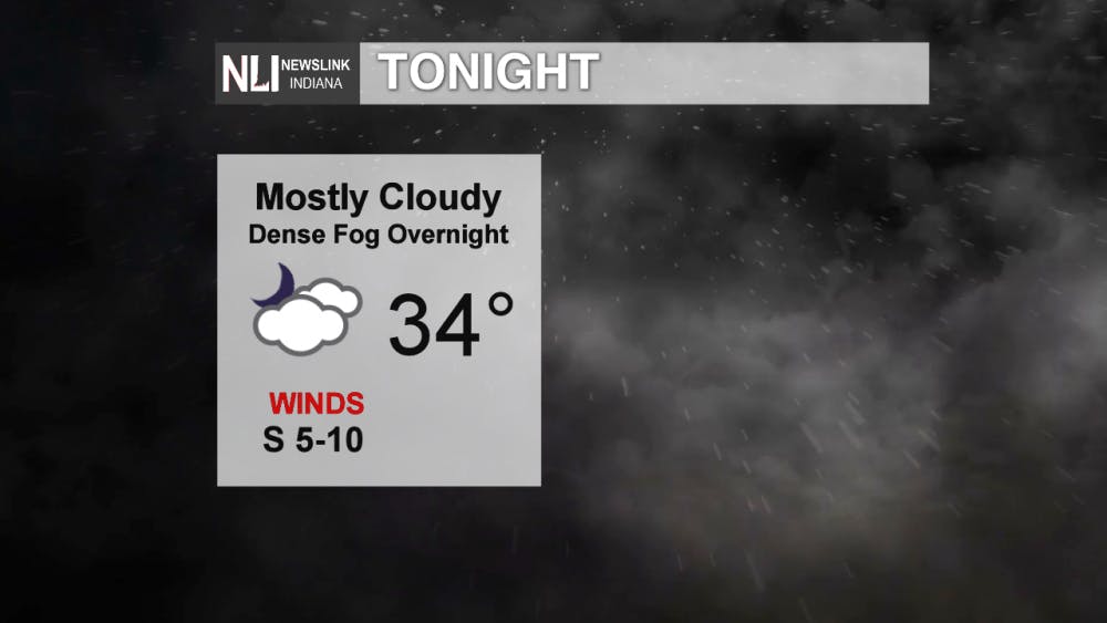
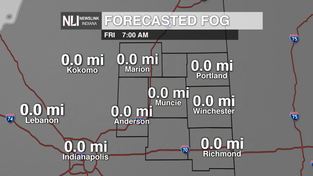
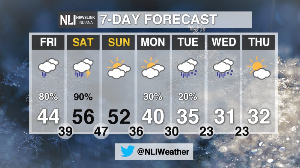
Tonight: As the night progresses and temperatures begin to rise above freezing, visibility due to fog will be the main threat. Overnight low will remain just above freezing at 34º with mild winds.
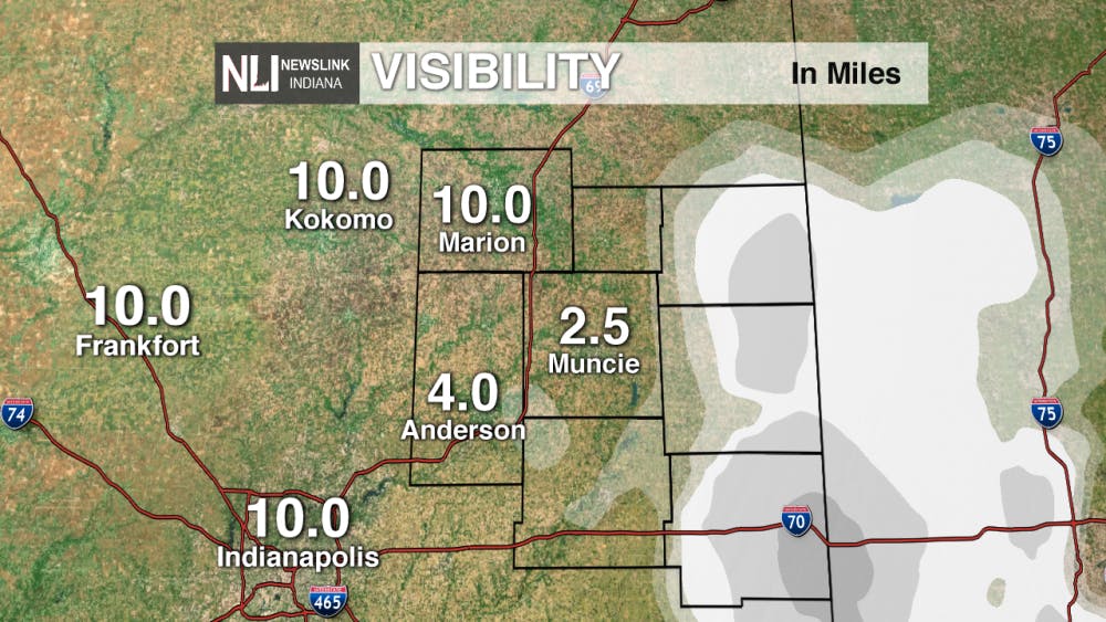
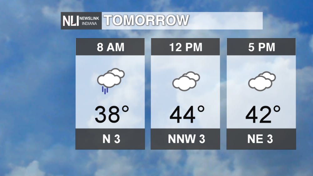
Tomorrow: Along with continuing visibility threats on the roadways, a slight drizzle may impact your commute as well. Rain will subside the rest of the day and allow for warmer temperatures to drive into the area. Tomorrow temperatures will hit right around the average for this time of the year at 44º.
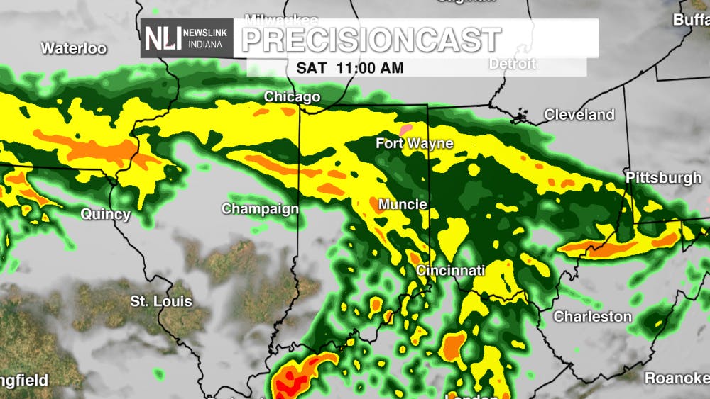
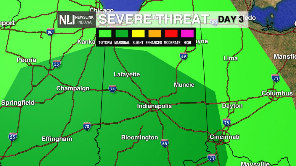
This Weekend: Above average temperatures and our next rainmaker move in for Saturday. The Storm Prediction Center has placed most of Central and Southern Indiana under a marginal risk which indicates threats of heavy rainfall and winds. As rainfall totals may near one inch, keep your umbrellas handy throughout the day on Saturday. On Sunday, clearing will occurring and temperatures will stay within the low 50's.
7-Day: Winter warm up occurs this weekend, but along with rising temperature comes rainfall. Temperatures return near or below normal as the beginning of next work week approaches!
-- Assistant Chief Weather Forecaster Payton Domschke
Follow us on Twitter @NLIWeather for breaking weather updates.
NewsLink Indiana is a proud Ambassador for the NOAA Weather-Ready Nation program.
For more information about the Weather-Ready Nation program please click HERE
Read More

Former Ball State Mens Tennis member Gene Orlando set to coach team
By Staff Reports / 5 hours agoFormer Ball State Men's Tennis Hall of Famer Gene Orlando has been named the new head coach of the team, according to Ball State Athletics, following the departure of long-time Head Coach Bill Richards, announced last week.

Muncie Moments: July Kick-off
By Ball State Daily / 10 hours agoLooking for free fun around Muncie? From June 29 to July 4, enjoy a creative Sunday at Stitch ‘n Bitch, connect with local health and food support at Open Door Connections, and savor powerful words at the Taste of Poetry reading. Then, explore local art during First Thursday, and wrap the week with fireworks, live music, and a foam party fun at Minnetrista’s Fourth of July Celebration.

Deena's Coffee House looks to serve a cup of community
By Kylee White / YesterdayLocated on 417 N. Reserve St, Deena’s Coffee House hopes to welcome and promote the community.
