

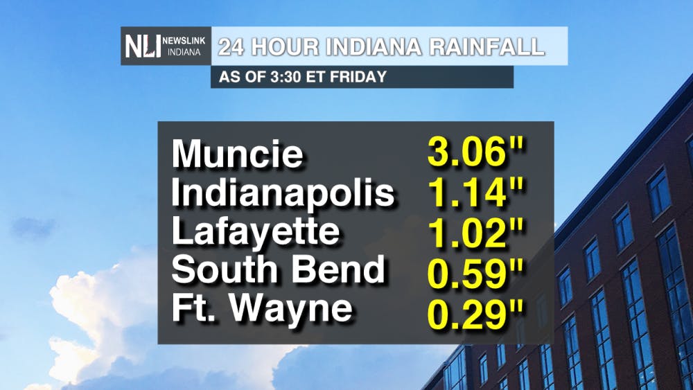
Rainfall thus far...
Heavy rainfall has already moved through east central Indiana this week. Many areas across the northern portion of the state have already seen substantial rain, but Muncie has totaled the most out of any location.
Flooding has been observed in various areas of the Ball State campus and around Muncie.
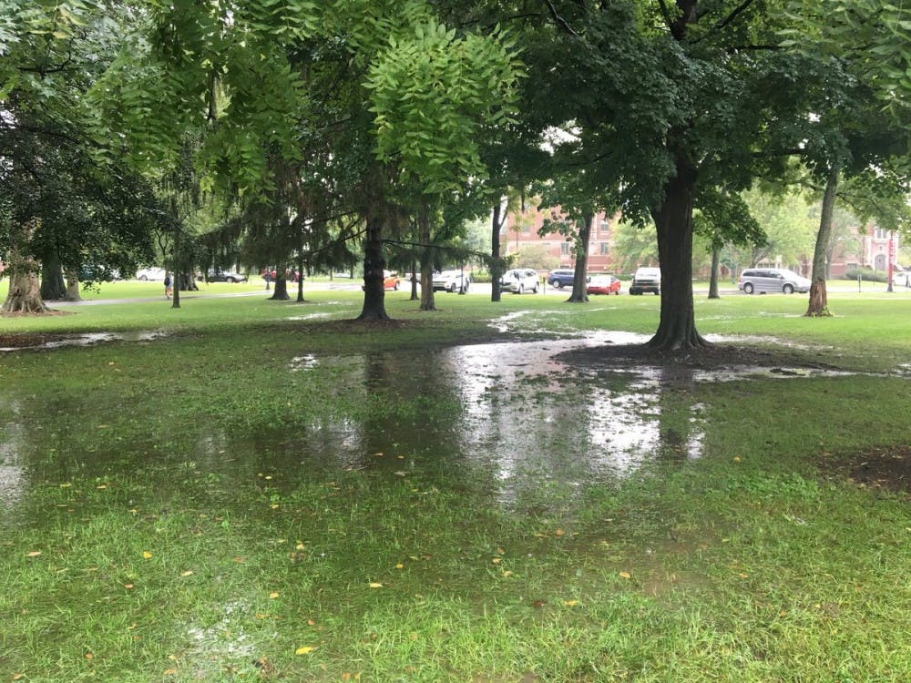
**Photo taken in the Ball State Quad by Assistant Chief Weather Forecaster Payton Domschke
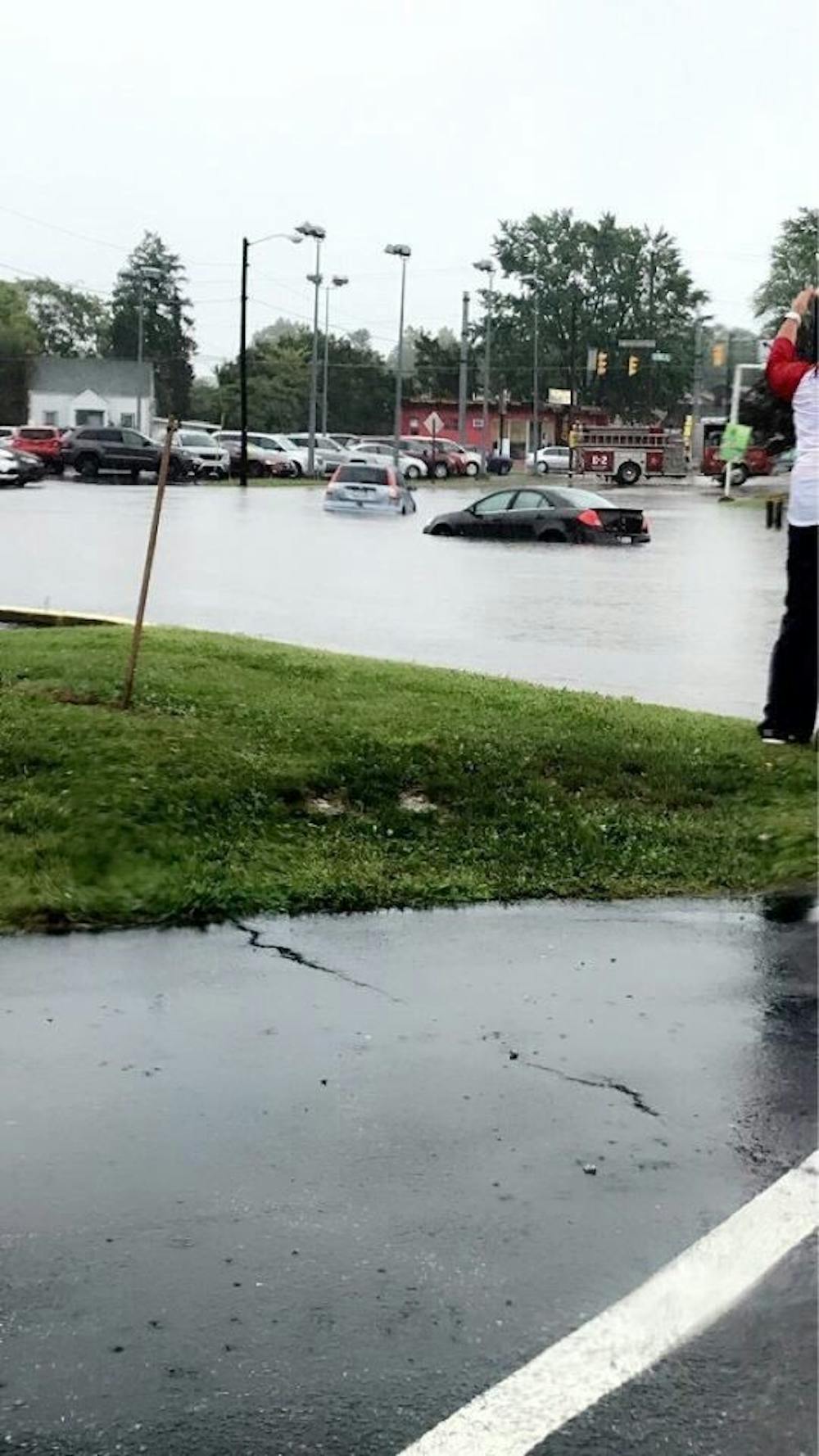
**Photo taken in Muncie of cars driving through flooded streets by Emily Cade
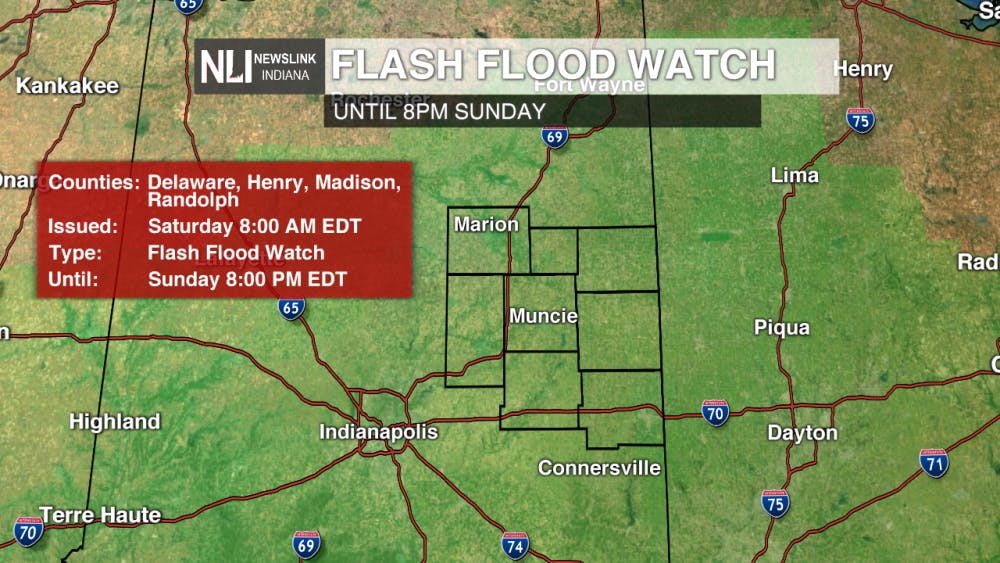
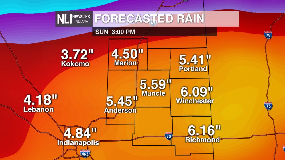
More rain yet to come this weekend...
FLASH FLOOD WATCH goes into effect Saturday morning for the entire NewsLink Indiana viewing area, as additional rainfall could 4-6+ inches.
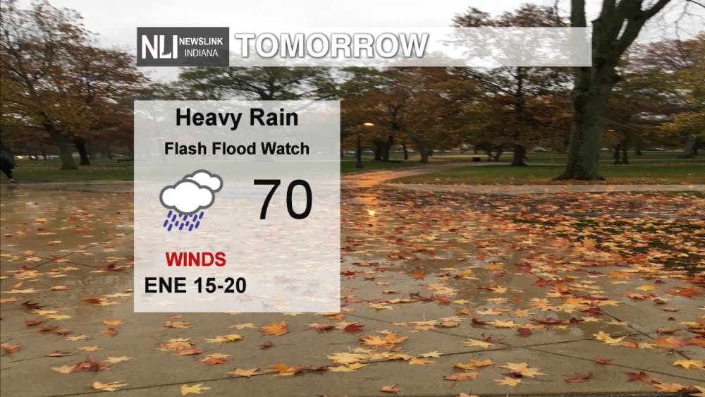
For Saturday--Many rounds of rain are expected throughout the day on Saturday. With dense cloud cover over head and a breezy northeast wind, temperatures will struggle to exceed the 70° mark.


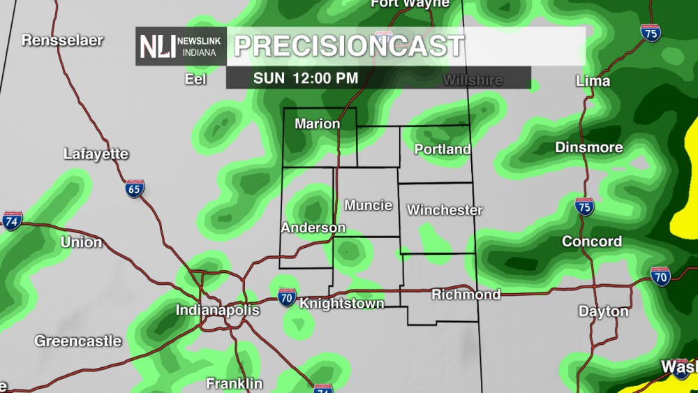
Rain continues Sunday...
More rounds of heavy rain are expected for Sunday, as the remnants of tropical storm Gordon make their way through the state. Remember the golden rule this weekend..."Turn around, Don't Drown!"

--Chief Weather Forecaster Joe Strus, Weather Forecaster Gabe Prough
For the latest on breaking weather updates, follow @NLIWeather on Twitter.
NewsLink Indiana is a proud Ambassador for the NOAA Weather-Ready Nation program.
For more information about the Weather-Ready Nation program please click HERE
Read More
'A blue-collar team:' Ball State run rules Akron in opening game of MAC Softball Championship
By Zach Carter / 10 hours agoNo. 4 Ball State topped No. 5 Akron 9-1 in the Cardinals' first game of the Mid-American Conference Softball Championship Wednesday afternoon.

9-1-1 What's Your Hot Take E8: Season 4 Recap
By Willow Emig and Sam Jasionowski / 12 hours agoIn this episode of 9-1-1 What’s Your Hot Take, Sam and Willow discuss the events of season 4 of 9-1-1.

