
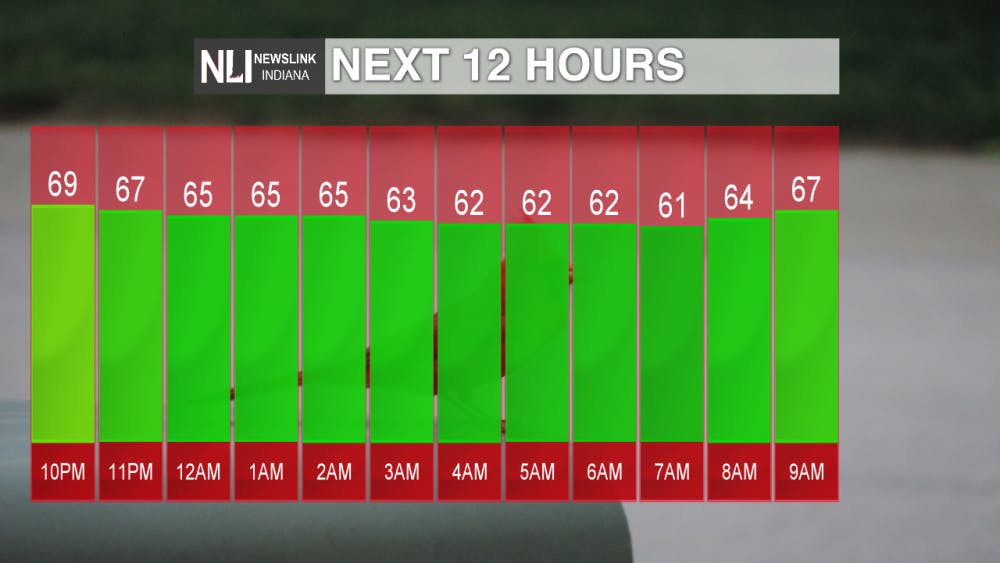
Tonight: Overnight temperatures will back down to a low of 61°. Skies will remain mostly clear with mild conditions.
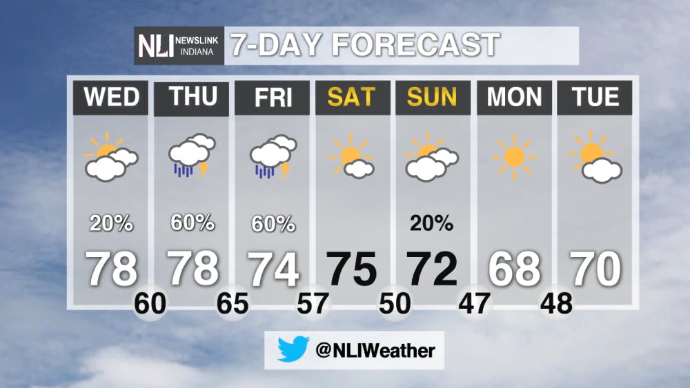
Tomorrow: Cloud coverage will push in as the result of a cold front moving toward the area. Temperatures will be similar to today, working up to a high of 78° in the late afternoon. There is a slight chance for a quick-hitting shower in the early afternoon with even a rumble or two of thunder. The Storm Prediction Center has issued an outlook for our viewing area for severe thunderstorms, with the biggest risk associated with this occurring overnight Wednesday into Friday.
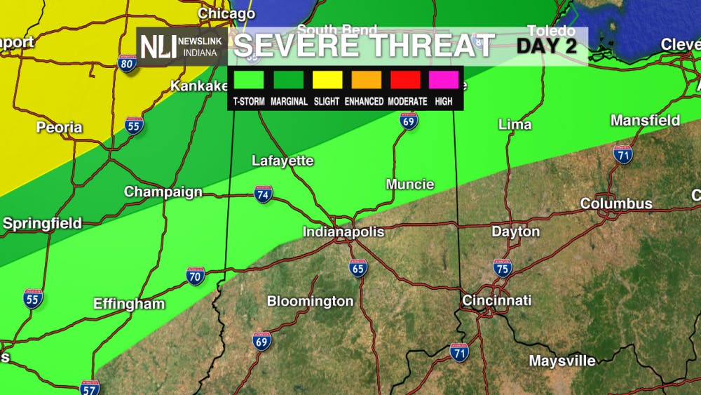
7-Day Forecast: The severe thunderstorm outlook from Wednesday will upgrade going into Thursday to a marginal risk for severe weather with storms lingering on into Friday. The risks with this include the possibility of isolated severe storms and a low tornado risk. It is important to exercise caution and stay weather aware when traveling home for summer break from Ball State's campus. The weekend kicks off clearer conditions until Sunday night with the possibilities for a sprinkle of rain overnight.
-- Weather Forecaster Liz Szewczyk--- For more updates be sure to follow us on Twitter @NLIWeather.NewsLink Indiana is a proud Ambassador for the NOAA Weather-Ready Nation program.
For more information about the Weather-Ready Nation program please click HERE
Read More

PHOTOS: Muncie holds 46th annual Iron Man Triathlon
By Kylee White / 10 hours agoOn July 12th, Muncie held its 46th annual Iron Man Triathlon at Prairie Creek Reservoir.

Rev it, Rock it and Relax: Muncie’s Week of Events
By Ball State Daily / 13 hours agoMuncie is buzzing with events this week, from thrilling Auto Cross at the Fairgrounds to stargazing at Big Astronomy. Enjoy live music on Minnetrista’s lawn or lend a hand during Horticulture Volunteer Day. Whatever your interest, there’s something for everyone!

Riverside Avenue Closed Due to 'Geothermal Leak' on Ball State's Campus
By Staff Reports / YesterdayConstruction crews were working as of Monday to reopen Riverside Avenue between Warwick and Briar roads due to a geothermal leak.
