
This Evening: A tornado watch remains in effect until 8 PM this evening.
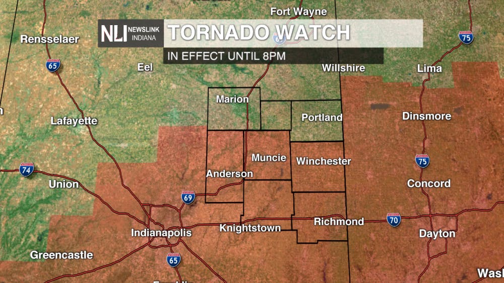
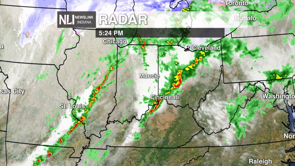
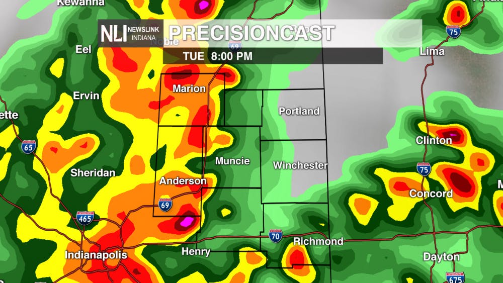
A second line of severe thunderstorms will pass through during the late evening hours. A cold front will sweep through central Indiana between 7 and 10 pm this evening, bringing another round of heavy precipitation and damaging winds. Small sized hail and an isolated tornado or two is not out of the question either with the passing of the front. A moderate risk for severe weather will remain through the evening.

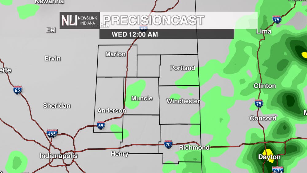
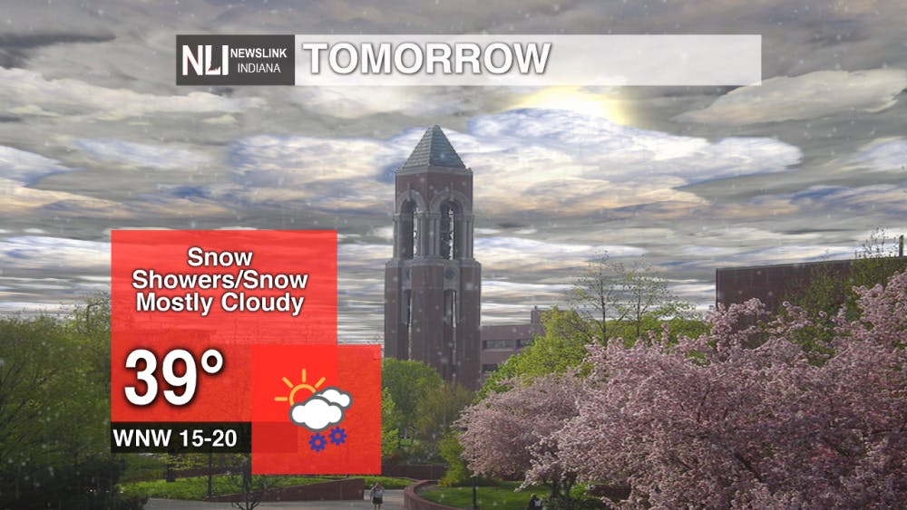
Tonight: Showers will push out by midnight, setting us up with the possibility for snow through the early morning hours.


Tomorrow: Temperatures will fall drastically tomorrow, only teasing the 40 degree mark. By 6 am, we could see isolated snow flurries across the region.

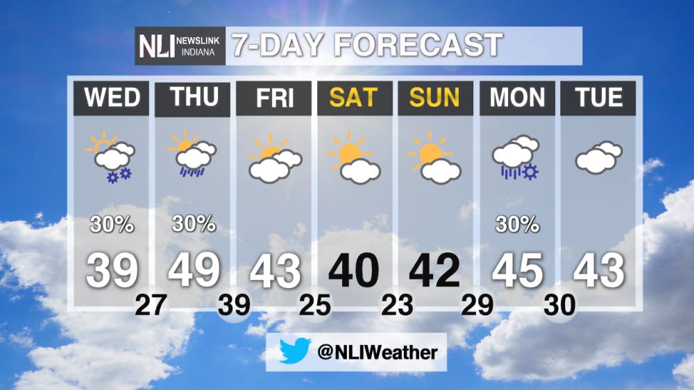
7-Day Forecast: Temperatures remain well below average for this time of year for the 7-day. The average for this time of year is 52 degrees, and Tuesday's high of 49 degrees will be the closest we will be to average.
---Chief Weather Forecaster Balint Szalavari
For more updates be sure to follow us on Twitter @NLIWeather.
NewsLink Indiana is a proud Ambassador for the NOAA Weather-Ready Nation program.
For more information about the Weather-Ready Nation program please click HERE
Read More
Road closure between Warwick and Briar road
By Staff Reports / 13 hours agoThere is a road closure on Riverside Avenue between Warwick and Briar roads directly in front of the Cooper Science Building due to a geothermal leak.

Tagayi to Represent France at U19 Tournament Before Joining Ball State
By Staff Reports / YesterdayBefore making her debut in the Mid-American Conference, incoming Ball State women's basketball player Aniss Tagayi will compete for her home country as part of the French national team in the U19 competition.

IPR: Ball State Village hotel project granted tax abatement for 10 years
By Indiana Public Radio / YesterdayThe new hotel being built next to Ball State University in the Village has been given a tax abatement for the next decade. But as IPR’s Stephanie Wiechmann reports, an agreement with the developer means Muncie coffers will see some money from the project in that time.
