
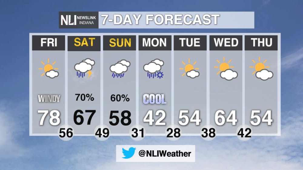
Tonight: Winds will die down to around 10-15 mph with wind gusts greater than 20 mph. After the sunsets, the temperatures will fall fast then bottoming out at 58° with very little cloud cover.

Tomorrow: Another warm day in in store, with highs reaching the upper 70's for the second day in a row. It will still be windy, getting to as high as 21 mph. But gusts will be higher at times, reaching 35-40 mph.


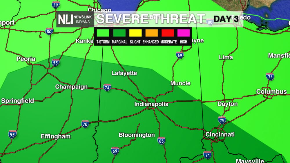
7-Day Forecast: Rain is back in the forecast, for potential severe weather on Saturday. As seen below, the SPC has the southern parts of East Central Indiana under a MARGINAL RISK for some isolated severe storms. Rain will be around throughout most of the day Saturday and then again on Sunday. After that, the temperatures will once again take a huge dive just in time for the work week on Monday.
---Weather Forecaster Ethan Rosuck
For more updates be sure to follow us on Twitter @NLIWeather.
NewsLink Indiana is a proud Ambassador for the NOAA Weather-Ready Nation program.
For more information about the Weather-Ready Nation program please click HERE
Read More

Road closure between Warwick and Briar road
By Staff Reports / 4 hours agoThere is a road closure on Riverside Avenue between Warwick and Briar roads directly in front of the Cooper Science Building due to a geothermal leak.

Tagayi to Represent France at U19 Tournament Before Joining Ball State
By Staff Reports / YesterdayBefore making her debut in the Mid-American Conference, incoming Ball State women's basketball player Aniss Tagayi will compete for her home country as part of the French national team in the U19 competition.

IPR: Ball State Village hotel project granted tax abatement for 10 years
By Indiana Public Radio / YesterdayThe new hotel being built next to Ball State University in the Village has been given a tax abatement for the next decade. But as IPR’s Stephanie Wiechmann reports, an agreement with the developer means Muncie coffers will see some money from the project in that time.
